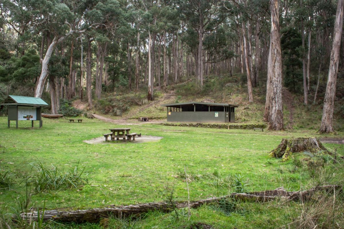
Richards Campground is a fantastic free campsite in the Mt Cole State Forest, Raglan. A large clearing surrounded by trees, ferns, and moss-lined logs, features excellent picnic facilities for visitors.
Free camping at Richards Campground
Excellent visitor facilities and a gorgeous bushland setting make Richards Campground a fantastic destination for a camping trip.
Camping is free at Richards Campground, no booking is required.
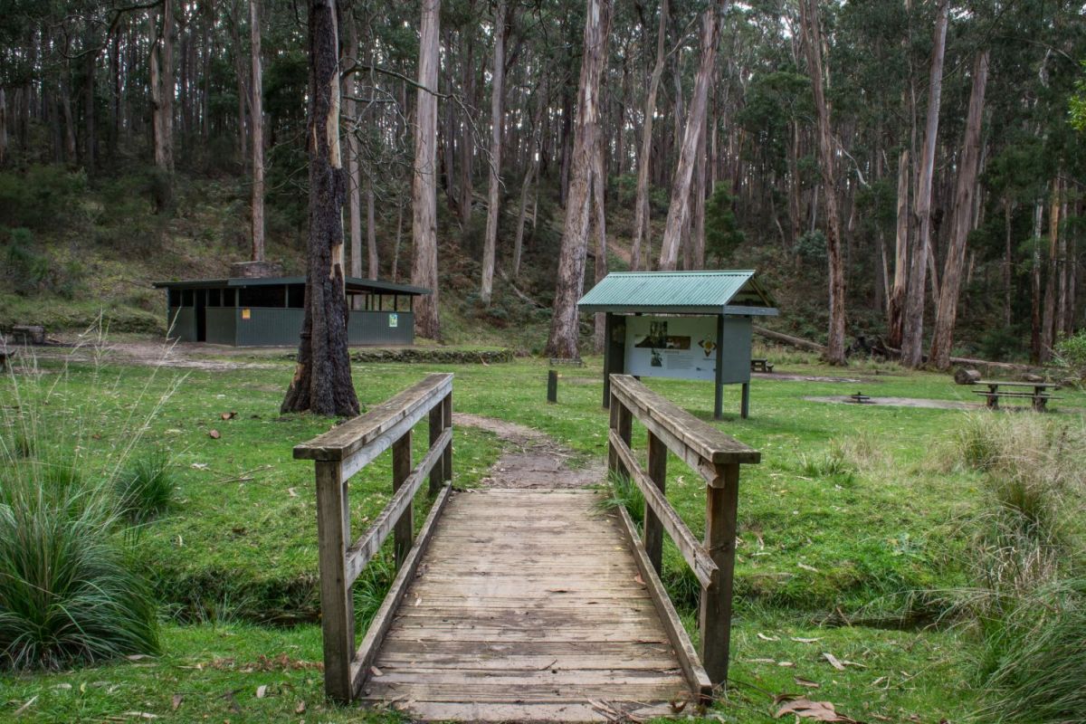
Please note that cars cannot drive into the camping area - you will need to leave the car at the parking area and carry your camping gear in to the camping area.
The camping area is set right by the car park though, it is not a long trek.
Picnics at Richards Campground
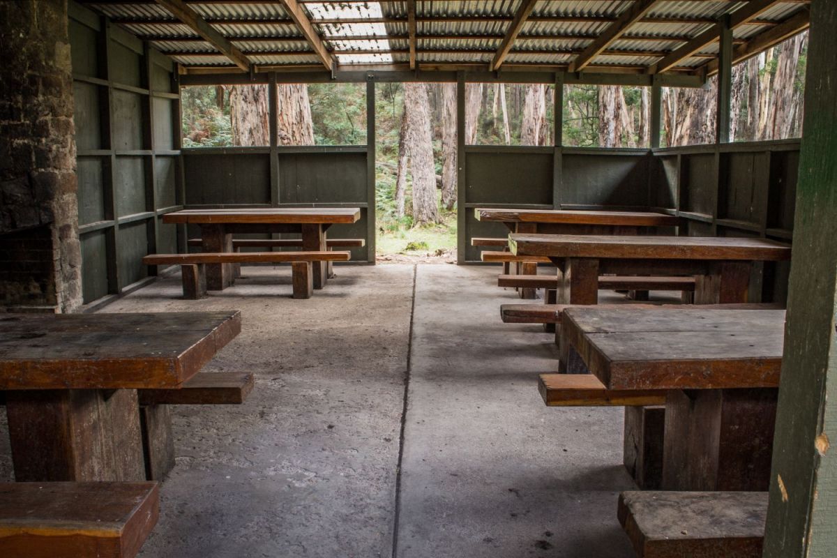
The undercover picnic facilities are a fantastic feature of Richards Campground, where five picnic tables are set within a shelter around a large stone fireplace.
This is a great place to visit for picnics during winter!
As well as the undercover area, there are several more picnic tables set out in the sun along with multiple fire pits / barbecue plates.
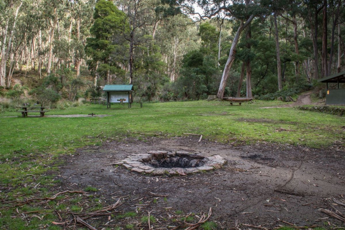
Visitor facilities at Richards Campground
Multiple picnic tables and wood fire barbecues are spread through the clearing, as well as a large fire pit.
A wooden hut is packed with picnic tables and an open fire place, with a rainwater tank/tap behind it.
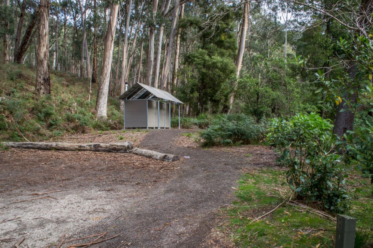
The toilet block is located alongside the gravel parking area.
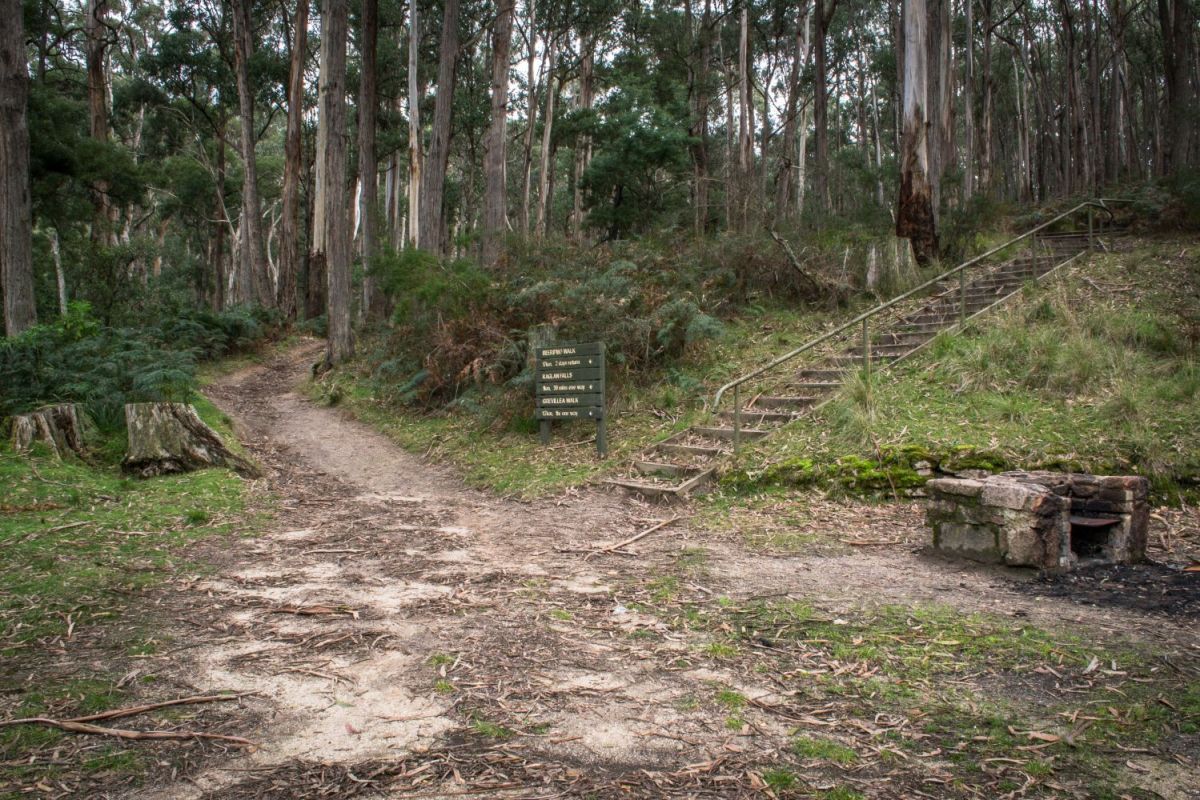
Walking tracks from Richards Campground
Several excellent walks start from Richards Campground:
- Raglan Falls, 1km, 30 mins one way
- Grevillea Walk, 1.7km, 1hr one way
- Beeripmo Walk, 17km, 2 days return
Please note that the signpost at the start of the walking track says Beeripmo Walk is 17km, the information signboard at Richards Campground says it is 21km, and
Trailhiking Australia says it is 20.6 km.
More information and history
A double sided information board at Richards Campground provides the following text:
WELCOME
Standing amongst nature's wonders in the Mt Cole State Forest, you are about to experience the charm and culture of the Beeripmo walk.
Created 390 million years ago, Mt Cole is a natural wonderland. The Beeripmo walk leads you to embrace the areas history, its inhabitants and a sustainable future that can be enjoyed by generations to come.
From the Aboriginal Beeripmo balug clan of the Dwab Wurrung people, to the early settlers lead by Mitchell, the Mt Cole State Forest is rich in cultural history.
Forestry has been a major part of the region, commencing in the 1860's until his demise in 1904, when all millable logs had been removed.
In the early 1940's charcoal burners worked the forest. Dead timber from the forest produced charcoal, a substitute for petrol during the Second World War.
Over time, significant regeneration has allowed managed timber harvesting in small areas since 1947.
Today the area is renowned for its tourism and recreational activities, giving thousands of people every year an opportunity to view its natural beauty.
This is your walk, enjoy it.
BEERIPMO WALK notes
Distance - 21 km. 11 hrs, 2 day walk (moderate)
The Beeripmo walk winds its way through Mt Cole State Forest and the Mt Buangor State Park and has been designed as a 2 day walk suitable for novice and experienced walkers. Both will be exposed to a seriously rewarding forest bushwalking experience.
"Walk through cool fern gullies and alpine plateaus then rest to take in the views across the spreading plains to Langi Ghiran and the Grampians. Experience a night at the charming Beeripmo campground, then descend through spectacular tall forests."
Richards to Raglan Falls
Distance - 1.0 km. 30 mins (steep)
The track climbs steadily through a ferny gully surrounded by large granite boulders until reaching the cliffs of Raglan Falls. The flat top of the cliffs is a good place to catch your breath and enjoy forested views.
Raglan Falls to Cave Hill
Distance - 2.6km. 1 hour (moderate)
The track continues to climb gently to Cave Hill. The forest begins to change from the tall eucalypt forest with a shrubby understorey to the more open sub alpine vegetation. Nearing Cave Hill, you will experience the extensive views to the south towards Mt Cole and the western plains.
Cave Hill to Sugarloaf
Distance - 3.5km. 2 hours (moderate)
As you climb Cave Hill, the views to the Grampians and Mt Langi Ghiran are revealed. To the north the densely forested ridge to the summit of Sugarloaf is exposed. The track now winds its way gently into Mt Buangor State Park, through eucalypt forests with a healthy understorey. If you look closely you may see the locally endemic Mt Cole Grevillea with its serrated leaf edges. As you begin to climb steeply to the top of the Sugarloaf, breaks in the forest reveal views south towards Cave Hill, where you have just come from.
The Sugarloaf to Beeripmo Campground
Distance - 0.9km. 30 mins (moderate)
Beeripmo Campground to Mt Buangor Lookout
Distance - 5.4km. 3 hrs (moderate)
The track heads uphill to the summit of Mugwamp Hill, which exposes views to the east of Mount Lonarch State Forest. At the base of the Mugwamp Hill, the Beeripmo walk meets the Mt Buangor lookout side track. The Mt Buangor lookout offers the most extensive views of the Mt Buangor State Park and the western plains from Mt Langi Ghiran to the Grampians.
Mt Buangor Lookout to Grevillea Track
Distance - 6.6km. 2.5 hrs (moderate)
The track slides past Dawson Rock and descends gradually through re growth forest before joining and following Long Gully. As you walk through Long Gully the eucalypts become overwhelmingly taller. Descending to the intersection of Grevillea Track, take time to enjoy the steep gullies lines with large tree ferns.
Grevillea Track to Richards
Distance - 1km. 20 minutes (moderate)
The track now follows open healthy forest, including Mt Cole Grevillea, back to Richards. Many of the trees have blackened outer bark from recent bushfires which have also promoted the undergrowth of heaths.
Camping
Camping is on a first come first serve basis and no bookings are required, but early arrival may be advisable in peak periods. The Beeripmo campground is flat, easily accessible, and includes 10 camp pads, fireplaces and a toilet.