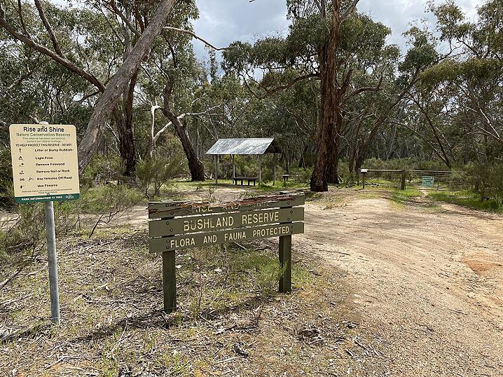
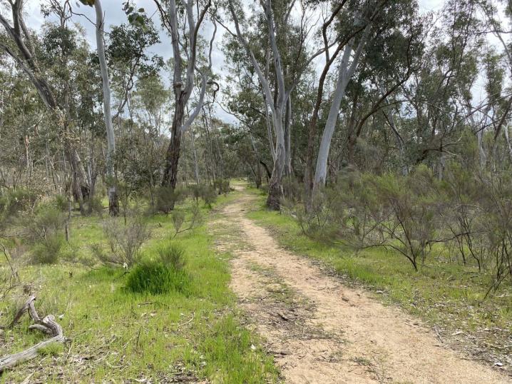
The Rise and Shine Nature Conservation Reserve, between Newstead and Daylesford, is a beautiful patch of bushland with an educational self guided tour.
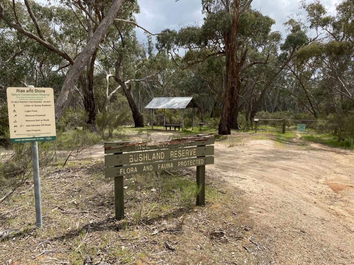
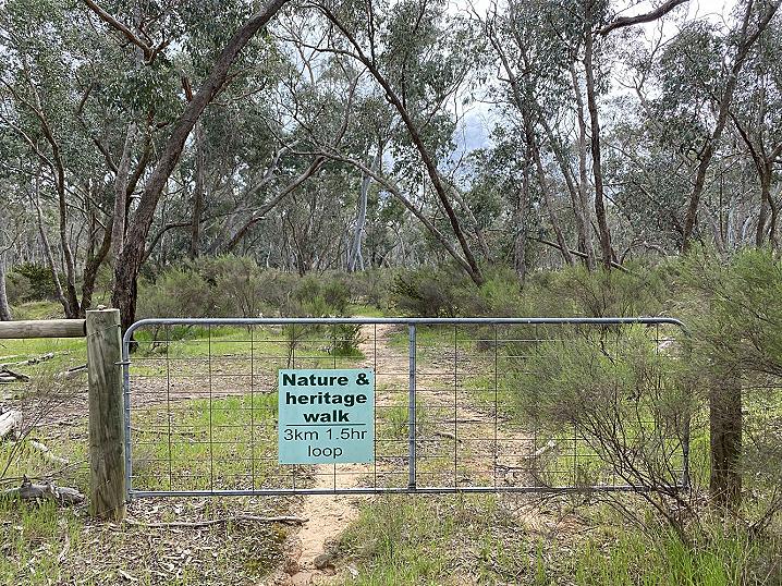
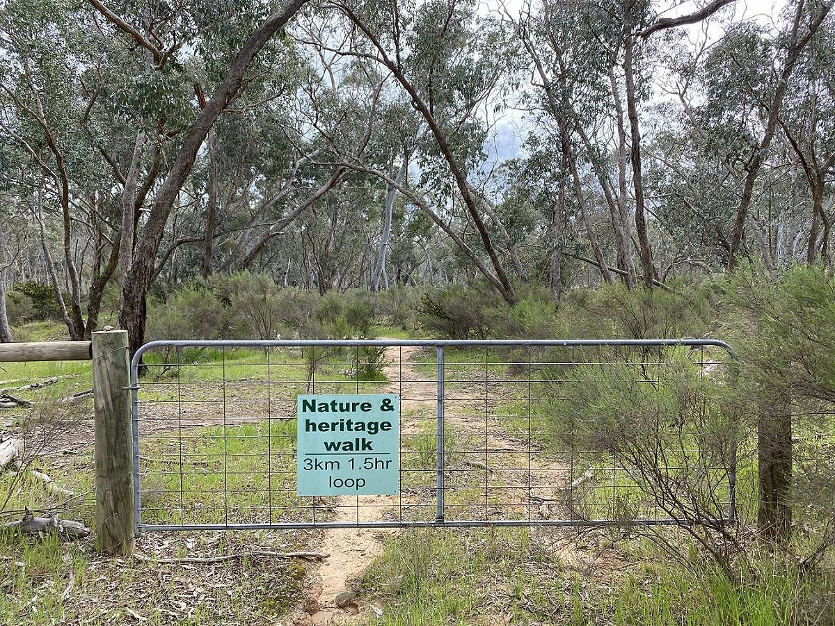
A walking track follows the path of an ancient river, and 21 numbered information points allow you to refer to your park notes (available in a container at the beginning of the walk) and learn about each feature.
Discover native plants and animals, fascinating geological features, and the impact both animals and humans have had on the land.
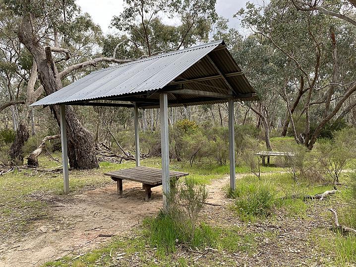
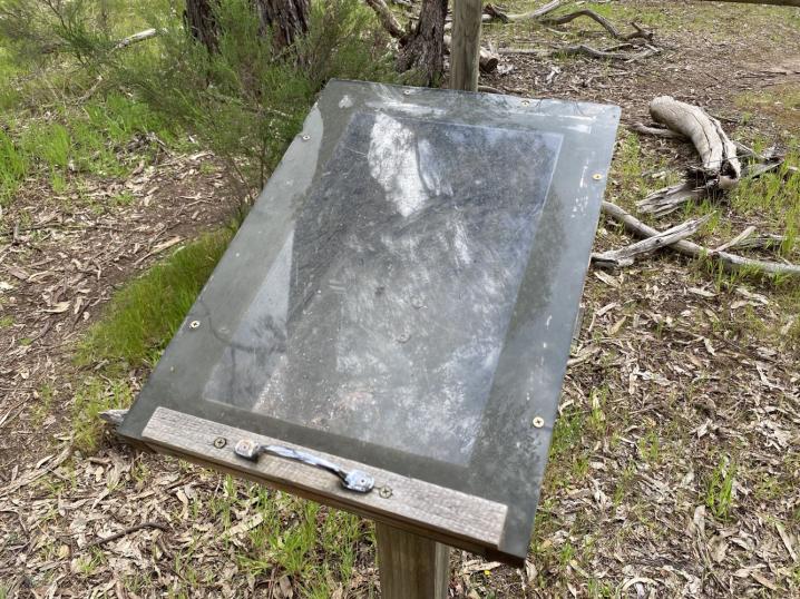
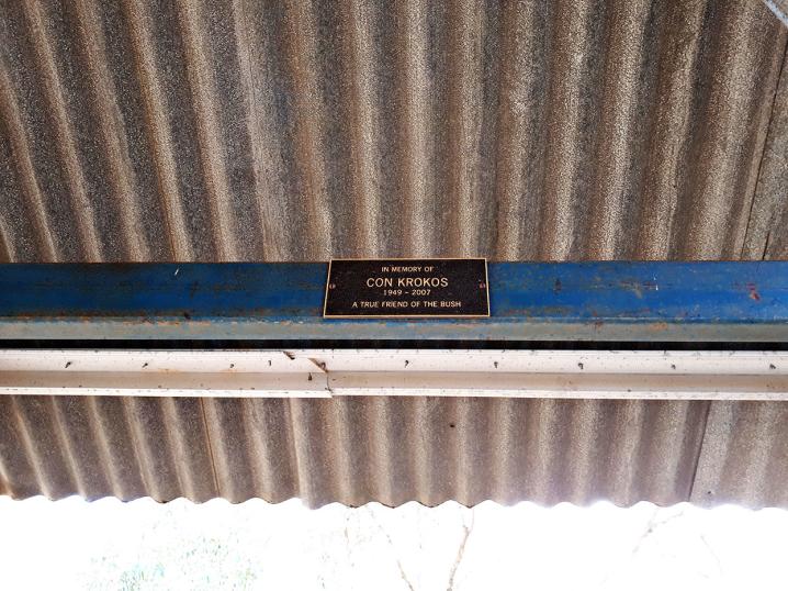
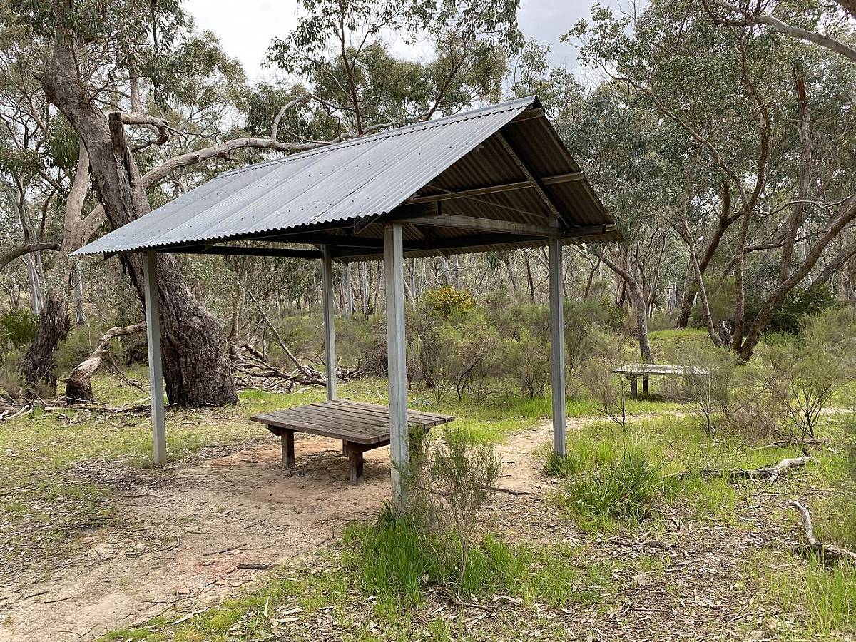
There is an undercover picnic bench as well as an uncovered bench at the beginning of the walk. A plaque within the undercover area reads:
In memory of Con Krokos
1949 - 2007
A true friend of the bush
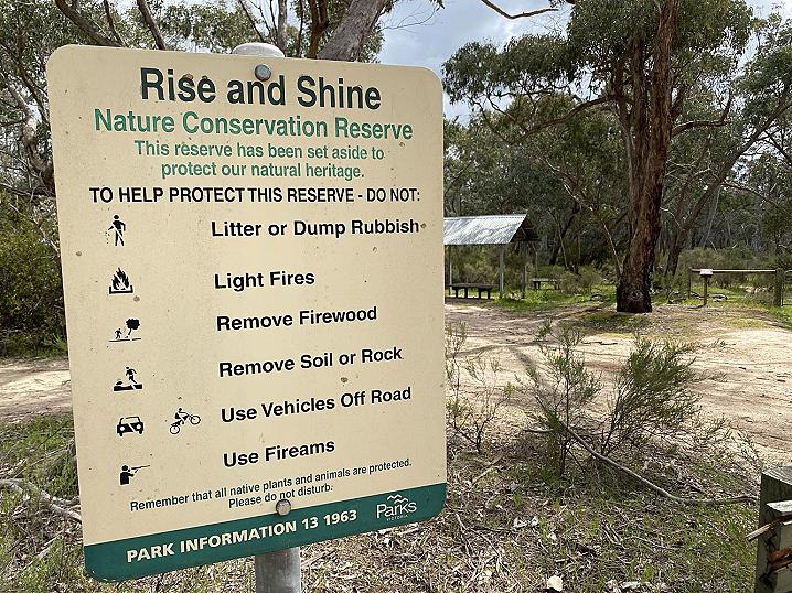
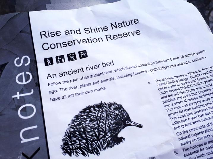
Parks Victoria's park notes for the Rise and Shine Nature Conservation Reserve, available in a container at the beginning of the walking track, provide the following text:
Rise and Shine Nature Conservation Reserve
An ancient river bed
Follow the path of an ancient river, which flowed some time between 5 and 35 million years ago. The river, plants and animals, including humans - both indigenous and later settlers - have all left their own marks.
- The traditional owners of this land are the Jaara Jaara people. Before European settlement, the Jim Crow Creek, to the east of the reserve, supplied food and water. It is likely that the people camped on the higher slopes as protection from the weather and floods and to ensure the safety of their water supply. The area that we call the Rise and Shine would have also provided some essential supplies.
- These two local native plants have often been mistaken for weeds. Cassinia arcuata (Drooping Cassinia, Coffee Bush or Chinese Scrub) is the fine leafed light green shrub about one metre high. It is an important coloniser of disturbed ground as it stabilises the soil and catches leaf litter and seeds, helping other plants to regenerate. Cassinia is used by many birds for nesting in and for nesting material. Acacia paradoxa (Hedge Wattle) is the large prickly shrub with short green leaves lying along the branches. It too provides very important habitat for many small birds.
- The ground here is covered with a crust of lichens and moss that come to life after rain and remain green throughout the cooler months. They reduce erosion and catch seeds of other plants, helping with regeneration.
- The old river flowed northwards from the Great Dividing Range. Quartz crystallised out of water in cracks and faults in ancient rocks around 350-400 million years ago and the old river broke this quartz into pebbles and rocks that became welded into a sheet of coarse sedimentary rock. This rock was scraped away to obtain gravel for road building until the 1980's. This large tree predates the gravel collection - you can see how much soil and gravel were removed. On the other side of the track, you can see natural regeneration occurring slowly but surely on the rocky surface.
- The hollows in these larger trees are essential for nesting for many species of native birds and mammals. Usually trees need to be over 600 mm diameter at breast height to develop good hollows. This may take about 200 years.
- There are three types of plant communities along the walk. This vegetation, called 'Healthy Woodland', has adapted to life on the dry, poor soils of the ridge top. The trees are Long-leaved Box (long drooping leaves) and Red Box (round leaves) with an understorey of small shrubs, mostly Daphne Heath, some Downy Grevillea and Showy Parrot Peas.
- The rock bed of the old stream is clearly visible underfoot here.
- The variety of stones from the old stream is apparent here. The larger, rounded rocks were used as grinding stones to make flour from the seed of the many wattles found in the reserve. They made damper and Johnnycakes from the flower and cooked them on hot rocks. The Jaara also fashioned cutting tools out of quartz and various types of sandstone were used as different grades of "sandpaper".
- Gravel quarrying has left a number of "artificial" waterholes that now provide habitat for frogs. Birds have carried in native water plants such as Juncus and Schoenus.
- The tree with the bright green foliage is a Cherry Ballart. This native tree taps into the roots of other plants to steal nutrients. Its small and tasty fruits were important bush tucker.
- This water race was built using "Sustenance" labour during the 1930's Depression bringing water from Daylesford to the Newstead reservoir until the 1980's. On the far side of the race is a stand of Bulokes, the trees with long, needle-like "leaves" (these are actually branches - the leaves are tiny serrations at the joints between small segments of the branches). Their seeds only germinate after two consecutive years of good rains. The young plants are a favourite food for wallabies and the fence will help to protect the next generation of bulokes. Bulokes were favoured by the Jaara people for making boomerangs. The other trees are Grey Box (with rough bark) and Yellow Gums (with smooth bark). This vegetation community is called "Box-Ironbark Forest". The trees are taller and there are no healthy plants.
- Gold also crystallised in the old rocks and these mounds and holes are the shafts of gold mines from the 1850's-1860's. The miners worked for themselves, digging down to the old riverbed to look for nuggets that had washed into the old river with the quartz. There was no processing on these diggings.
- The trees on the other side of the fence has bunches of mistletoe, a semi-parasitic native plant. Mistletoe does not kill a tree, but may heavily infest a tree that is already unwell. Mistletoe is an important food source for many birds including the Mistletoe bird and several local butterflies. The fruit is very sticky and the Mistletoe bird wipes its droppings off on branches of trees, spreading the mistletoe. The fruits were important food for the Jaara people who also used the swelling where the mistletoe joins the tree's branch as a club.
- Dead wood on the ground provides a habitat for insects, reptiles, frogs and many birds and also reduces erosion. The fungi and termites that decompose it become food for other animals like Echidnas. As you walk, watch for their characteristic scratchings that finish with long narrow holes where they hunt for ants.
- The Government kept the land that was thought to be gold bearing. Crown land was used as a source of wood for the mines and factories and retains some native vegetation. Farming land was mostly cleared.
- Here the lines in the rock run North-South. These Ordovician rocks were the bottom of an ancient sea, laid down 450 million years ago and pushed up as Australia was squeezed from East to West. A major thrust 400 million years ago pushed up a range 1500m high - the top of this range has eroded to expose these old rocks. The old stream flowed across these rocks.
- An old tree was cut for timber here many years ago. The tree has survived underground and sent up new trucks - coppices. The old stump has mostly rotted away, but you can see it was about a metre across at the base, making it over 200 years old when it was cut.
- This area is lower and the old river is closer to the surface. The gold diggers did not have to dig so far to get to the gold bearing riverbed so there are no mounds.
- The Black-anther Flax Lily (Dianella admixta) has blue flowers in Spring followed by purple fruits in Summer. The long blade-like leaves were used by the Jaara people for weaving baskets.
- These large old trees are Yellow Box. They have survived as they are not very good for building or firewood as the spiral grain of the wood does not split well.
- Yellow Box (with rough bark and small leaves) and River Red Gums (with smooth bluish bark) denote the community called "Alluvial Terraces Herb-rich Woodland". Erosion from the ridge behind you has produced a deep alluvial soil. The area is rich with small native plants (or herbs) often only seen in spring. Many of these were bush tucker for the Jaara people, including Bulbine Lilies and Yam Daisies with large edible underground tubers. This type of vegetation community is now uncommon as it mostly occurred on good farming land.
This walk was developed by Newstead Landcare Group with assistance of David Bannear (Heritage Victoria), Bambi Lees (Indigenous Project Officer, Parks Victoria), and Garry Cheers (local naturalist) with funding from Parks Victoria. The walk is dedicated to Con Krokos and has been made possible by donations made in his memory.
(Source: Parks Victoria's parknotes for the Rise and Shine Nature Conservation Reserve, published November 2009).