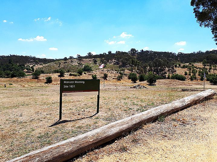
In this area on the
Forest Creek gold diggings in 1851, several thousand diggers met in protest, angered by an unfair mining licence fee imposed by the Government.
Continued objections in regards to licencing on the goldfields led to the 1853 Red Ribbon Rebellion in Bendigo, and ultimately to the 1854 Eureka Stockade in Ballarat.
History
Before the 1850's gold rush, European occupation in Victoria was primarily of a pastoral nature, and farmers were profitably working large pastoral runs.
Early discoveries of gold in Victoria were kept secret by the land owners, as they feared a rush of gold diggers would disrupt their way of life.
The Simson brothers of Charlotte Plains were "associated with the White Hills gold rush In 1854, but, by their silence in regard to a nugget found there, prevented a rush to Daisy Hill In 1848, years before the official discovery of gold in Victoria"
(source).
It was the discovery of gold at Ballarat in 1851 that resulted in Victoria's gold boom. The rush spilled over to the Mt Alexander field at Castlemaine and by December 1851 the field had attracted 20,000 diggers and was yielding 23,000 oz of gold a week!
(source).
Thousands of people left their homes and their jobs to seek their fortunes on the goldfields.
The police force was unequipped to deal with the rapidly growing rush of diggers, and in July 1851, matters were made worse when in Melbourne out of forty police, all but two had resigned to join the rush
(source).
In October 1851 there was an enormous rush to Mt Alexander, leaving Melbourne almost without males
(source).
The world was turned upside down with gold fever!
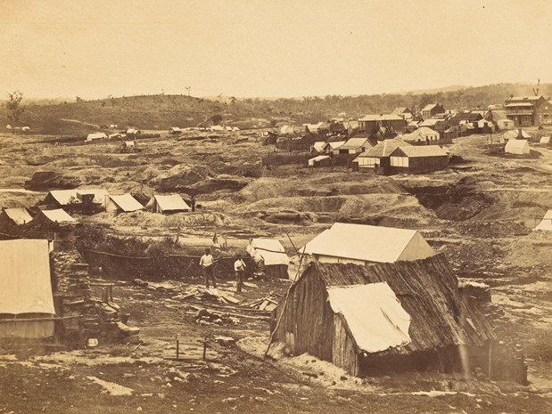
Golden Point, Forest Creek, 1858. Photographer: Richard Daintree (image source: Culture Victoria).
In an attempt to stop or at least slow the madness of the gold rush, as well as resolve the question of ownership of the gold (all Australian gold had been declared 'Royal Gold' and officially belonged to the Queen
(source)), Governor La Trobe imposed a licence fee in 1851 to dig on the goldfields.
The following article was published in
The Melbourne Daily News, Friday 30th May 1851
(source):
Government regulations for miners
A supplement to the Sydney Government Gazette of the 23rd instant, contains the Regulations under which parties are to be licensed to work at the "Diggings".
1. Mr. Hardy has been appointed Commissioner for the Gold District.
2. Licences will be issued to each "Digger;" the fee to be thirty shillings a month ; licences to be renewed monthly.
3. Licences will not be issued to persons who cannot provide a discharge from their last employer.
4. The Governor to have power at any period, to alter these Regulations in any manner he shall deem advisable.
As we have no accurate account of the number of persons engaged at the "Diggings", we cannot estimate the revenue to be derived from these rules - the proceeds, or a large portion of them will, we understand, be devoted to the establishment of an efficient body of police.
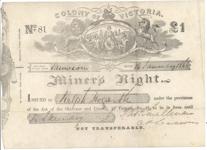
Miner's Right issued to Ralph Hogarth at Jamieson, 16 January 1856 (source: Museums Victoria).
Diggers were being exorbitantly taxed by the Government whether they found gold or not. Licences had to be held at all times, and failure to present licence upon request would result in harsh penalties.
There was already great unrest on the goldfields regarding the licencing when, in December 1851, Governor La Trobe proposed doubling the licence fee.
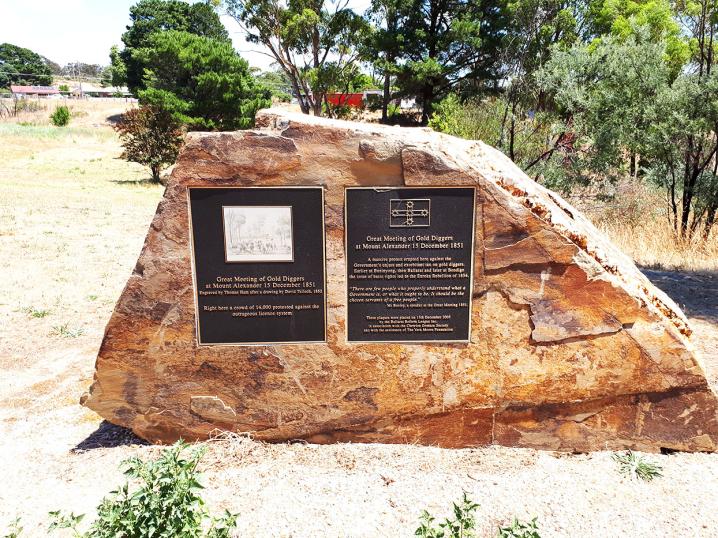
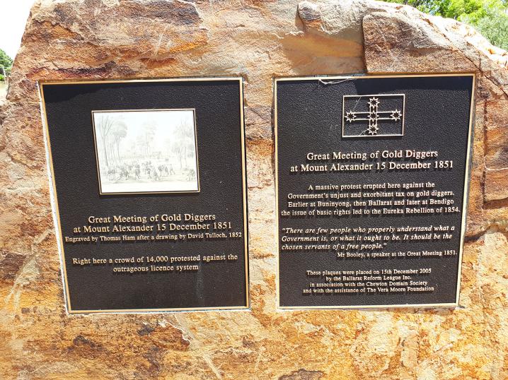
The protest
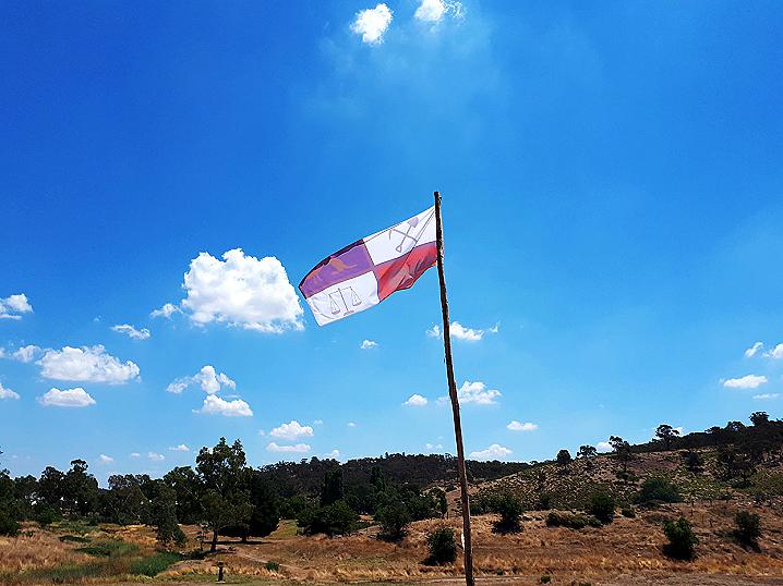
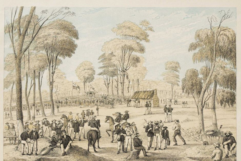
In response to the proposed increase in licence fees, thousands of diggers met in protest beneath their new diggers flag at the Shepherd's Hut, Forest Creek on the 15th of December, 1851.
This significant protest would become known as the Monster Meeting.
Two days later the government announced that the licence fee increase had been revoked, although Governor La Trobe's decision to revoke the licence fee increase had been made on 13 December 1851, two days prior to the Monster Meeting.
Continued objections in regards to licencing on the goldfields led to the 1853 Red Ribbon Rebellion in Bendigo, and ultimately to the 1854 Eureka Stockade in Ballarat
. (source: Victorian Heritage Database).
Thousands of diggers attended the Monster Meeting in 1851 at Golden Point. Image from the Chewton Town Hall Collection (source).
The Victorian Heritage Database describes the Monster Meeting as follows:
On 1 December 1851 Governor La Trobe issued a proclamation
which proposed to double the licence fee to £3, effective from 1 January 1852.
Shortly after, notices appeared
along the Forest Creek diggings urging diggers to meet and object to the proposed increase. During the following
days a meeting of up to 3,000 people was held to establish the day and location of the Monster Meeting or the
Great Meeting as it was originally known. The Monster Meeting, of approximately 10,000 to 15,000 diggers, took
place on 15 December 1851, at the Shepherd's Hut, Forest Creek.
Two days later the government announced
that the licence fee increase had been revoked, although Governor La Trobe's decision to revoke the licence fee
increase had been made on 13 December 1851, two days prior to the Monster Meeting.
The gold licencing
system continued to be a point of contention and continued objections led to the Red Ribbon Rebellion in
Bendigo in 1853 and ultimately to the Eureka Stockade in Ballarat in 1854.
Location of the Monster Meeting Site identified
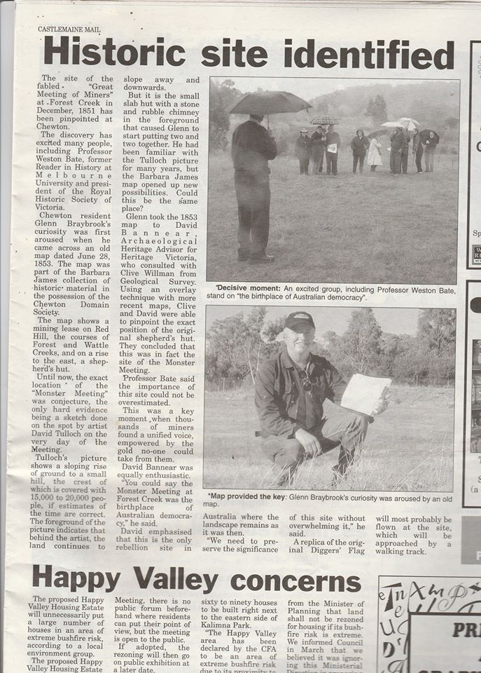
The following article was printed in the Castlemaine Mail, Friday 4th June 2004:
Historic site identified
The site of the fabled "Great Meeting of Miners" at Forest Creek in December, 1851 has been pinpointed at Chewton.
The discovery has excited many people, including Professor Weston Bate, former Reader in History at Melbourne University and president of the Royal Historic Society of Victoria.
Chewton resident Glenn Braybrook's curiosity was first aroused when he came across an old map dated June 28, 1853. The map was part of the Barbara James collection of historic material in the possession of the Chewton Domain Society.
The map shows a mining lease on Red Hill, the courses of Forest and Wattle Creeks, and on a rise to the east, a shepherd's hut.
Until now, the exact location of the "Monster Meeting" was conjecture, the only hard evidence being a sketch done on the spot by an artist Dave Tulloch on the very day of the Meeting.
Tulloch's picture shows a sloping rise of ground to a small hill, the crest of which is covered with 15,000 to 20,000 people, if estimates of the time are correct. The foreground of the picture indicates that behind the artist, the land continues to slope away and downwards.
But it is the small slab hut with a stone and rubble chimney in the foreground that caused Glenn to start putting two and two together. He had been familiar with the Tulloch picture for many years, but the Barbara James map opened up new possibilities. Could this be the same place?
Glenn took the 1853 map to David Bannear Archaeological Heritage Advisor for Heritage Victoria, who consulted with Clive Willman from Geological Survey. Using an overlay technique with more recent maps, Clive and David were able to pinpoint the exact position of the original shepherd's hut. They concluded that this was in fact the site of the Monster Meeting.
Professor Bate said the importance of this site could not be overestimated.
This was a key moment when thousands of miners found a unified voice, empowered by the gold no-one could take from them.
David Bannear was equally enthusiastic.
"You could say the Monster Meeting at Forest Creek was the birthplace of democracy," he said.
David emphasised that this is the only rebellion site in Australia where the landscape remains as it was then.
"We need to preserve the significance of this site without overwhelming it," he said.
A replica of the original Diggers' Flag will most probably be flown at the site, which will be approached by a walking track.
Source: Castlemaine Mail, Friday 4th June 2004
dispute over officially recognized location
It is important to note that although this spot is officially recognized as the exact location of the Monster Meeting, this is disputed by several historians and researchers, including Glenn Braybrook who originally identified the location (see the above article from the Castlemaine Mail).
A hearing was held by the Heritage Council regarding the registration of the site, and there were several objections.
Local historian Glenn Braybrook was involved in the research and discovery of the Monster Meeting Site, as detailed in the article above, and heavily objects to the current accepted location.
He and David Petrusma both objected at the hearing on the basis of location and information relating to the Monster Meeting, claiming that the area of registration needed to be extended further to the east.
Mr Braybrook objected to the Recommendation and submitted that the recommended extent of registration does not correctly identify or include the site of the Monster Meeting. Mr Petrusma also submitted that the recommended extent of registration does not correctly identify or include the entire site of the Monster Meeting. (Source: Heritage Council Registrations Committee Hearing)
You can read the full document regarding the Heritage Council Hearing
here.
HISTORICAL MAP OF THE CASTLEMAINE MINING DISTRICT, 1860
Map of the Castlemaine Mining District which shows historical features in superb detail, including mining divisions, reefs, gullies, and gold workings. Mining Department, Melbourne, 1860. High quality, durable A1 print in a satin finish. Large, 594 x 891 mm. Go to online shop.