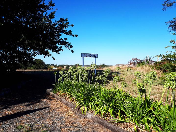
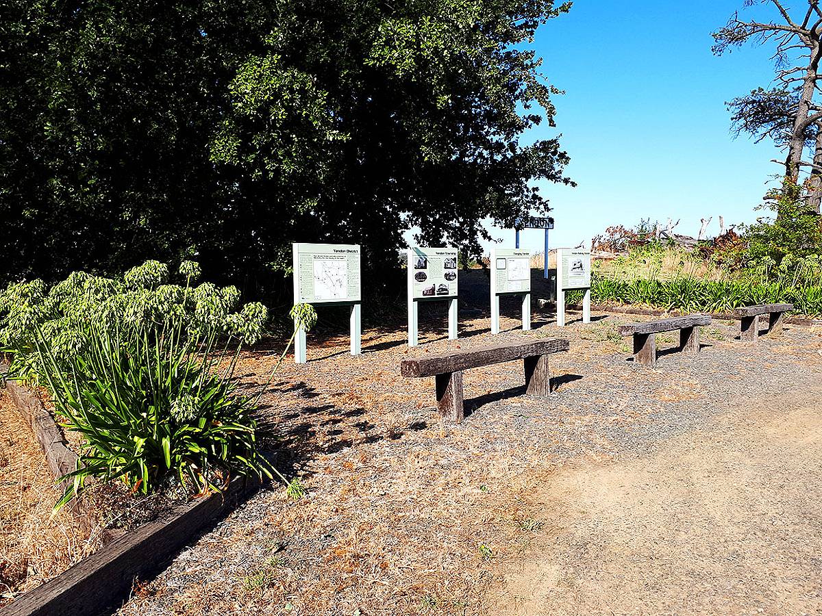
Stop by this educational display in Yendon and learn about the history of the township, the landscape and the railway of the area!
This is a very interesting place to drop by while in the area exploring the surrounding attractions such as Mount Buninyong, Mount Warrenheip, Kryal Castle and more.
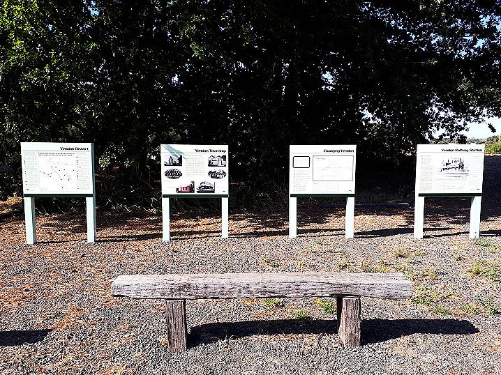
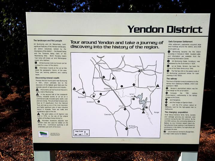
The following text is displayed on a series of well presented information signs at Yendon, Victoria, erected in 2011 by Yendon History Group and Moorabool Shire Council:
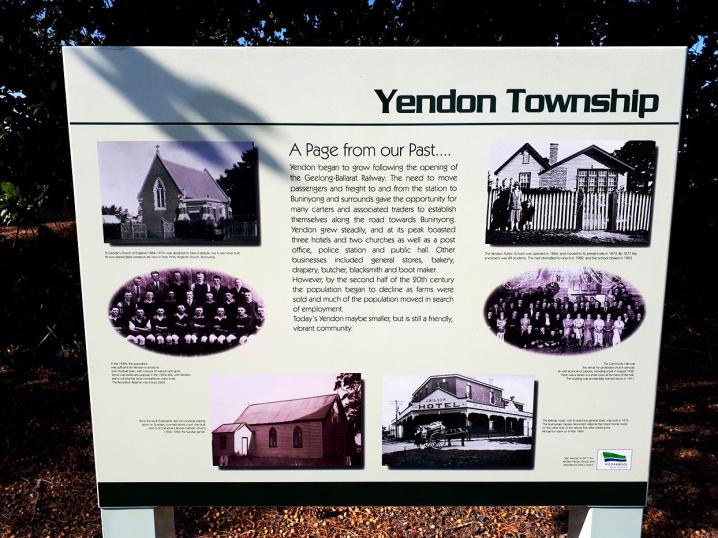
YENDON TOWNSHIP
A page from our past...
Yendon began to grow following the opening of the Geelong-Ballarat Railway. The need to move passengers and freight to and from the station to Buninyong and surrounds gave the opportunity for many carters and associated traders to establish themselves along the road towards Buninyong. Yendon grew steadily, and at its peak boasted three hotels and two churches as well as a post office, police station and public hall. Other businesses included general stores, bakery, drapery, butcher, blacksmith and boot maker. However, by the second half of the 20th century the population began to decline as farms were sold and much of the population moved in search of employment.
Today's Yendon maybe smaller, but is still a friendly, vibrant community.
TOUR AROUND YENDON AND TAKE A JOURNEY OF DISCOVERY INTO THE HISTORY OF THE REGION.
The landscape and first people.
Mt Buninyong and Mt Warrenheip, both significant features of the Yendon landscape, are extinct volcanoes named by the Aborigines of the district - the Keyeet balug and the Tooloora balug clans of the Wautharong tribe. Bonin Yowang means 'man lying with knees up' and Warrengeep means 'emu feathers'.
- Mt Buningyong's look-out tower can be climbed for a view of the district.
- Information boards at the Lal Lal Falls detail the geographic history of the area. There are viewing platforms and walking tracks.
Early European Settlement
After settlement, pastoralists acquired large land holdings around the district, and small towns grew up.
- Buninyong became the first inland township in Victoria in 1838. Guided walks and information are available from the Buninyong Information Centre.
- Mt Boninyong Estate, Scotsburn, was established by the Scott family in 1839.
- Lal Lal Estate, Yendon, has been the home of the Fisken family since 1846.
- The Trial Saw Mill on the eastern side of Mt Buninyong produced timber for road planking in the 1850s.
Discovering mineral wealth
Thomas Hiscock found gold near Buninyong in 1851, which ultimately led to the discovery of the Ballarat gold field and the dramatic growth of agriculture and industry.
- Monuments can be found at Hiscock's Gully, west of Buninyong.
- In the second half of the nineteenth century, industrial activity at Lal Lal on a commercial scale included gold, kaolin, coal and iron mining. The Lal Lal blast furnace ruins have an 'A' classification from the National Trust, and rate as one of the most important and highly significant sites of early industrial history in Australia. There are walks and explanatory signs at the site.
- The gold battery at Mt Egerton was built in 1912, on the site of the original battery of the Black Horse Mining Co.
- Abandunt bluestone deposits near Yendon were first used for ballast on the railway line. Commercial quarrying is still undertaken just north of the town.
The railway
The town of Yendon owes its existence to the railway from Geelong to Ballarat, which was opened in 1862.
- Yendon's demolished station was the same design as the Lal Lal station.
- Compare the 19th century stone-masons' craftsmanship in the railway bridges at Mt Doran, Navigators, and the bridge on Egerton Road with the 21st century viaduct at Millbrook, built for the high-speed train to Melbourne.
The changing population
Small labour-intensive family farms, (potato and cabbage growing and dairying) were common during the late 19th century. By the mid 20th century, the commuting distance to Ballarat, by now Victoria's largest inland city, had attracted those seeking a rurual lifestyle to subdivisions in the district, but agriculture still dominates the area.
- Lal Lal reservoir, formed by Bungal Dam, is a major water source for Ballarat.
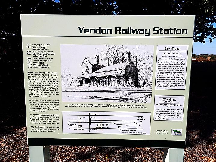
YENDON RAILWAY STATION
1841 Buninyong town settled
1851 Gold discovered in Buninyong and Ballarat
1862 April - Railway line opened
1862 September - Station opened as Buninyong Road
1876 Name changed to Yendon
1934 Line became single track
1968 Station closed
1969 Station demolished
1986 Platform demolished
Following the opening of the Geelong-Ballarat Railway, the need to move passengers and freight to and from Buninyong and the surrounding district gave the opportunity for many carters and associated traders to establish themselves along the road to Buninyong. This was the beginnings of the township originally known as Buninyong East. In-coming freight included mining and building equipment, and livestock and farm produce were dispatched.
Initially, four passenger trains ran each weekday in each direction, and the first station master was also the post master. The station master's family always lived on site. Yendon station won many prizes for its beautiful gardens.
As the 20th century progressed, better roads brought an increase in the use of buses and trucks. Rail traffic steadily declined and after 106 years of community service, the station was closed.
After its demolition, the station's stone was used for retaining walls at the University of Ballarat, Mount Helen.
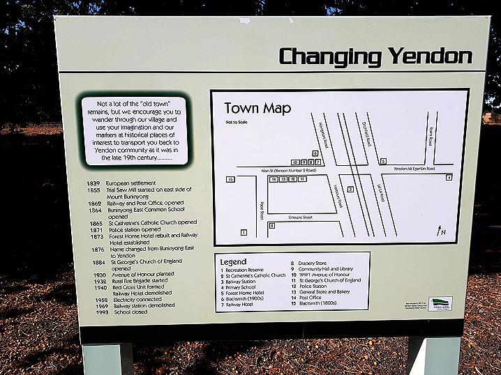
CHANGING YENDON
Not a lot of the "old town" remains, but we encourage you to wander through our village and use your imagination and our markers at historical places of interest to transport you back to Yendon community as it was in the late 19th century
1839 European settlement
1855 Trial Saw Mill started on east side of Mount Buninyong
1862 Railway and Post Office opened
1864 Buninyong East Common School opened
1865 St Catherine's Catholic Church opened
1871 Police station opened
1873 Forest Home Hotel rebuilt and Railway Hotel established
1876 Name changed from Buninyong East to Yendon
1884 St George's Church of England opened
1930 Avenue of Honour planted
1932 Rural Fire Brigade started
1940 Red Cross Unit formed, Railway Hotel demolished
1952 Electricity connected
1969 Railway station demolished
1993 School closed