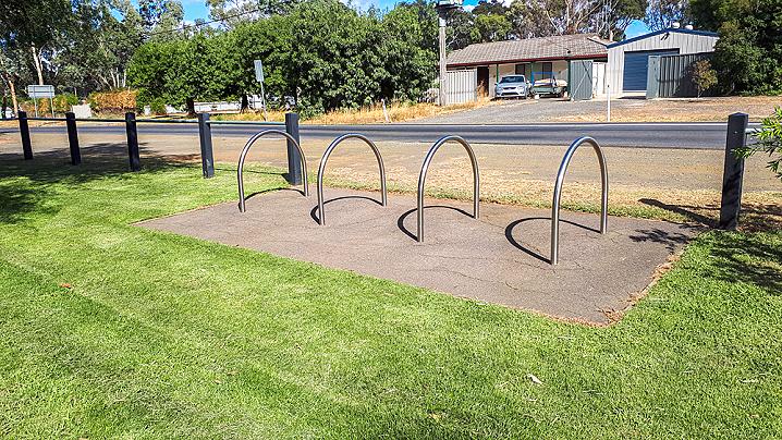
The Axedale Park is a well equipped recreation area which features a playground, skate park and undercover picnic/barbecue facilities. Axedale is a beautiful little town to visit and is located just twenty minutes out of Bendigo.
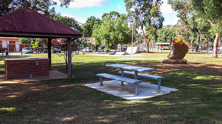
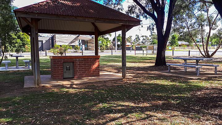
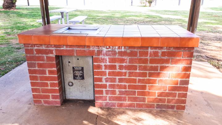
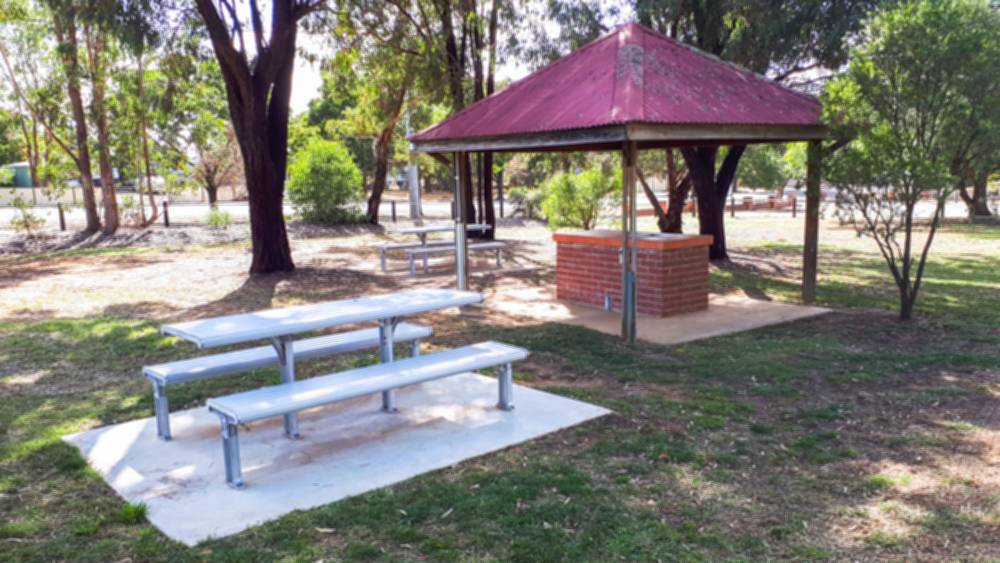
A free barbecue is set in a brick bench beneath an undercover area, with several picnic tables set alongside it.
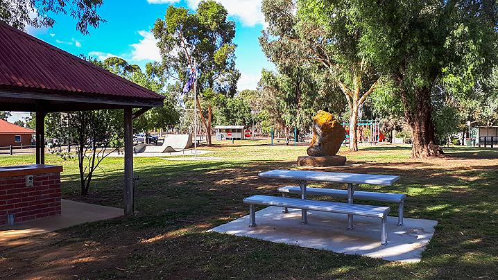
This little picnic area is set in a quiet corner of the park, with the playground, toilets and skatepark located over the other side.
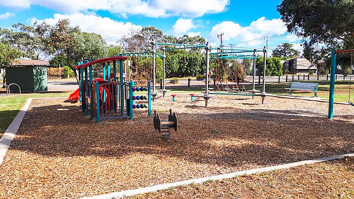
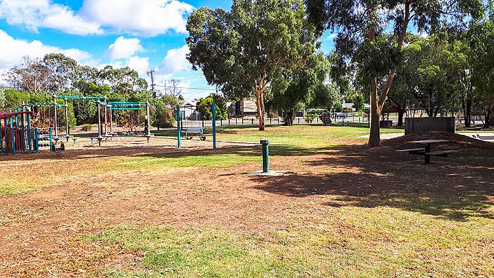
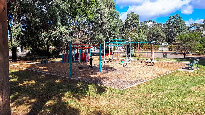
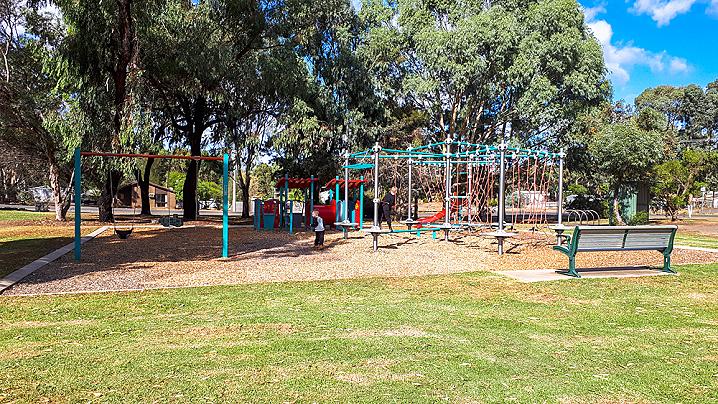
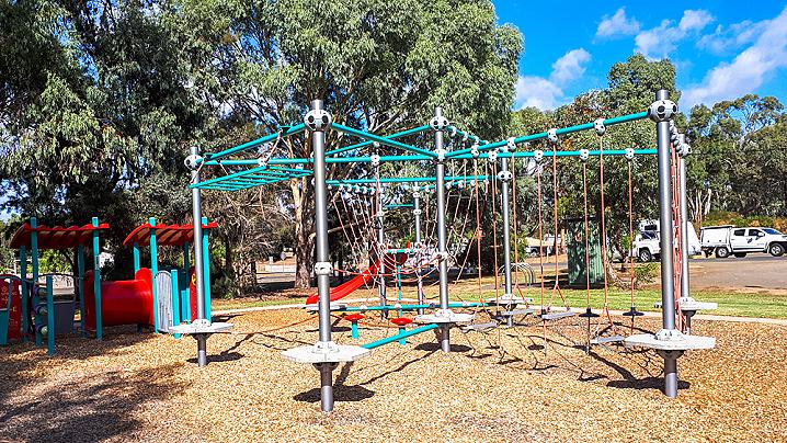
The playground at Axedale Park features lots of interesting play equipment, including rope climbing frame, monkey bars, fort, springers, swings and more.
Bench seating is set alongside the playground.
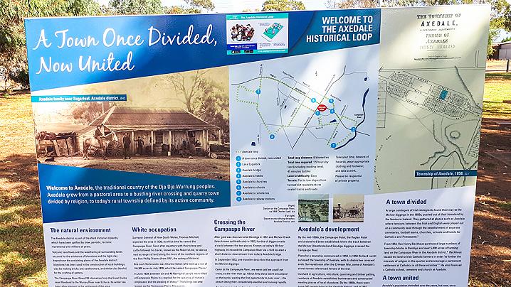
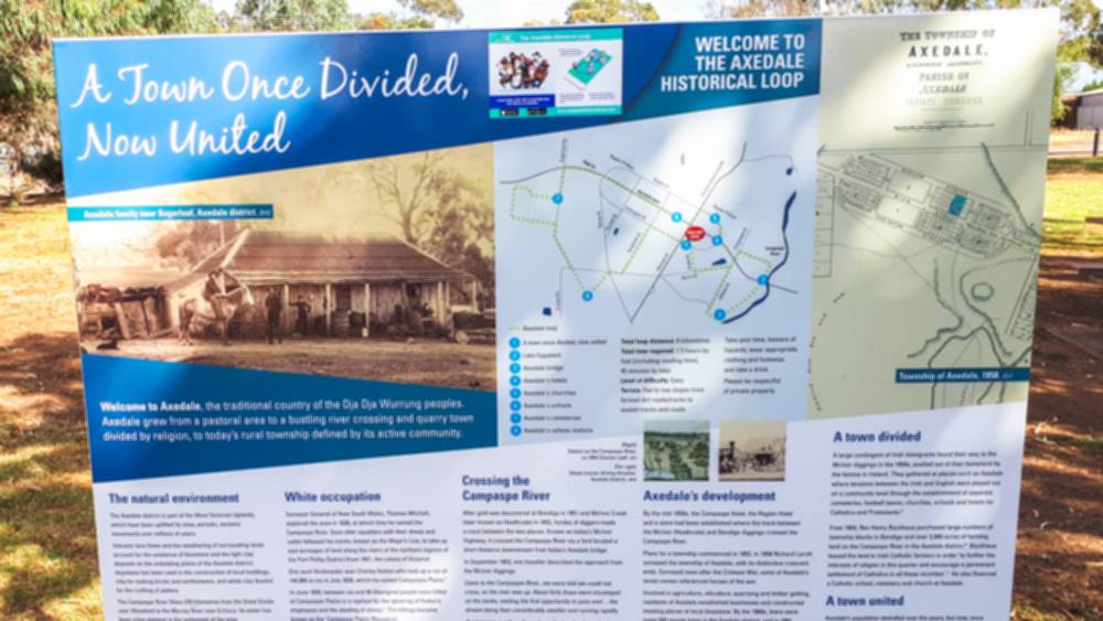
This park is the first stop on the Axedale Historical Loop walking/cycling track.
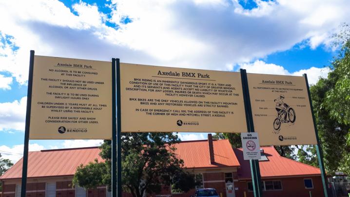
A beautifully presented information sign at Axedale Park displays the following text:
Welcome to Axedale, the traditional country of the Dja Dja Wurrung peoples. Axedale grew from a pastoral area to a bustling river crossing and quarry town divided by religion, to today's rural township defined by its active community.
The natural environment
The Axedale district is part of the West Victorian Uplands, which have been uplifted by slow, periodic, tectonic movements over millions of years.
Volcanic lava flows and the weathering of surrounding lands account for the existence of bluestone and the light clay deposits on the undulating plains of the Axedale district: bluestone has been used in the construction of local buildings, clay for making bricks and earthenware, and which clay (kaolin) for the crafting of pottery.
The Campaspe River flows 220 kilometres from the Great Divide near Woodend to the Murray River near Echuca. Its water has been a key element in the settlement of the area.
As part of the box-ironbark ecosystem, before the arrival of Europeans the Axedale district was covered with a mixture of dry forest and woodland. Because of heavy demand for timber and agricultural land, today only about 17 per cent of the Box-Ironbark forest of Victoria remains.
White occupation
Surveyor General of New South Wales, Thomas Mitchell, explored the area in 1836, at which time he named the Campaspe River. Soon after squatters with their sheep and cattle followed his tracks, known as the Major's Line, to take up vast acreages of land along the rivers of the northern regions of the Port Phillip District (from 1851, the colony of Victoria)
One such flockmaster was Charles Hutton who took up a run of 144,900 acres in July 1838, which he named Campaspie Plains.
In June 1839, between six and 40 Aboriginal people were killed at Campaspie Plains in a reprisal for the spearing of Hutton's employees and the stealing of sheep. The killings became known as the 'Campaspe Plains Massacre'.
Daniel Jennings and George Playne took over Campaspie Plains in 1840, excising 67,000 acres, which they gave to William McGill who named the run Axedale, or The Axe. This name is likely to have been taken from a nearby reek named Exe, and later known as Axe Creek.
Crossing the Campaspe River
After gold was discovered at Bendigo in 1851 and McIvor Creek (later known as Heathcote) in 1852, hordes of diggers made a track between the two places. Known as today's McIvor Highway, it crossed the Campaspe River via a ford located a short distance downstream from today's Axedale bridge.
In September 1853, one traveller described the approach from the McIvor diggings:
Came to the Campaspie River... we were told we could not cross, as the river was up. About forty drays were encamped on the banks, waiting the first opportunity to pass over... the stream being then considerably swollen and running rapidly.
An immense number of people, on foot and on horseback, crossed the Campaspie [the next day], on their way to and from the diggings [when] the river fell considerably... we thought it advisable to cross the river at once, as it was probable we should be detained on its banks a week or two if it should happen to rain.
Axedale's development
By the mid-1850s, the Campaspe Hotel, the Raglan Hotel and a store had been established where the track between teh McIvor (Heathcote) and Bendigo diggings crossed the Campaspe River.
Plans for a township commenced in 1853. In 1858 Richard Larritt surveyed the township of Axedale, with its distinctive crescent ends. Surveyed soon after the Crimean War, some of Axedale's street names referenced heroes of the war.
Involved in agriculture, viticulture, quarrying and timber getting, residents of Axedale established businesses and constructed meeting places of local bluestone. By the 1860s, there were some 500 people living in the Axedale district, and in 1881, 208 residents lived in the Axedale township.
Development of the district and its industries were further enhanced with the construction of the railway from Bendigo to Heathcote in 1888, with a railway station and siding located at Axedale.
A town divided
A large contingent of Irish immigrants found their way to the McIvor diggings in the 1850s, pushed out of their homeland by the famine in Ireland. They gathered at places such as Axedale where tensions between the Irish and English were played out on a community level through the establishment of separate cemeteries, football teams, churches, schools and hotels for Catholics and Protestants.
From 1854, Rev Henry Backhaus purchased large numbers of township blocks in Bendigo and over 5,000 acres of farming land on the Campaspe River in the Axedale district. Backhaus leased the land to Irish Catholic farmers in order 'to further the interests of religion in this quarter and encourage a permanent settlement of Catholics in all these vicinities'. He also financed a Catholic school,
cemetery and church at Axedale.
A town united
Axedale's population dwindled over the years, but now, once again, more than 500 residents call the town home and a variety of community groups have a united commitment to the township's prosperous future.