Browse by Tag
BBQ
Educational
Free camping
Gold history
Gold prospecting
Swimming
Walking track
Search

Dead Dog Gully Alluvial Gold Workings

  • 20170828 153309
  • 20170828 153316
  • 20170828 153255
  • 20170828 153518
  • 20170828 153538
  • 20170828 153337
  • 20170828 153459
  • 20170828 153423
  • 20170828 153432
  • 20170828 153415
  • 20170828 153441
  • 20170828 154100
  • 20170828 153231
  • 20170828 153148
  • 20170828 153213
  • 20170828 153242
  • 20170828 153409
  • 20170828 153508
  • 20170828 154118
  • 20170828 154122
  • 20170828 154144
  • 20170828 154154
  • 20170828 154219
Alongside Burns Street, Spring Gully VIC 3550. Best accessed from an unnamed road which turns off into the bush from Burns Street - see map.

Explore other locations around this area using our interactive map

Features

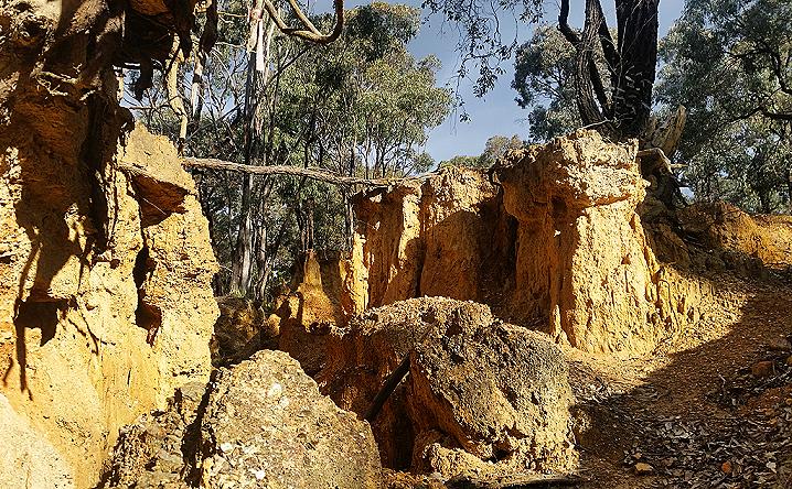
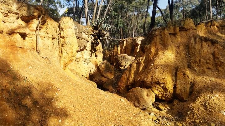
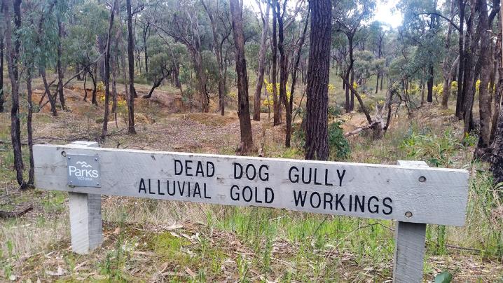
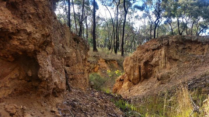
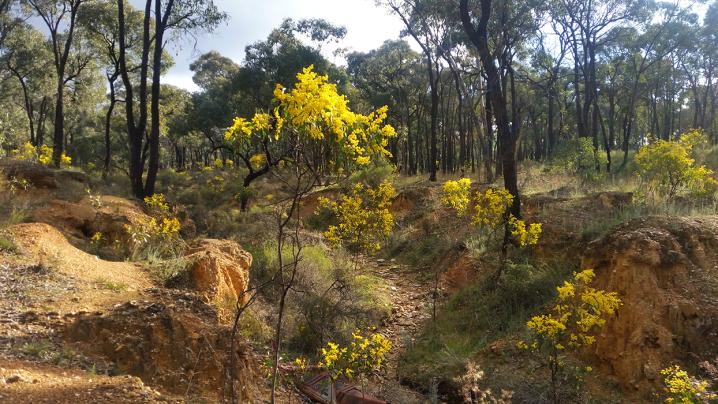
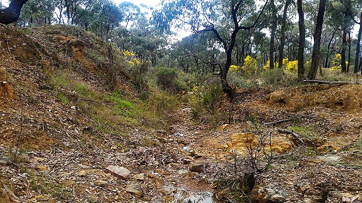
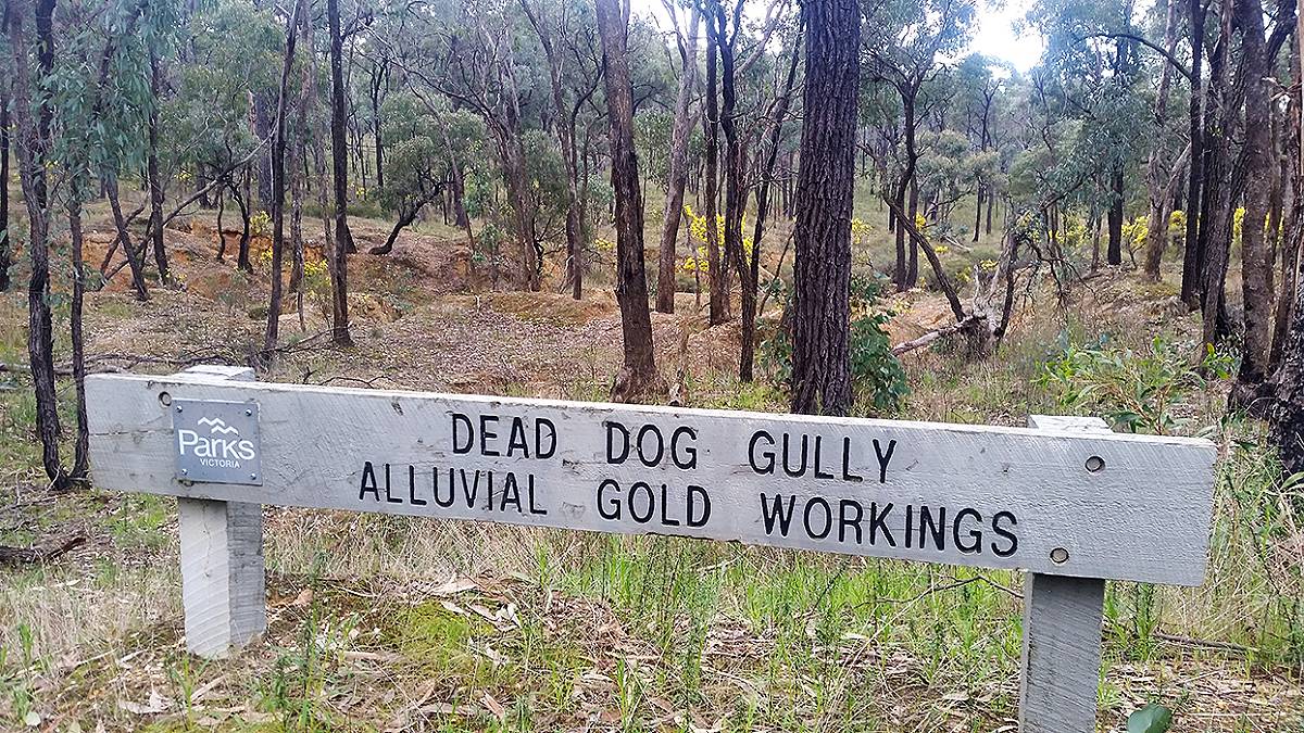
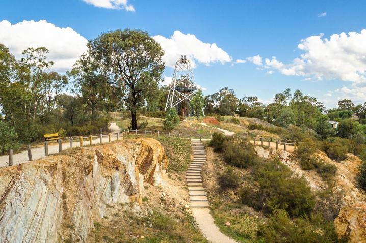
Dead Dog Gully is located right between Spring Gully and Golden Gully on Burns Street, and is part of Bendigo Regional Park. 

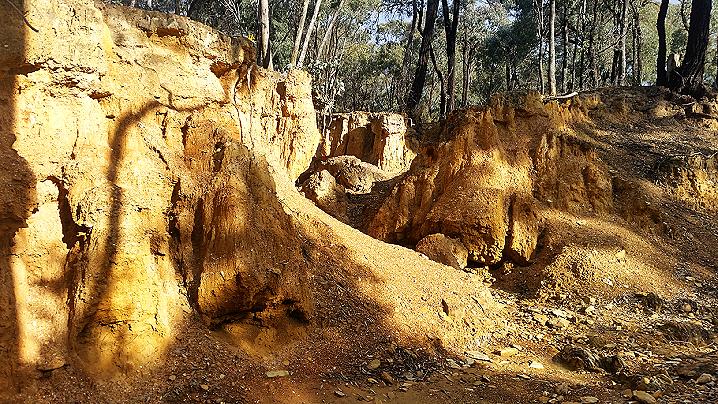
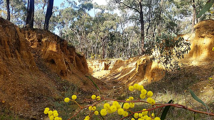
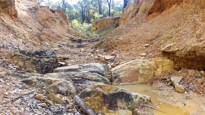
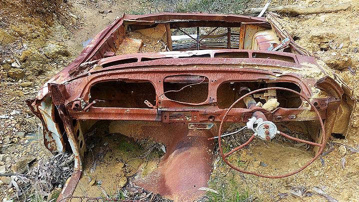
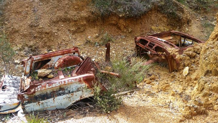
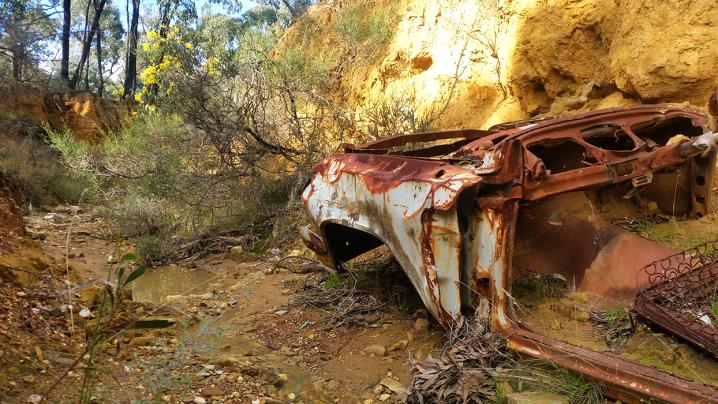
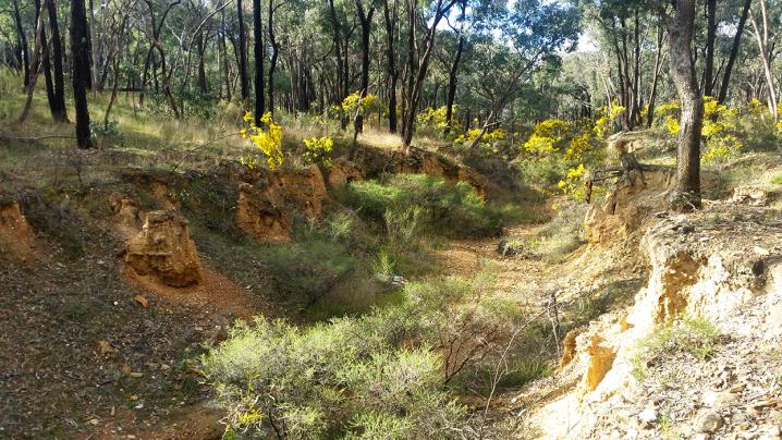
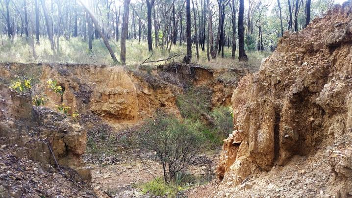
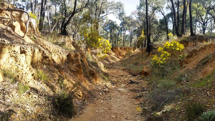
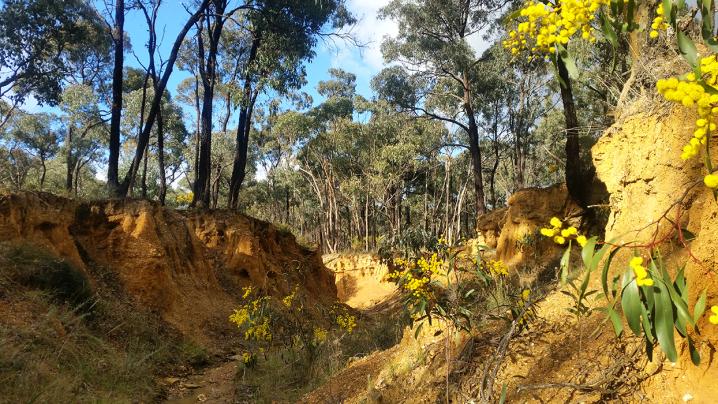
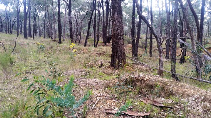
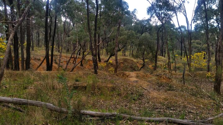
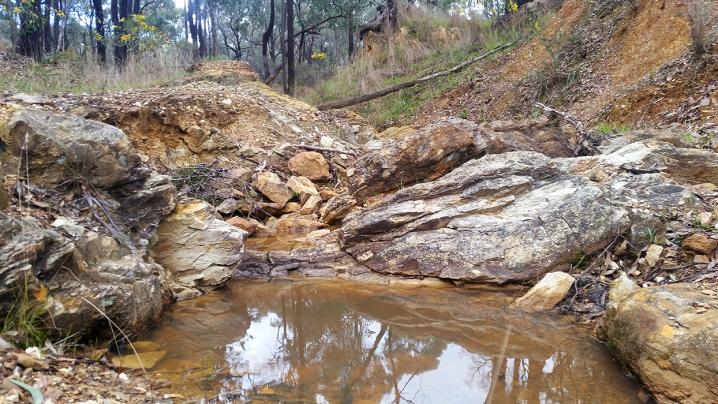
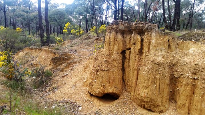
This gully, contrary to its name, is a beautiful dry creek bed with interesting formations in the clay walls and attractive layers of bedrock in many parts of the gully floor. 

During spring the gully is decorated with wattle flowers. 

After heavy rains there may be water in the creek, but it is mostly dry.

This is a great place to go for a wander and explore, children will love clambering through the gully over stones and up the walls.


An interesting feature of the gully is the rusty remains of a classic car resting unexpectedly in the creek bed. 

A sign along Burns Street reads "Dead Dog Gully Alluvial Gold Workings" and as the name suggests, the land surrounding the gully is littered with shallow depressions and ravaged earth - the familiar remains of old gold mining efforts.


Prospecting is allowed in Bendigo Regional Park and there are lots of nooks and crannies in the gully for gold to collect after a big rain, so bring a gold pan or detector along for a look.

GEOLOGICAL MAP OF THE BENDIGO GOLD FIELD, 1923


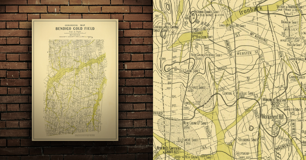
Geological map of the Bendigo gold field which shows historical features in superb detail, including mine shafts/companies, gullies, lines of reef, dams, and sand heaps. Originally prepared in the Bendigo Office, Mines Department, 1923. High quality, durable A1 print in a satin finish. Large, 594 x 891 mm. Go to online shop.


DID YOU KNOW...

  • Bushwalking is an excellent way to get outdoors and exploring nature.
  • Kids love to climb! There are plenty of places throughout the Goldfields with great trees, rocks, fallen logs and more for kids to climb up, around and over.
  • Gold prospecting is the recreational act of searching for natural gold deposits in the ground using tools such as gold detectors, gold pans and gold sluices. The Goldfields region of Victoria is a popular destination for gold prospectors, with many of the world's largest alluvial gold nuggets found in the area!
 

Comments

Leave a comment

Danny Ovenden
29/05/2020
Always enjoy wandering here. Many of my relatives mined here in the 1850s and I have a distant relative buried here somewhere in one of the many early graves. Good colour can be found after each rain by panning the silt extracted from the shale crevices that span the gullies. Gold can also still be found when digging in the high creek walls where the tree roots are exposed. My most recent find weighed just under 2 grams. I have also found coins, old tools and rubbish pits containing bottles, crockery and buckles. When you start finding these treasures it certainly confirms the fact that there were once thousands of people living in this small area with churches and schools, long since gone.
Byron Kenworthy
05/07/2020
I have been researching my family history and found this site when I searched for dead dog gully. The area was generally known as Diamond Hill from the 1850's and my family records show that my great great grandmothers sister died in a cottage fire near where the water race now runs. The rest of the family moved to crusoe village further west in the early 1860's but were later forced off their property when a large dam was built there. I plan to come to the area one day and have a look. I wonder if any early maps or photographs of the area exist as I would like to find the site of the Town hotel which they owned at one time.
Follow us on Facebook