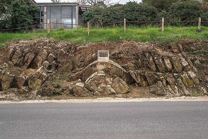
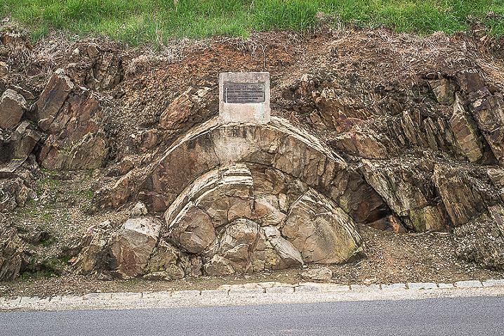
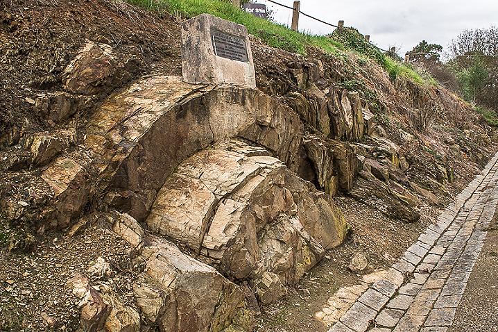
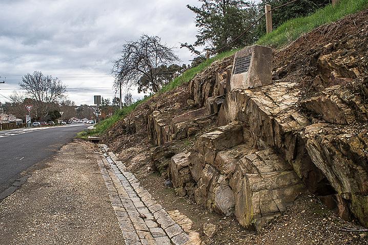
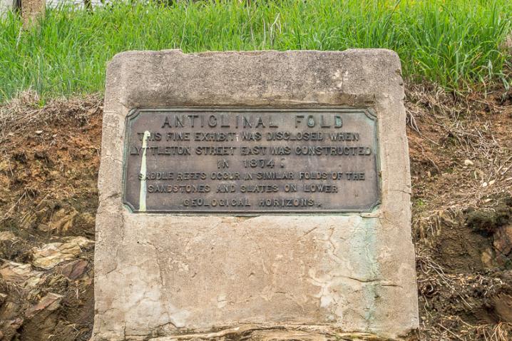
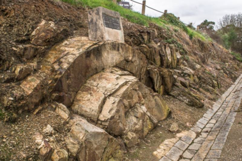
Browse by Tag
BBQ
Educational
Free camping
Gold history
Gold prospecting
Swimming
Walking track
Search

Anticlinal Fold

  • Dsc 9851
  • Dsc 9853
  • Dsc 9848
  • Dsc 9855
  • Dsc 9847
Lyttleton Street, Castlemaine VIC 3450

Explore other locations around this area using our interactive map

Features

  • Impressive example of an anticlinal fold
  • Educational
  • Roadside stop
The impressive Castlemaine Anticlinal Fold is visible in the roadside cutting along Lyttleton Street. This curious geological formation makes an interesting roadside stop, well worth a look if you're in the area. 

A plaque sits directly atop the fold and displays the following text:

ANTICLINAL FOLD

This fine exhibit was disclosed when Lyttleton Street East was constructed in 1874.

Saddle reefs occur in similar folds of the sandstones and slates on lower geological horizons. 

What is an anticlinal fold?


An anticline is a geological fold in the shape of an upward arch, with its oldest beds at its core. This is an excellent example and its location makes it easy for any one to drop by and take a look at its structure. 

Mindat.org provides the following concise definition of a saddle reef: "A saddle reef is a mineral deposit associated with the crest of an anticlinal fold and following the bedding planes, usually found in vertical succession, esp. the gold-bearing quartz veins of Australia".

HISTORICAL MAP OF THE CASTLEMAINE MINING DISTRICT, 1860


Map of the Castlemaine Mining District which shows historical features in superb detail, including mining divisions, reefs, gullies, and gold workings. Mining Department, Melbourne, 1860. High quality, durable A1 print in a satin finish. Large, 594 x 891 mm. Go to online shop.

SEE ALSO


Comments

No comments

Leave a comment

Follow us on Facebook