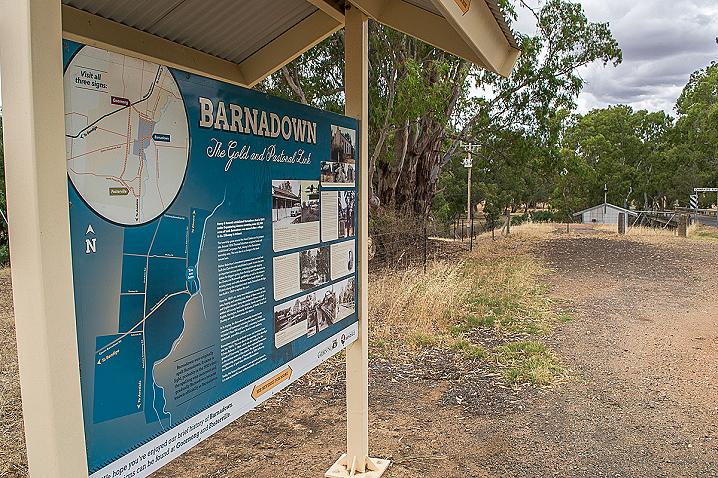
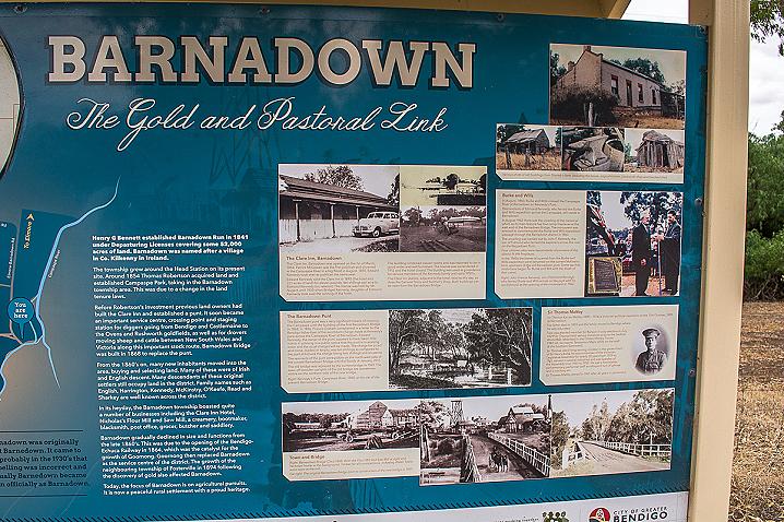
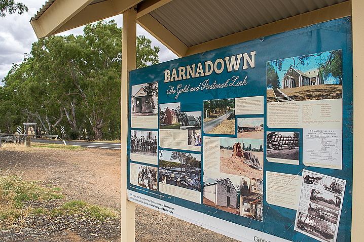
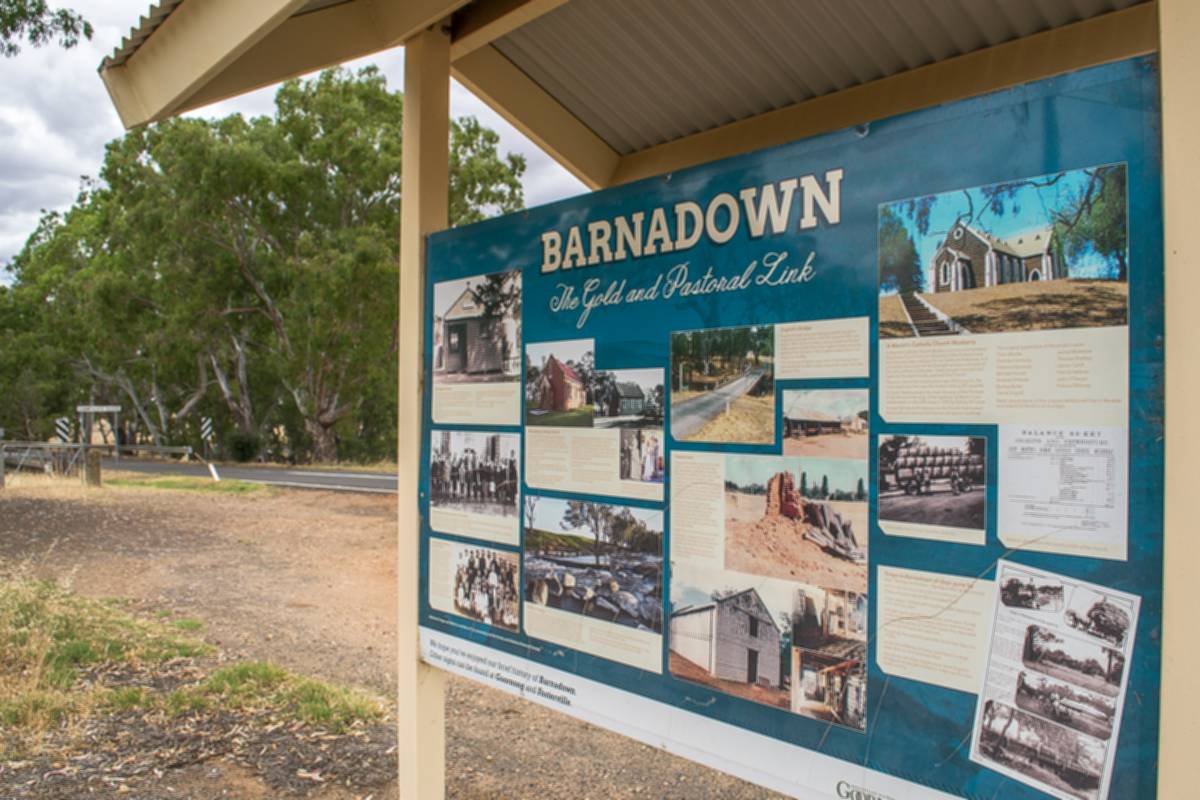
Along with a fascinating collection of historical photos and detailed descriptions, the sign displays the following introductory text:
BARNADOWN
The Gold and Pastoral Link
Barnadown was originally spelt Barnedown. It came to light, probably in the 1930's that the spelling was incorrect and gradually Barnedown beecame known officially as Barnadown.
Henry G Bennett established Barnadown Run in 1841 under Depasturing Licenses covering some 52,000 acres of land. Barnadown was named after a village in Co. Kilkenny in Ireland.
The township grew around the Head Station on its present site. Around 1854 Thomas Robertson acquired land and established Campaspe Park, taking in the Barnadown township area. This was due to a change in the land tenure laws.
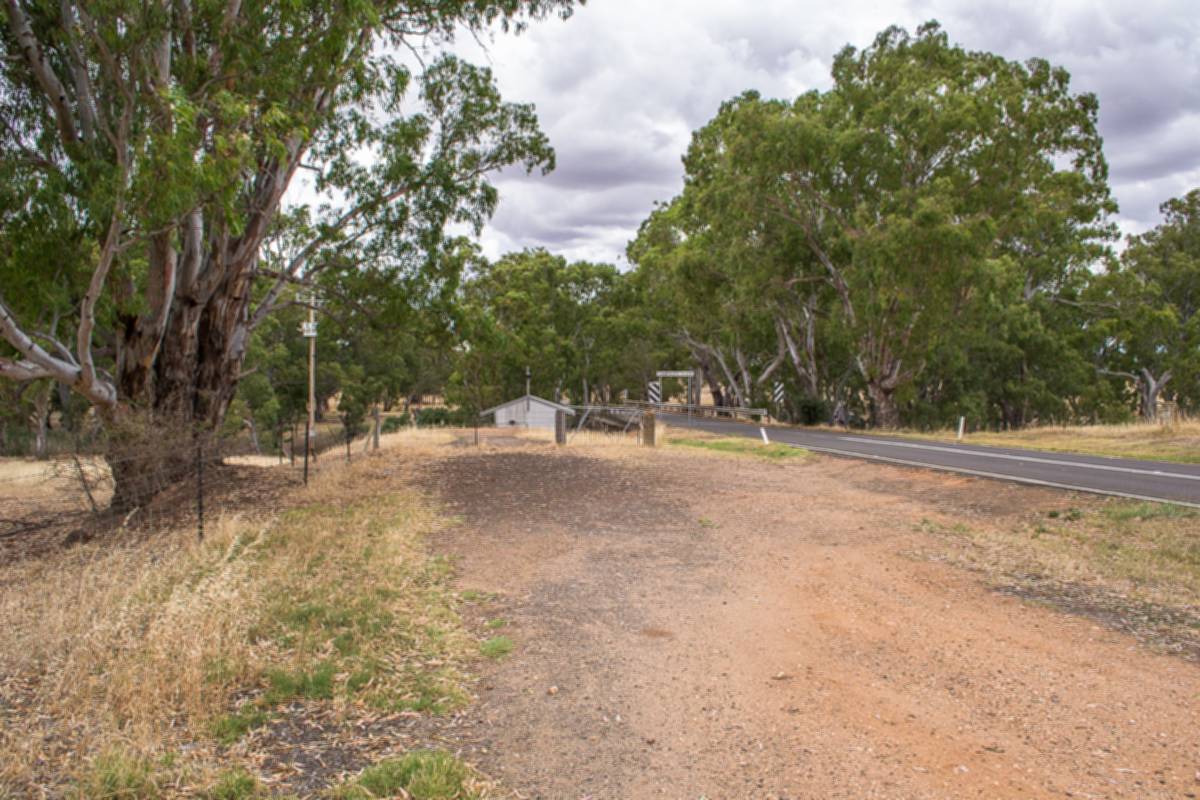
Before Robertson's investment previous land owners had built the Clare Inn and established a punt. It soon became an important service centre, crossing point and staging station for diggers going from Bendigo and Castlemaine to the Ovens and Rushworth goldfields, as well as for drovers moving sheep and cattle between New South Wales and Victoria along this important stock route. Barnadown Bridge was built in 1868 to replace the punt.
From the 1860's on, many new inhabitants moved into the area, buying and selecting land. Many of these were of Irish and English descent. Many descendants of these original settlers still occupy land in the district. Family names such as English, Harrington, Kennedy, McKinstry, O'Keefe, Read and Sharkey are well known across the district.
In its heyday, the Barnadown township boasted quite a number of businesses including the Clare Inn Hotel, Nicholas's Flour Mill and Saw Mill, a creamery, bootmaker, blacksmith, post office, grocer, butcher and saddlery.
Barnadown gradually declined in size and functions from the late 1860's. This was due to the opening of the Bendigo-Echuca Railway in 1864, which was the catalyst for the growth of Goornong. Goornong then replaced Barnadown as the service centre of the district. The growth of the neighbouring township of Fosterville in 1894 following the discovery of gold also affected Barnadown.
Today, the focus of Barnadown is on agricultural pursuits. It is now a peaceful rural settlement with a proud heritage.
This is one of three signs in a series, the other two are located at Goornong and Fosterville.
SEE ALSO