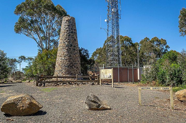
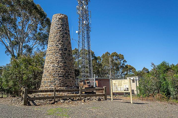
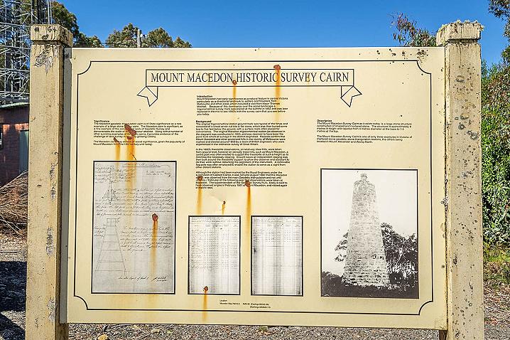
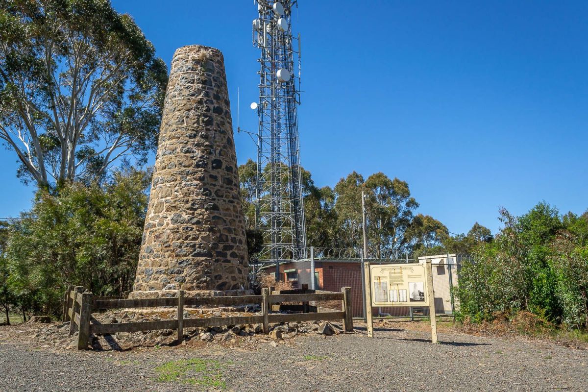
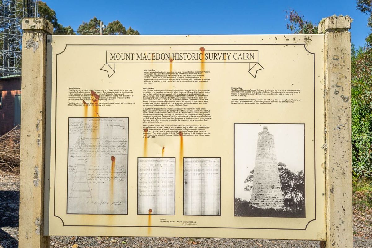
MOUNT MACEDON HISTORIC SURVEY CAIRN
Significance
The Macedon geodetic triangulation cairn is of State significance as a rare example of a large stone survey cairn. The Macedon cairn is significant, as a fine example of the construction work of Geodetic Survey and demonstrates the scale of the endeavour attained.
Along with a number of other surviving examples of Geodetic cairns, it provides evidence of the challenge of land survey in a rapidly growing Colony.
The Macedon cairn may also be of social significance, given the popularity of Mount Macedon from the 19th century until today.
Introduction
Mount Macedon had early significance as a natural feature in central Victoria, particularly as a directional landmark to settlers and travellers from Melbourne and other areas which included a visit from Major Thomas Mitchell.
Because of this dominance over the social landscape a trigonometrical survey mark was placed at the summit in 1853 and was later replaced in the mid to late 1860's with the survey cairn that you see before you today.
Background
The original trigonometrical station ground mark was typical of the times and consisted of a broad arrow cut into a flat stone, which was then buried some two to five feet below the ground, with a surface mark often placed or convenience.
The original Macedon trigonometrical station (as observed in the diagram) was constructed in 1853, and was deemed to have been the point from which all surveys in the district originated.
Records confirm that Mount Macedon and other prominent hills in the vicinity of Melbourne were marked and cleared around 1853 by a team of British engineers who were experienced in the ordinance survey of Great Britain.
In the 1800's theodolite observations, on relatively clear hills, were taken from ground level, however on densely treed hills, such as Mount Macedon, a centre post was often erected to support the theodolite at such a height as to minimise the necessary clearing.
In such cases an independent staging was then built around the theodolite support to allow the observer and assistant to do their work without disturbing the alignment of the instrument.
A removable flag pole was often employed to enable the station to serve as a sight from other distant stations.
Although the station had been marked by the Royal Engineers under the supervision of Captain Clarke, it was not until August 1860 that the Macedon station was observed from the main Geodetic triangulation and not until January / February of the following year that observations were taken at Macedon.
The superintendent of the Geodetic Survey R.J.L. Ellery is said to have observed angles in February 1861 at Mount Macedon, and visited again in March 1864.
Description
The Mount Macedon Survey Cairn as it exists today is a large stone structure constructed of shaped and mortared stone.
The structure is approximately 8 metres in height and tapered from 4 metres diameter at the base to 1.5 metres at the top.
The Mount Macedon Survey Cairn is one of only three examples in Victoria of mortared stone geodetic triangulation stations, the others being located in Mount Alexander and Warby North.
