Section of 1908 geological survey map, County of Gladstone, State Library Victoria.
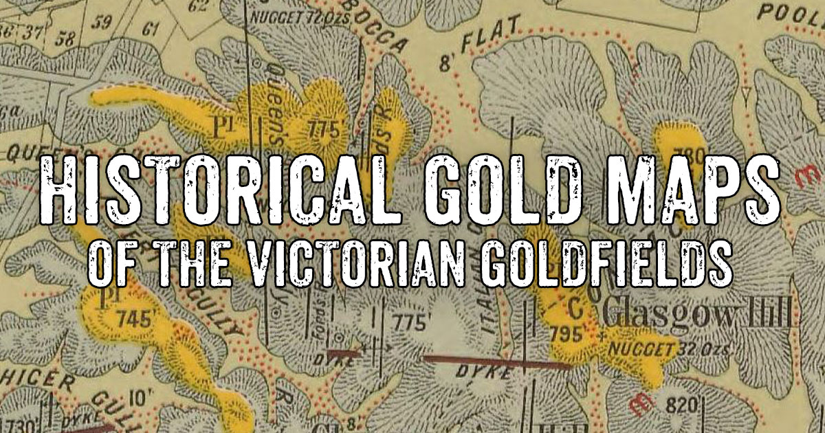
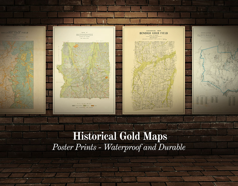
Looking for detailed historical gold maps? Browse a curated collection of high quality gold maps here.
The State Library Victoria and National Library of Australia contain a wealth of digitised resources, many of which provide valuable information for the modern day gold prospector.
Historical maps provide insights into the geological features and gold mining operations of the past, helping prospectors to determine ideal locations to search for gold.
The huge list of maps on this page links to historical maps for various towns and regions throughout the Victorian Goldfields.
These maps have been selected because they display useful information regarding the location of reefs, leads, diggings, mining operations, and geological features.
This list is not complete, and will continue to be added to over time - you can like/follow the Goldfields Guide Facebook page for updates.
Always check the land access rules of the area you are planning on prospecting in.
VICTORIAN HISTORICAL GOLD MAPS by town/region
Historical goldfields maps of Victoria
Section of the 1853 pocket map of the roads to all the mines in Victoria, Trove.
- Diggers road guide to the gold mines of Victoria and the country extending 210 miles round Melbourne, 1853
- Ham's Squatting Map of Victoria, 1853
- Pocket map of the roads to all the mines in Victoria, 1853.
- Diagram map showing the worked portions of the Victorian gold fields and the boundaries of the Gold Commissioners' districts, 1855
- General agricultural and goldfields map of Victoria, 1860.
Ararat gold maps
Section of 1875 map of Ararat gold field, State Library Victoria.
- Ararat gold field, Mining Department, 1875. Shows quartz reefs, dykes, dips, post pliocene, upper newer pliocene, lower newer pliocene, older pliocene, lower silurian, granite, upper volcanic. Includes notes. Second page shows detailed sections and particulars of bores.
- Plan of portion of the Langi Logan lead system, near Ararat, Geological Survey of Victoria, 1917. Shows bedrock levels, private and government bores, recent, tertiary, devonian, and ordovician.
Avoca gold maps
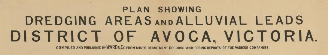
From 1920s plan showing dredging areas and alluvial leads, district of Avoca, State Library Victoria.
- Plan showing dredging areas and alluvial leads, district of Avoca, Victoria, 192?. Shows worked portions of alluvial leads, unworked portions of alluvial leads, lines of bores which have indicated the position of the leads at various points shown, depth of bore from surface to bottom of lead, mining lease numbers, basalt, other valleys not covered by basalt, exposures of granites, rocks of ordovician time.
- Special lands, Parish of Avoca, 1863. Shows location of gold workings and crushing machine.
- Plan showing Loddon and Avoca deep lead systems, Geological Survey of Victoria, 1904.
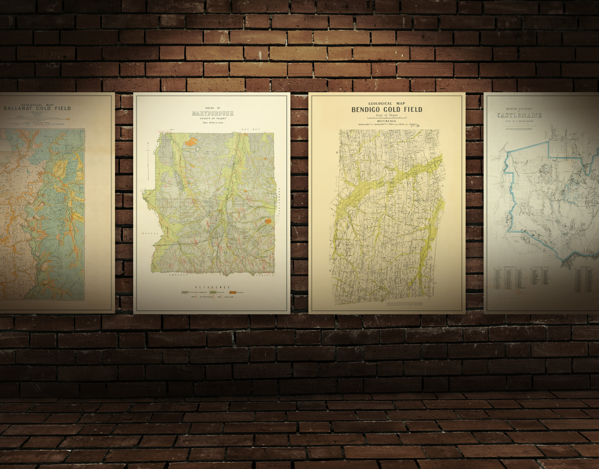
Ballarat gold maps
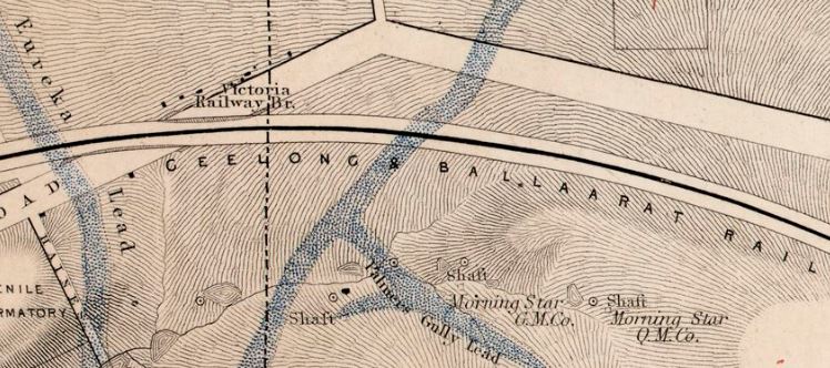
Section of Ballaarat gold field map, 1861, State Library Victoria.
- Ballarat gold field, geological survey, 1874. Shows gold workings and leads, most recent drift, recent drift, volcanic, older gold drift, oldest gold drift, lower silurian, quartz reefs, proved auriferous reefs, points of volcanic eruption, shafts, sub basaltic reef washes. Includes detailed notes.
- Ballarat gold field, geological map, 1917. Shows recent alluvial, thin capping, post basaltic gravels, new volcanic, inter-basaltic clays, gravels and drift, sub-basaltic clays, gravels and drift, deep leads where exposed, reef wash where proved under newer deposits, high level pre-basaltic gravels, ordovician shales and fine grained sandstones. Also shows shafts, alluvial, dykes, anticlines and synclines.
- Plan of leads and gold workings at Ballaarat, 1863. How the frontage system changed gold mining at Ballaarat, includes map and notes.
- Mining district of Ballaarat, 1859. Shows reefs, leads, gullies, workings.
- Plan of Ballarat, Sebastopol and Buninyong gold field showing mining areas to be drained by a proposed adit along the valley of the Yarrowee River, 1870. Shows reefs, gullies, various geological features.
- Niven's Mining Map of Ballaarat, 1870. Shows leads, gullies and companies (including their claim areas and amount/depth/area of gold obtained).
- Ballaarat gold field, 1861. Shows leads, reefs and outcrops.
- Gold fields Ballaarat, drawn on stone by E. Gilks, from information supplied by mining surveyors Cowan and Davidson, 1868. Shows leads (depth of leads from surface, height of surface above sea level), quartz reefs outcropping, granite, basalt, indurated clays and sandstone, palaeozoic.
Baringhup gold maps
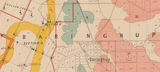
Section of 1899 map of deep lead system, State Library Victoria.
- Berry-Moolort-Loddon deep lead system, 1899. Boring operations in the parishes of Eddington, Carisbrook, Neereman, Baringhup and Moolort. Shows boring operations, leads, silurian and granite. Also includes diagrams - sections of bores.
Beaufort gold maps
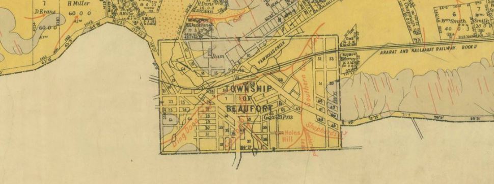
Section of historical map of the area around Beaufort, 1889? State Library Victoria.
- Township of Beaufort, Public Lands Office, 1858. Shows location of the Yam Hole Diggings.
- Beaufort, County of Ripon, Crown Lands Dept, 1889? Shows leads, surface workings, alluvial, tertiary and silurian.
Bealiba gold maps
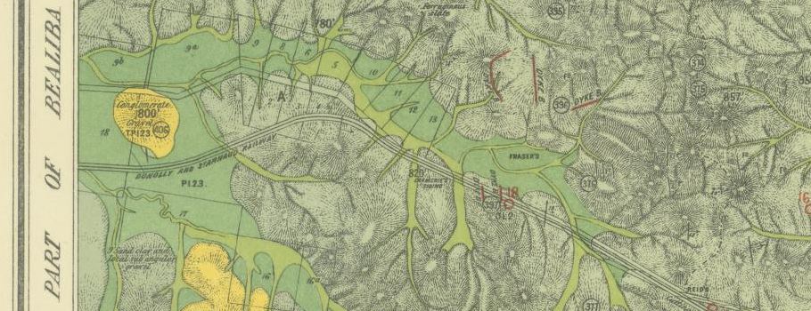
Section of 1915 map by Geological Survey of Victoria, State Library Victoria.
- Geological Survey of Victoria, parts of parishes of Bealiba, Moliagul, Tarnagulla, Waanyarra, Dunolly and Archdale, 1915. Shows anticlines, dips, strike, dykes, quartz reefs, auriferous reefs, indicator lines, outcrops of ironstone, nuggets, shafts and alluvial workings.
Beechworth gold maps
Section of 1871 geological map of Beechworth, State Library Victoria.
- Geological sketch map of the Parish of Beechworth, Mining Dept, 1871. Shows quartz reefs, gold, dykes, diamonds, eurite, breccia, oxide of tin, granite, gneiss, silurian, conglomerate, older pliocene, newer pliocene, recent.
Bendigo gold maps
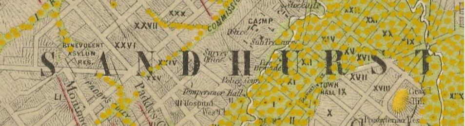
Section of 1873 Sandhurst gold field map, State Library Victoria.
- Geological map, Bendigo gold field. Dept of Mines, 1923. Shows reefs, shafts, alluvial, sands, gullys, dams.
- Plan showing outcrops of reefs on supposed extension south of the New Chum line of reef, from the Eureka Extended Company's ground, 1886.
- Plan showing the anticlinal axial lines at surface of a portion of the Bendigo gold field. Geological survey of Victoria, 1910. Three maps. Notes on the map: The saddle reefs occur along axial lines, line of reefs auriferous at surface, alluvial workings, and land sold.
- Sandhurst gold field, 1873. Two maps, shows quartz reefs where proved auriferous, gold workings, granite, lower silurian, older pliocene, newer pliocene, post pliocene.
- Sketch map of alluvial and deep lead systems, Bendigo-Huntly, Campaspe, Malmsbury, Kyneton, Trentham, 191x. Shows alluvial flats/swamps, surface gravel deposits, volcanic/basalt, deep leads and alluvial workings, line of bores, glacial conglomerates, dacites, ordovician and silurian, granite.
- Yankee Creek gold field, 1900. Shows quartz veins, scattered quartz, shafts, silurian and recent. Area covers Axedale, Wellsford and Ellensmere.
- Mining surveyors map of the district of Sandhurst, 1871. Showing the different companies and ground leased up to November 1st, 1871.
- Sandhurst gold field, 1873. Shows reefs and blocks held under leasing.
- Map of Sandhurst district from the Campaspe to Loddon Rivers, and from Echuca to the Porcupine Inn, 1860. Shows reefs, gold mining companies and leases.
Blackwood gold maps
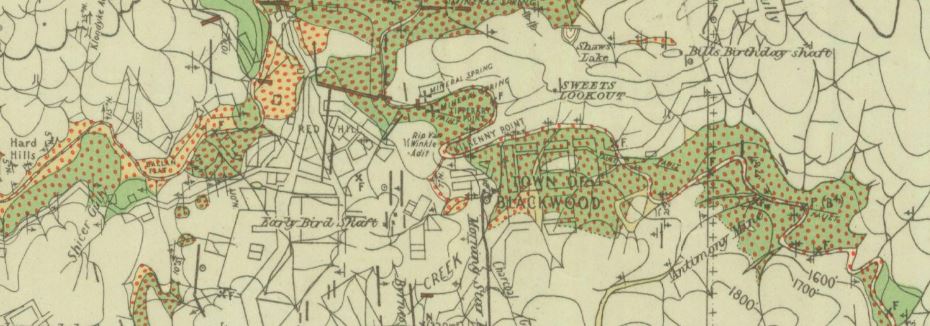
Section of 1937 geological map of Blackwood, State Library Victoria.
- Blackwood, County of Bourke, topographically and geographically surveyed by H. Foster, 1923. Dept of Mines, 1937. Shows alluvial gold workings, surface workings, nuggets, quartz reefs, auriferous quartz reefs, shafts, adits, fossils, springs, dams, grit beds, contours, heights above sea level, anticlines, synclines, dips and strikes, pitch, dykes, recent, pliocene, miocene, newer volcanic, older volcanic, glacial, and ordovician.
- Township of Blackwood, County of Bourke Surveyor General's Office, 1856. Shows the township and the location of the Tipperary Flat Diggings.
- Gorong and portions of Blackwood and Myrniong, Geological Survey of Victoria, 1931. Shows dykes, acid, basic, granite, anticlines, synclines, dips and strikes, bores, native ovens, contours, heights above sea level, recent, pliocene, miocene, newer volcanic, older volcanic, glacial, ordovician, metamorphosed ordovician, and granodiorite.
Bright gold maps
Section of 1906 map of Pioneer Mine, State Library Victoria.
- Bright, Wandiligong and Freeburgh gold-field, Geological Survey of Victoria, 1925. Shows quartz reefs, aurierous, dykes, bores, strike and dip of strata, tunnels, deep leads, anticlines, synclines. Also shows river flats/gullies gravel, clay, boulders, sand, swamp deposits, terrace gravels, sandstones, slates, quartzites and occational grits.
- Pioneer Mine, Bright. Geological Survey of Victoria, 1906. Map of Pioneer Mine, shows shafts, adits, stopes, open cut, surface workings, quartz reefs, outcrops, strike and dip of strata, anticlinal folds, synclinal folds.
- Pioneer Mine, Bright. Geological Survey of Victoria, 1906. Shows underground sections of Pioneer Mine. Shows sandstone, slate, quartz and quartz spurs.
Carisbrook gold maps

- Berry-Moolort-Loddon deep lead system, 1899. Boring operations in the parishes of Eddington, Carisbrook, Neereman, Baringhup and Moolort. Shows boring operations, leads, silurian and granite. Also includes diagrams - sections of bores.
Castlemaine gold maps
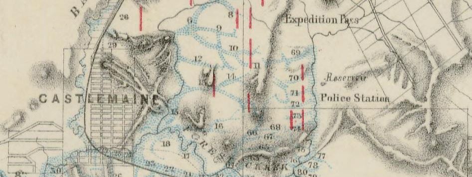
Section of 1860 map of the mining district of Castlemaine, State Library Victoria.
- Geological sketch of the country in the vicinity of Mnt Alexander, 1854. Shows granite, metamorphosed paleozoic strata, basalt, dip of strata, strike and position of the chief auriferous quartz veins of Forest Creek and Bendigo.
- Mining district of Castlemaine, Mining Department, 1860. Shows reefs, gullies, gold workings across four divisions - Castlemaine, Tarrengower, Hepburn, and Fryer's Creek.
- Geological Survey of Victoria, 1864. Parts of parishes of Muckleford, Castlemaine, Chewton, Yandoit, Strangways, Guildford and Tarrengower. Shows quartz reefs, copper, zinc, lead, manganese, iron, dips, strikes, dykes, post pliocene, newer pliocene, older pliocene, lower silurian, upper volcanic, slate, sandstone, clay, gravels, more. Includes detailed notes.
- Castlemaine, compiled and drawn by R. Hicksh from surveys of Mining Surveyor Brown, 1866. Shows reefs, gullies, gold workings, locations of crushing machines.
- Plan of the Chewton-Castlemaine gold field, 1902. Shows reefs, dykes, dip of strata, anticlinal folds, synclinal folds, anticlinal axial lines, alluvial, lower level hill gravels, higher level hill gravels, slates, flags and sandstones, granite.
Clunes gold maps
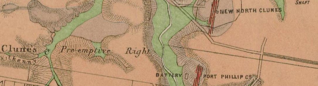
Section of 1883 map of Clunes, Mt Greenock and Talbot gold fields, State Library Victoria.
- Clunes, Mt Greenock and Talbot gold fields, Mining Dept, 1883. Shows outcrops of quartz reefs, quartz reefs proved auriferous, strike and dip of rocks, points of volcanic eruption, gold workings, alluvial, post pliocene, newer volcanic, upper pliocene, lower pliocene, lower silurian, granite, and trappean.
Creswick gold maps
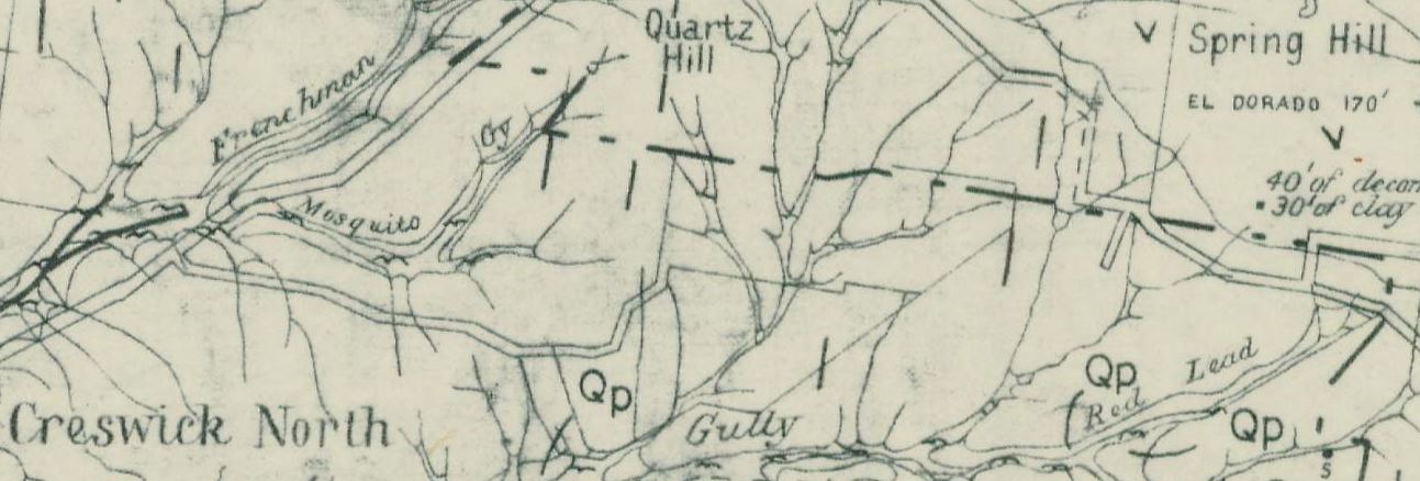
Section of 1880 Creswick gold field map, State Library Victoria.
- Creswick gold field, Dept of Mines, 1880. Shows quarries, shafts, springs, rock specimens, points of eruptions, dips and strikes, quartz reefs, and auriferous leads. Detailed notes to the side of the map.
- Creswick gold field geological map, 1880. Shows quartz reefs, dips of strata, points of eruption, auriferous leads, porphyry, lower silurian, lower pliocene, middle pliocene, newer volcanic, upper pliocene, and post pliocene.
- Plan showing Loddon and Avoca Deep Lead Systems, Dept of Mines, 1904. Four maps covering the area between Bridgewater, Berrimal, Creswick and Beaufort.
Dunolly gold maps

Reference section of 1894? map of Dunolly and district, State Library Victoria.
- Geological Survey of Victoria, parts of parishes of Bealiba, Moliagul, Tarnagulla, Waanyarra, Dunolly and Archdale, 1915. Shows anticlines, dips, strike, dykes, quartz reefs, auriferous reefs, indicator lines, outcrops of ironstone, nuggets, shafts and alluvial workings.
- Dunolly, Crown Lands Dept, 1894? Shows reefs, gold workings, silurian and recent.
Eaglehawk gold maps
Section of 1879 map of quartz reefs northward from Eaglehawk, State Library Victoria.
- Plan shewing surface extensions of quartz reefs northward from Eaglehawk, Sandhurst, 1879. Shows alluvial gold workings, quartz reefs, gullies.
Eddington gold maps
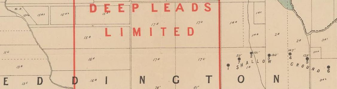
- Berry-Moolort-Loddon deep lead system, 1899. Boring operations in the parishes of Eddington, Carisbrook, Neereman, Baringhup and Moolort. Shows boring operations, leads, silurian and granite. Also includes diagrams - sections of bores.
Enfield gold maps
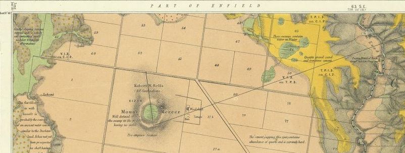
Section of 1868 Geological Survey of Victoria map, State Library Victoria.
- Parts of parishes of Enfield, Cargerie, Bamganie, Shelford West, Wurrook, Warrambine and Lawaluk, Geological Survey of Victoria, 1868. First map shows dykes, dip and strike, quartz reefs, gold, museum specimens, post pliocene, older pliocene, lower silurian, upper volcanic, thin capping of tertiary on older rocks, volcanic hills and points of eruption, detailed notes included on map. Second map shows cross section of the Durham Lead from Mt Mercer to Green Hill.
Goldsborough gold maps
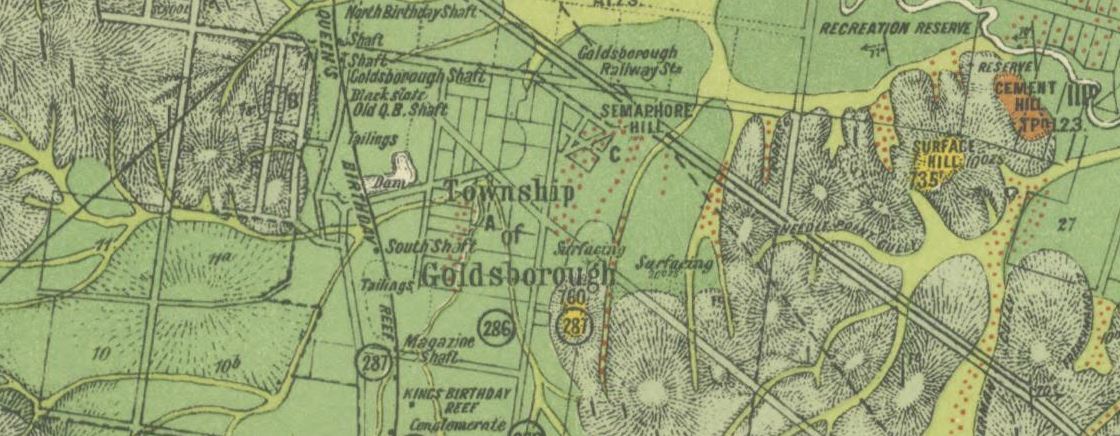
Section of 1915 Geological Survey map, State Library Victoria.
- Geological Survey of Victoria, parts of parishes of Bealiba, Moliagul, Tarnagulla, Waanyarra, Dunolly and Archdale, 1915. Shows anticlines, dips, strike, dykes, quartz reefs, auriferous reefs, indicator lines, outcrops of ironstone, nuggets, shafts and alluvial workings.
Heathcote gold maps
Section of 1903 Geological Survey Map, State Library Victoria.
- Plan of allotments between Heathcote and the McIvor Inn, 1854. Shows Argyle Gully diggings, quartz crushing machine, road to the antimony mine.
- Suburban allotments adjoining the Township of Heathcote, 1856. Shows diggings.
- Township of Heathcote, 1864. Shows alluvial flats, worked auriferous ground, gold commissioner's reserve.
- Parts of parishes of Knowsley East, Dargile, Costerfield and Heathcote, Geological Survey of Victoria, 1903. Shows reefs, dips of strata, alluvium, old gravels, glacial beds, silurian, ordovician, diabase, metamorphic.
- Heathcote, County of Dalhousie, Geologlical Survey of Victoria, 1940. Shows quartz reefs, shafts, dip and strike, alluvial gold, fossil localities.
Inglewood gold maps
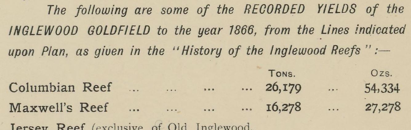
Section of 1896 plan of Inglewood gold field, State Library Victoria.
- Plan of Inglewood gold field, 1896. Shows reefs, leads, gullies. Also shows some recorded yields of the Inglewood goldfield to the year 1866.
Kingower gold maps
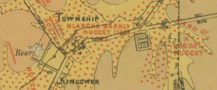
Section of 19?? map of Kingower, State Library Victoria.
- Kingower, County of Gladstone. Department of Crown Lands and Survey, 19??. Shows reefs, gold workings, recent, pliocene, silurian, metamorphic and granite.
Majorca gold maps
Section of 1869 map of the Young Sadowa Gold Mining Co. State Library Victoria.
- Plan of the Young Sadowa Gold Mining Co. 1869. Shows Majorca, McCallums Creek, Back Creek. Location of many shafts, depth of five of the shafts and whether they had been bottomed.
Malmsbury gold maps
Section of 1906 map of Malmsbury and Lauriston gold field, State Library Victoria.
- Parts of parishes of Elphinstone, Metcalfe, Edgecombe, Drummond, Fryers and Lauriston. Geological Survey Office, 1865. Shows quartz reefs, gold, gold workings, iron, tin, dip and strike, anticlinal line, synclinal line, alluvial, post pliocene, newer pliocene, older pliocene, lower silurian, granite, thin capping on older rocks.
- Malmsbury and Lauriston gold field, Department of Mines, 1894. Shows alluvial, gold workings, gold leads, quartz reefs, shafts, dip, anticlinal fold, synclinal fold, upper volcanic, pliocene, mesozoic, lower silurian, heights above sea level.
- Malmsbury and Lauriston gold field, Department of Mines, 1906. Updated version of above map.
Maryborough gold maps
A section of an old Maryborough map showing reefs and leads, State Library Victoria.
- Parish of Maryborough, County of Talbot, 19xx. Shows reefs, alluvial leads, dykes, dip of silurian rocks, reef rocks, slates, sandstones, alluvial flats, cement beds.
- Mining district of Maryborough, Mining Dept 1861. Extends to surrounding towns such as Clunes, Dunolly, Tarnagulla, Avoca and Redbank.
- Geological Survey of Victoria, 1913. Parts of Parishes of Rathscar, Wareek, Maryborough, Bet Bet and Bung Bong.
- Plan showing Loddon and Avoca Deep Lead Systems, Dept of Mines, 1904. Four maps covering the area between Bridgewater, Berrimal, Creswick and Beaufort.
Mitta Mitta gold maps
Section of the reference on an old Mitta Mitta map, State Library Victoria.
- Geological and topographical map of Tallandoon, Eskdale and Mitta Mitta Tinfield, Geological Survey of Victoria, 1912? Shows dykes, quartz reefs, alluvial gold workings, sliced specimen, strike and dip, shafts, syncline, anticline, approximate contours, barometric heights, recent alluvial gravels, post pliocene, pliocene, ordovician, metamorphosed ordovician.
Moliagul gold maps
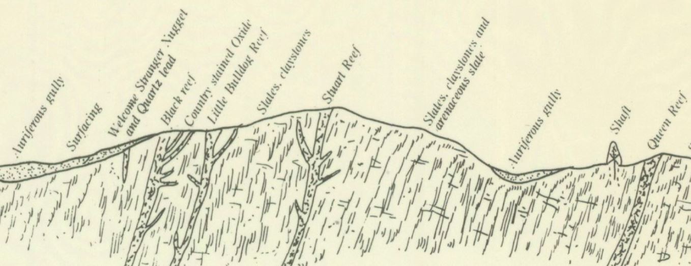
Section of 1899 (re-issued in 1980) map of Moliagul, diagram of section near Welcome Stranger nugget, State Library Victoria.
- Parish of Moliagul, geological survey. Surveyed 1899, re-issued by the Dept of Minerals and Energy in 1980. Shows leads, dykes, reefs, alluvials, newer pliocene, older pliocene, silurian and granite. Also shows a diagram of the section near Welcome Stranger nugget.
- Geological Survey of Victoria, parts of parishes of Bealiba, Moliagul, Tarnagulla, Waanyarra, Dunolly and Archdale, 1915. Shows anticlines, dips, strike, dykes, quartz reefs, auriferous reefs, indicator lines, outcrops of ironstone, nuggets, shafts and alluvial workings.
Moonambel gold maps
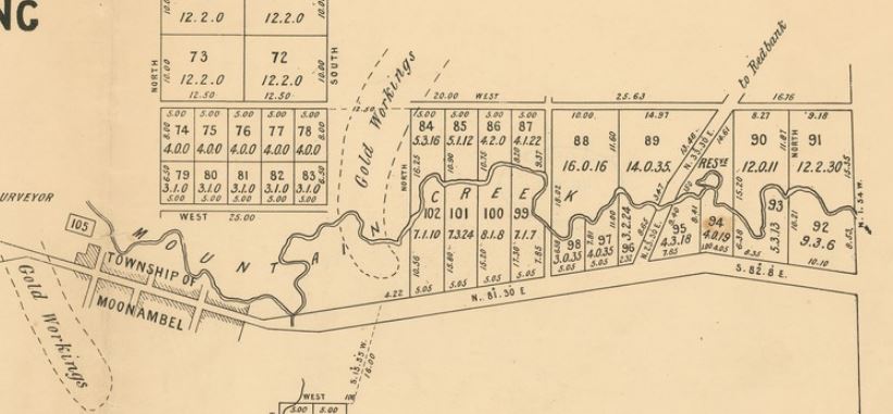
Section of 1864 map of Moonambel, State Library Victoria.
- Suburban allotments, Parish of Warrenmang, county unnamed, 1864. Shows gold workings.
Rushworth gold maps
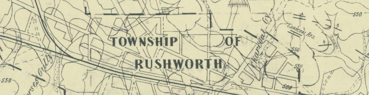
Section of 1954 Rushworth goldfield map, State Library Victoria.
- Rushworth goldfield, Dept. of Mines, Victoria. 1954. Shows names of hills, gullies, reefs, flats, etc. Shows shafts, alluvial workings, strike of rock and dip, vertical beds, anticline, syncline, reefs, faults, contours.
Smythesdale gold maps
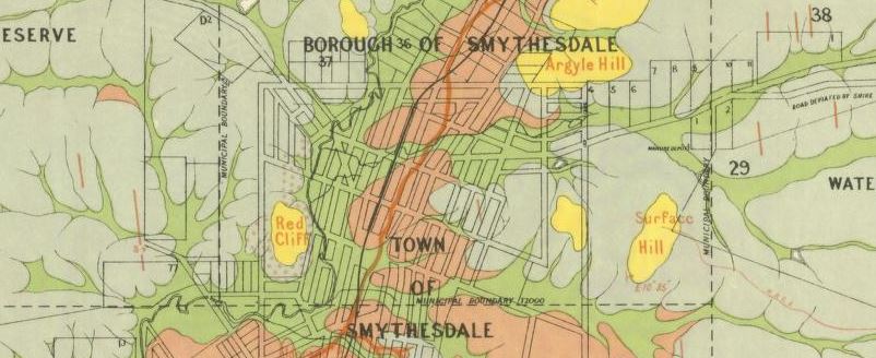
Section of 1888 geological map of Smythesdale, State Library Victoria.
- Smythesdale, County of Grenville, Geological Survey of Victoria, 1888. One map along with an informative written report. Map shows quartz reefs, shafts, post pliocene, upper pliocene, middle pliocene, lower pliocene, silurian and newer volcanic. Report goes into detail about various features and locations on the map.
- Smythesdale, Scarsdale, Clarkesdale, County of Grenville. Department of Crown Lands and Survey, 19??. Shows shafts, quartz reefs, dip of silurian strata, post pliocene, upper pliocene, middle pliocene, deep leads, lower pliocene, lower silurian.
St Arnaud gold maps
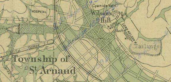
Part of St Arnaud gold field map, 1898, State Library Victoria.
- Map of St Arnaud gold field, underground survey of mines, 1898. Shows reefs, leads, gold workings, alluvial and pliocene. Also shows underground map of Lord Nelson Mine.
- St Arnaud, County of Kara Kara, Crown Lands Survey, 19??. Shows reefs, basaltic dykes, recent, pliocene, silurian.
Stawell gold maps
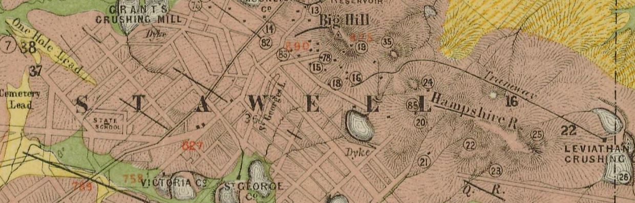
Section of 1878 map of Stawell gold field, State Library Victoria.
- Stawell gold field, Mining Department, 1878. Shows shafts, quartz reefs, dykes, dip of rocks, alluvial and post pliocene, upper pliocene, older gold drift, oldest gold drift, lower silurian and metamorphic, and granite.
- Plan of mining leaseholds and of land applied for under mining lease, Stawell, 1887. Map shows mining companies and their lands, includes list of the companies along with their capital, shares and managers. Also includes a trade directory for Stawell.
- Underground survey of the principal mines at Stawell, Mines Department, 1879. Shows detailed maps across six pages. Also includes a statistical statement showing number of steam engines, stamp heads, whims and whips, quantity of timber used for caps, props, laths, etc, and more.
Talbot gold maps
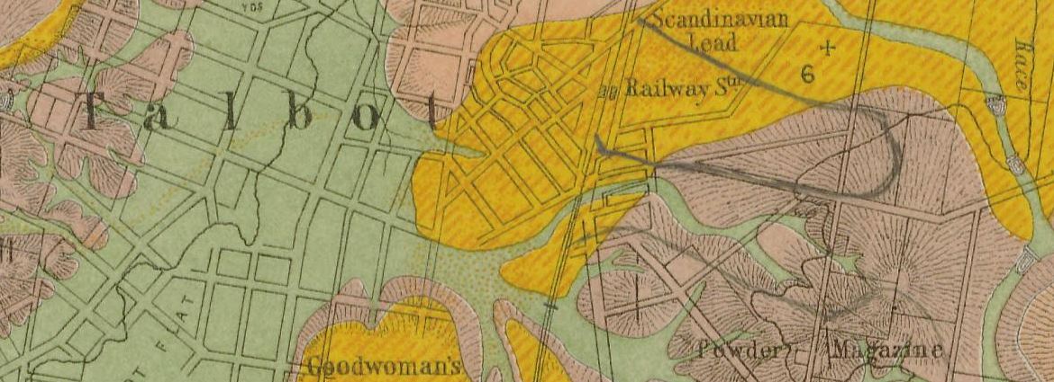
- Clunes, Mt Greenock and Talbot gold fields, Mining Dept, 1883. Shows outcrops of quartz reefs, quartz reefs proved auriferous, strike and dip of rocks, points of volcanic eruption, gold workings, alluvial, post pliocene, newer volcanic, upper pliocene, lower pliocene, lower silurian, granite, and trappean.
Tarnagulla gold maps
Reference section of 1979 (compiled from old reports) sketch map of Tarnagulla and Newbridge goldfields, State Library Victoria.
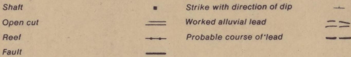
- Sketch map of Tarnagulla and Newbridge goldfields, Dept of Minerals and Energy, 1979. Note: this map has been compiled from old reports and plans and is not the result of any recent survey. Shows shafts, open cuts, reefs, faults, strikes, worked alluvial leads, probable course of leads.
- Geological Survey of Victoria, parts of parishes of Bealiba, Moliagul, Tarnagulla, Waanyarra, Dunolly and Archdale, 1915. Shows anticlines, dips, strike, dykes, quartz reefs, auriferous reefs, indicator lines, outcrops of ironstone, nuggets, shafts and alluvial workings.
Vaughan gold maps
Section of 1856 map of Vaughan, State Library Victoria.
- Hamlet of Vaughan, at the junction of the Loddon and Fryers Creek, 1856. Shows locations of gold workings and burial ground.
Waanyarra gold maps
Section of 1915 geological survey map of Waanyarra, State Library Victoria.
- Geological Survey of Victoria, parts of parishes of Bealiba, Moliagul, Tarnagulla, Waanyarra, Dunolly and Archdale, 1915. Shows anticlines, dips, strike, dykes, quartz reefs, auriferous reefs, indicator lines, outcrops of ironstone, nuggets, shafts and alluvial workings.
Walhalla gold maps
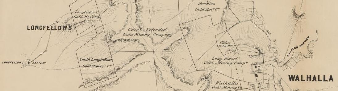
Section of 1871 plan of Walhalla and surrounding mines, State Library Victoria.
- Plan of Walhalla and the surrounding mines, 1871.
- Geological and topographical plan of Walhalla gold field and surrounding country, 1901. Shows bores, reefs, dykes, synclinal folds, anticlinal folds, dip and strike, alluvial gold, shafts, tunnels and tramways. Also recent, pleistocene, pliocene, volcanic, eocene, upper silurian, quartz-mica-diorite. Descriptive notes also included on the map.
- 17 maps of Walhalla mines and gold fields.
- Plan Walhalla to Timboon showing topographical and geological features, 1884. Shows dykes, reefs, strikes and underlay of strata. Also shows mining companies.
Warrandyte gold maps
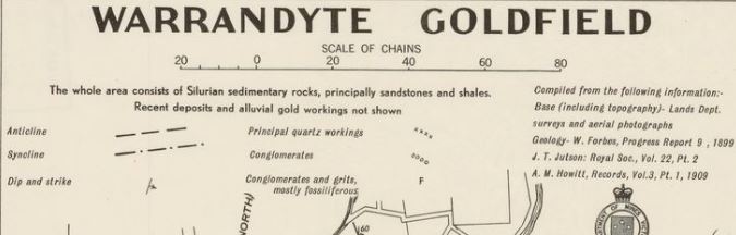
Section of 1909 map of Warrandyte goldfield, State Library Victoria
- Parts of parishes of Bulleen, Warrandyte, Ringwood, Scoresby and Nunawading, Geological Survey of Victoria, 1893. Shows alluvial gold workings, strike dip, quartz reefs, intrusive dyke, specimens retained for reference, barometer heights, alluvial, pliocene, upper silurian, thin capping of tertiary on older rocks.
- Warrandyte goldfield, Dept of Mines, 1909? Shows principal quartz workings, conglomerates, conglomerates and grits (mostly fossiliferous), anticline, syncline, dip and strike. Does not show recent deposits and alluvial gold workings.
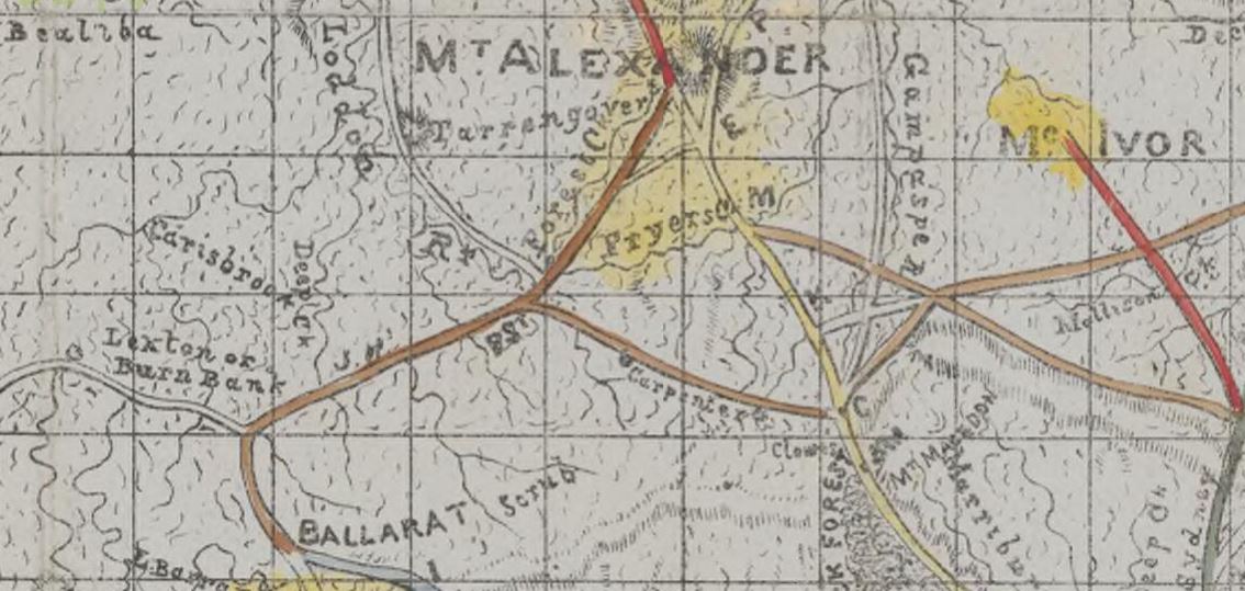
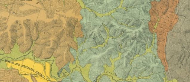
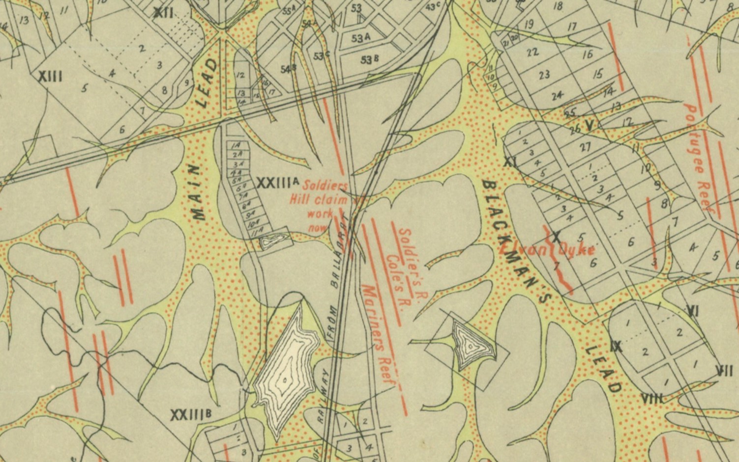
Wedderburn gold maps

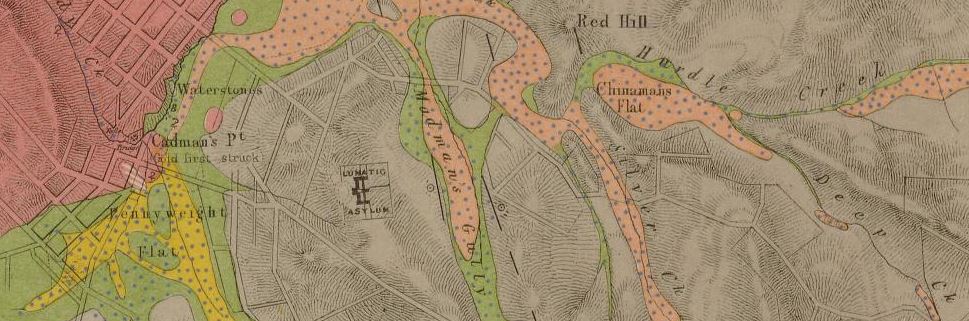
Section of 1908 geological survey map, State Library Victoria.
- County of Gladstone, Geological Survey of Victoria, 1908. Shows reefs, auriferous reefs, dips, dykes, synclines, anticlines, thin capping, bores, alluvial workings, recent, newer pliocene, older pliocene, ordovician, metamorphosed ordovician, and granite.
Yackandandah gold maps
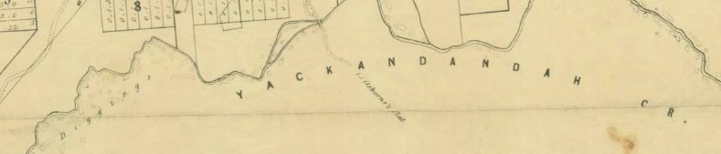
Section of 1856 map of the township of Yackandandah, State Library Victoria.
- The township of Yackandandah (county unnamed), Melbourne, Surveyor General's Office, 1856. Shows township, creeks, huts, various gold diggings (named and unnamed) including Kirby's Flat Diggings, The Doctor's Flat Diggings and Whiskey Flat Diggings.
Other useful gold prospecting resources
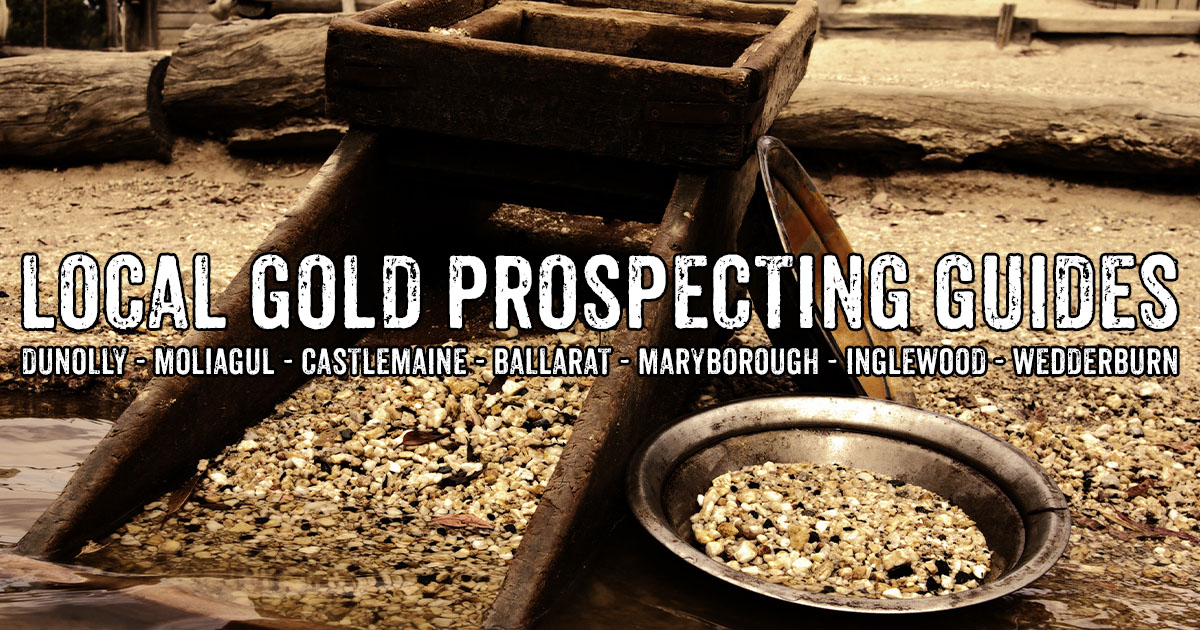
- Guide to gold prospecting in the Victorian Goldfields
- Places to prospect in the Victorian Goldfields
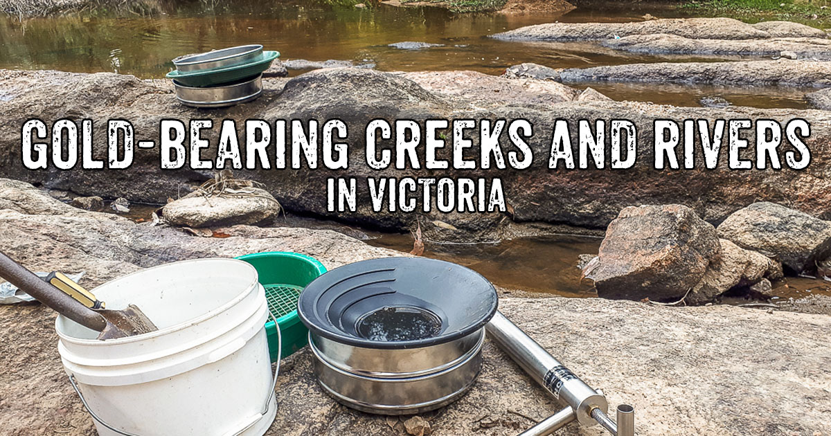
- Gold-bearing creeks and rivers in Victoria
- Gold prospecting maps for Victoria's State and National Parks
- Historical gold maps of the Victorian Goldfields
- Researching gold prospecting and history - online resources
- Surfacing in the Victorian Goldfields
- Gold shops, detector hire and gold tours in the Victorian Goldfields
- YouTube channels from the Victorian Goldfields
- Dangers of mine shafts in the Victorian Goldfields
PROSPECTORS AND MINERS ASSOCIATION VICTORIA
Established in 1980, the Prospectors and Miners Association of Victoria is a voluntary body created to protect the rights and opportunities of those who wish to prospect, fossick or mine in the State of Victoria, Australia.
You can support the PMAV in their fight to uphold these rights by becoming a member. You'll also gain access to exclusive publications, field days, prospecting tips, discounts and competitions.
Check out the PMAV website for more information.