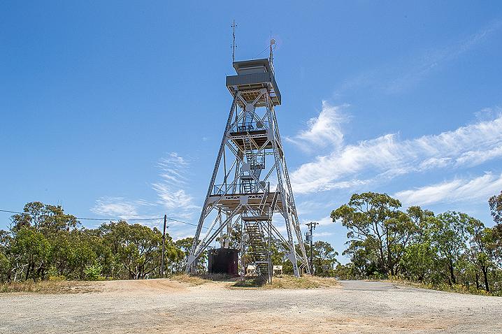
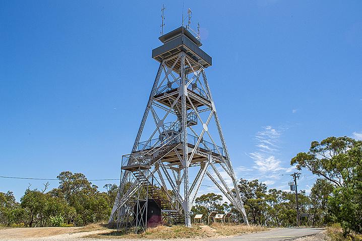
Head to the top of Mount Tarrengower in Maldon and check out the view from the top of the town's iconic poppet head lookout tower!
This multi level lookout tower was constructed in 1923 using the poppet head from the Comet Mine in Bendigo.
Climbing the Mount Tarrengower Lookout Tower
The tower has three levels - the first two levels are open to the public, but the topmost level is closed off and used as a fire lookout.
The stairs from the ground to the first level are easy to navigate, with a platform halfway up and good railing.
The stairs from the first level to the second level are much narrower and a lot steeper, you climb up almost vertically within a cage with thin railings to hold on to on the way up and down.
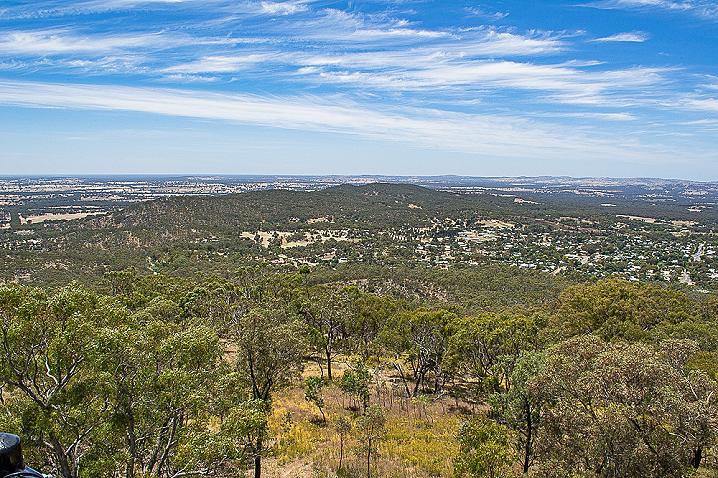
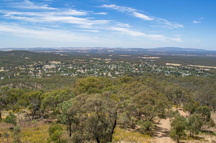
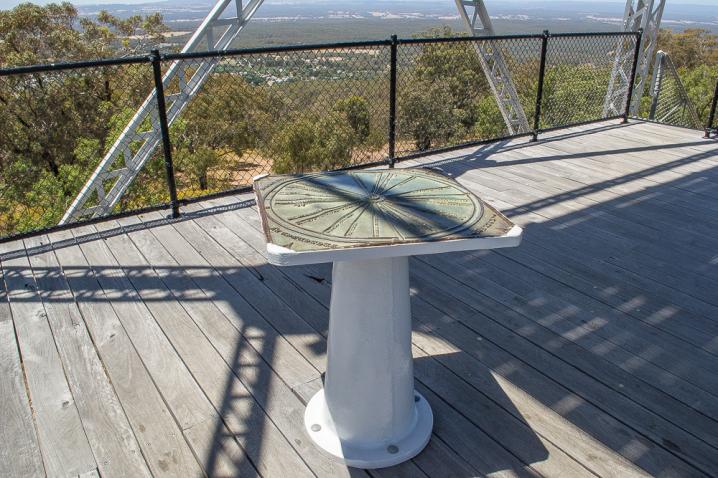
An interesting feature of the Mt Tarrengower Lookout Tower is a direction-board on the first viewing platform showing the directions to look (and distances) for many interesting visible landmarks, including Mt Alexander, Mt Macedon,
Mt Franklin and the spectacular
Grampians National Park.
Cairn Curran Reservoir is also visible.
Visitor facilities at the Mount Tarrengower Lookout Tower
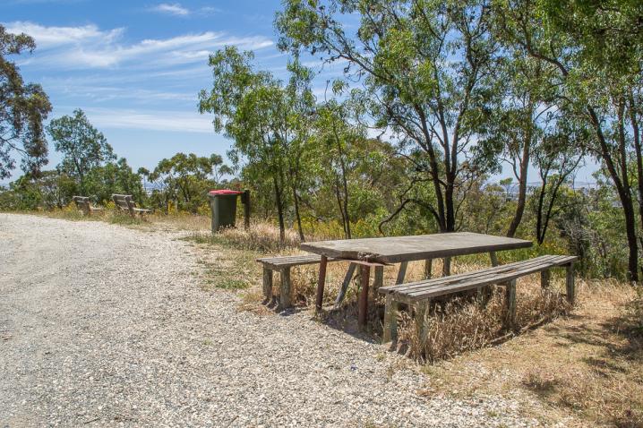
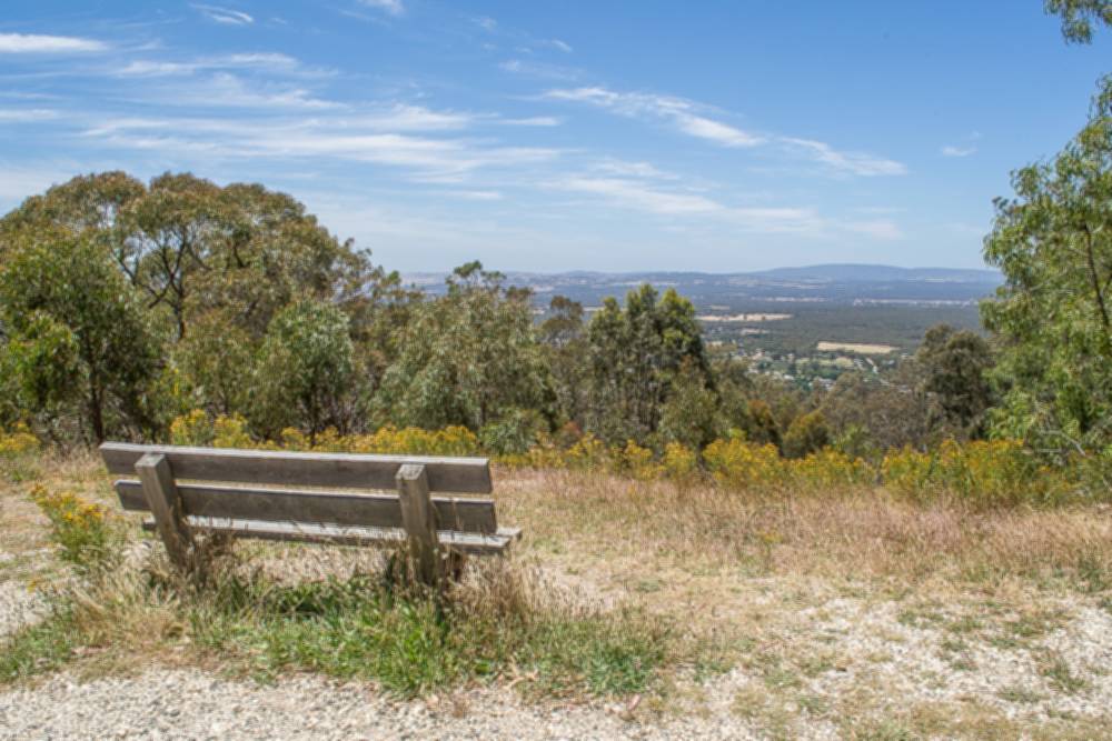
There are only basic visitor facilities at the Mount Tarrengower Lookout Tower. There's a picnic table, a bench seat with a great view over
Maldon, and a rubbish bin.
Free camping near the Mount Tarrengower Lookout Tower
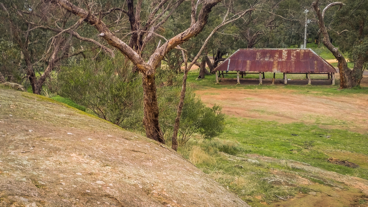
Butts Reserve is a fantastic free campground which features picnic and wood fire barbecue facilities and toilets. The campground is located part way up Mt Tarrengower Road, on the way up to the lookout tower.
Bushwalking at the Mount Tarrengower Lookout Tower
Lisles Reef Walk begins at the car park and takes about an hour. It has great views, interpretive signs and many significant mining relics along the way.
Walking down Adair Track or Fountain Track will take you down to
Maldon.
Historical INFORMATION ABOUT THE MOUNT TARRENGOWER LOOKOUT TOWER
Beneath the tower there are four fascinating information signs. They display the following text:
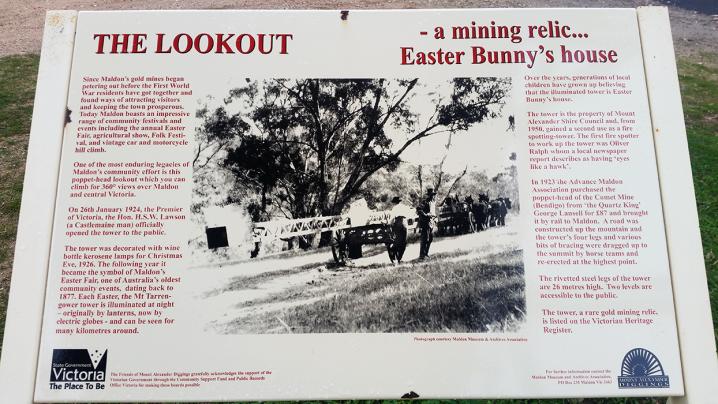
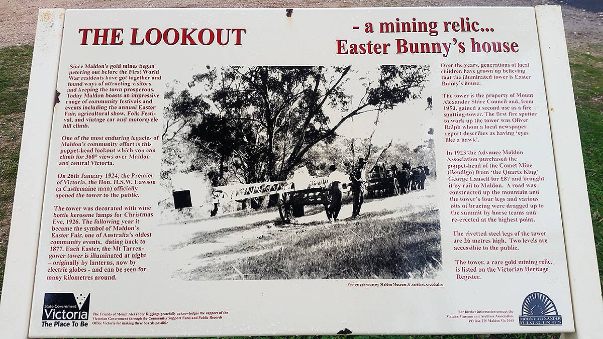
The Lookout - a mining relic... Easter Bunny's house
Since Maldon's gold mines began petering out before the First World War residents have got together and found ways of attracting visitors and keeping the town prosperous. Today Maldon boasts an impressive range of community festivals and events including the annual Easter Fair, agricultural show, Folk Festival and vintage car and motorcycle hill climb.
One of the most enduring legacies of Maldon's community effort is this poppet-head lookout which you can climb for 360 degree views over Maldon and central Victoria.
On 26th January 1924, the Premier of Victoria, the Hon. H.S.W. Lawson (a Castlemaine man) officially opened the tower to the public.
The tower was decorated with wine bottle kerosene lamps for Christmas Eve, 1926. The following year it became the symbol of Maldon's Easter Fair, one of Australia's oldest community events, dating back to 1877. Each Easter, the Mt Tarrengower tower is illuminated at night - originally by lanterns, now by electric globes - and can be seen for many kilometres around.
Over the years, generations of local children have grown up believing that the illuminated tower is Easter Bunny's house.
The tower is the property of Mount Alexander Shire Council and, from 1950, gained a second use as a fire spotting tower. The first fire spotter to work up the tower was Oliver Ralph whom a local newspaper report describes as having 'eyes like a hawk'.
In 1923 the Advance Maldon Association purchased the poppet-head of the Comet Mine (Bendigo) from 'the Quartz King' George Lansell for £87 and brought it by rail to Maldon. A road was constructed up the mountain and the tower's four legs and various bits of bracing were dragged up to the summit by horse teams and re-erected at the highest point.
The rivetted steel legs of the tower are 26 metres high. Two levels are accessible to the public.
The tower, a rare gold mining relic, is listed on the Victorian Heritage Register.
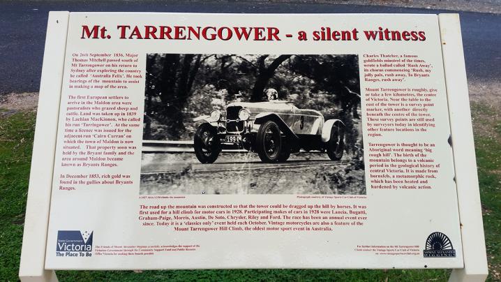
Mt Tarrengower - a silent witness
On 26th September 1836, Major Thomas Mitchell passed south of Mt Tarrengower on his return to Sydney after exploring the country he called 'Australia Felix'. He took bearings of the mountain to assist in making a map of the area.
The first European settlers to arrive in the Maldon area were pastoralists who grazed sheep and cattle. Land was taken up in 1839 by Lachlan MacKinnon, who called his run 'Tarringower'. At the same time a licence was issued for the adjacent run 'Cairn Curran' on which the town of Maldon is now situated. That property soon was held by the Bryant family and the area around Maldon became known as Bryants Ranges.
In December 1853, rich gold was found in the gullies about Bryants Ranges.
Charles Thatcher, a famous goldfields minstrel of the times, wrote a ballad called 'Rush Away', its chorus commencing 'Rush, my jolly pals, rush away, To Bryants Ranges, rush away'.
Mount Tarrengower is roughly, give or take a few kilometres, the centre of Victoria. Near the table to the east of the tower is a survey point marker, with another directly beneath the centre of the tower. These survey points are still used by surveyors today in identifying other feature locations in the region.
Tarrengower is thought to be an Aboriginal word meaning 'big rough hill'. The birth of the mountain belongs to a volcanic period in the geological history of central Victoria. It is made from hornsfels, a metamorphic rock, which has been heated and hardened by volcanic action.
The road up the mountain was constructed so that the tower could be dragged up the hill by horses. It was first used for a hill climb for motor cars in 1928. Participating makes of cars in 1928 were Lancia, Bugatti, Graham-Paige, Morris, Austin, De Soto, Chrysler, Riley and Ford. The race has been an annual event ever since. Today it is a 'classics only' event held each October. Vintage motorcycles are also a feature of the Mount Tarrengower Hill Climb, the oldest motor sport event in Australia.
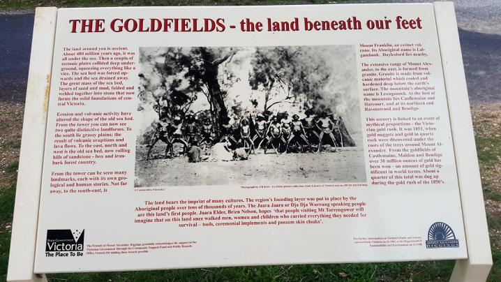
The Goldfields - the land beneath our feet
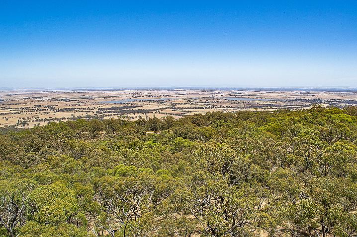
The land around you is ancient. About 480 million years ago, it was all under the sea. Then a couple of tectonic plates collided deep underground, squeezing everything like a vice. The sea bed was forced upwards and the sea drained away. The great mass of the sea bed, layers of sand and mud, folded and welded together into stone that now forms the solid foundations of central Victoria.
Erosion and volcanic activity have altered the shape of the old sea bed. From the tower you can now see two quite distinctive landforms. To the south lie grassy plains: the result of volcanic eruptions and lava flows. To the east, north and west is the old sea bed, now rolling hills of sandstone - box and ironbark forest country.
From the tower can be seen many landmarks, each with its own geological and human stories. Not far away, to the south-east, is Mount Franklin, an extinct volcano. Its Aboriginal name is Lalgambook. Daylesford lies nearby.
The extensive range of Mount Alexander, to the east, is formed from Granite. Granite is made from volcanic material which cooled and hardened deep below the earth's surface. The mountain's aboriginal name is Leanganook. At the foot of the mountain lies Castlemaine and Harcourt, and at its northern end Ravenswood and Bendigo.
This scenery is linked to an event of mythical proportions - the Victorian gold rush. It was 1851, when gold nuggets and gold in quartz rock were discovered under the roots of the trees around Mount Alexander. From the goldfields of Castlemaine, Maldon and Bendigo over 30 million ounces of gold has been won - an amount of gold significant in world terms. About a quarter of this total was dug up during the gold rush of the 1850s.
The land bears the imprint of many cultures. The region's founding layer was put in place by the Aboriginal people over tens of thousands of years. The Jaara Jaara or Dja Dja Wurrung speaking people are this land's first people. Jaara Elder, Brien Nelson, hopes 'that people visiting Mt Tarrengower will imagine that on this land once walked men, women and children who carried everything they needed for survival - tools, ceremonial implements and possum skin cloaks'.
Fire Spotting - over sixty years of vigilance
There is a fire lookout box on the top level of the tower. It is manned for approximately 125 days over the summer months. The person (or fire spotter) on duty scans the landscape for smoke and reports any signs to the fire authorities (currently the Department of Sustainability & Environment, Parks Victoria and the CFA) who in turn send out trucks and firefighters to put out the flames.
It was the establishment of the Victorian Forests Commission in 1919 that led to the State Government's first serious approach to fire protection in Victoria. Hitherto, fire control as it is now understood was almost non-existent. Some patrol work and fire fighting was attempted by individual officers, but lack of funds and co-ordination left the few district officers without men or means.
From 1919, a fire protection plan for the State's forests took shape as the Forests Commission took a more scientific approach towards the problem. The first fire-spotting towers were constructed in 1924. During the fire season of 1927-28 observations were recorded at several fire-spotting towers for the purpose of matching fire occurrences with weather conditions. The number of towers dramatically increased, from 15 to 37, after bad bushfires in 1929.
The Forests Commission also sought to improve efficiency by the introduction of new tools (such as spray pumps), the construction of ams and the provision of water tanks at strategic locations, and better fire protection measures such as fire breaks and tracks.
Pin-pointing the location of a fire is done by triangulation, using the compass bearings of the smoke from the fire taken from two or three surrounding towers - One Tree Hill (Bendigo), Fryers Ridge (Elphinstone) and Mt Franklin (Daylesford). Sight-lines on the compass bearings are crossed, thereby accurately positioning the fire.
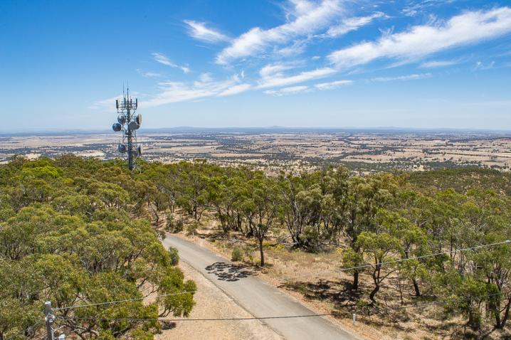
The viewing distance from this tower is up to 100 km in all directions, except northwards to Bendigo and Mt Alexander where it is about 30 km. Most fire spotters become long-time occupants of the towers. In its first sixty years, this tower has been manned by only five different spotters:
- Oliver Ralph - 1950s
- Frank Webster - 1960s
- Lindsay Brown - 1970s
- Ken Weatherall - 1980 - 1994
- Geoff Exon - 1995
- Peter Skilbeck - 1996 - present