Drop in at this informative picnic area for lunch before spending the afternoon exploring the many historic sites and walking tracks throughout the Whroo Historic Area!
This fascinating bushland reserve features extensive remnants of Whroo's rich mining history, as well as multiple picnic areas and lots of informative signs.
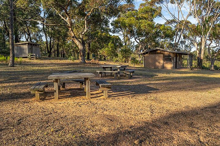
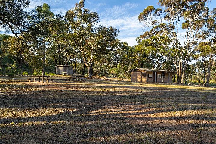
Visitor facilities at the Whroo Visitor Centre and Picnic Area
This park is equipped with multiple picnic tables, information signs, a walking track and toilets.
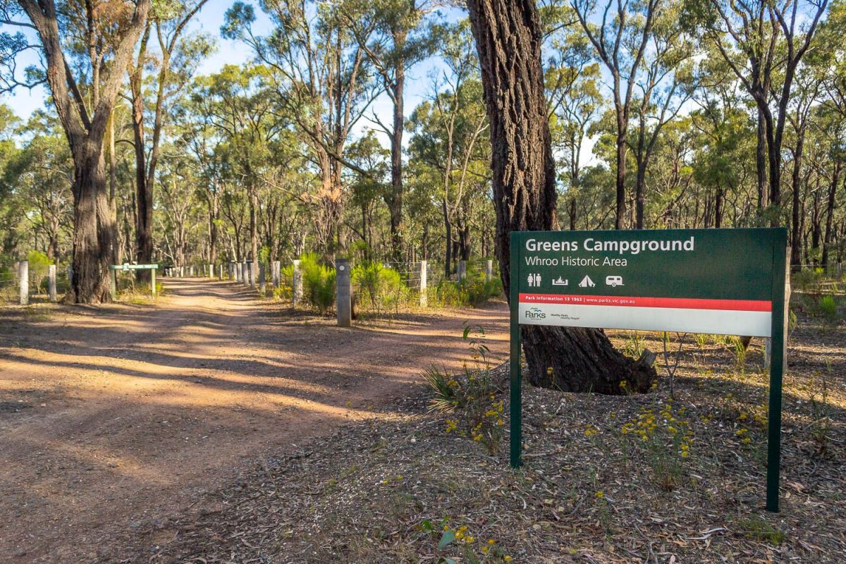
Camping is available at the nearby Greens Campground (more information below).
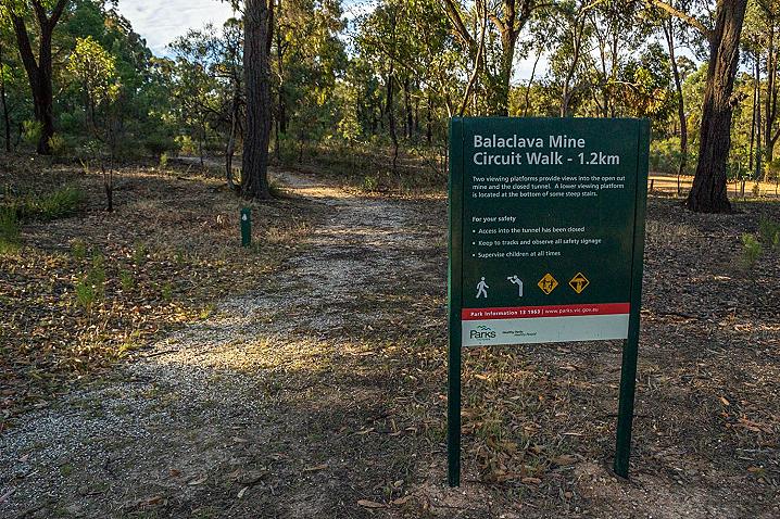
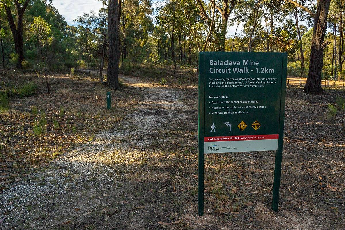
Walking track to the Balaclava Mine
Walk from here to the impressive
Balaclava Mine at Whroo and look down from the edge into this massive open cut mine! Lookout points provide views down over the extensive workings below.
The Balaclava Mine Circuit Walk - 2.1 km
Two viewing platforms provide views into the open cut mine and closed tunnel. A lower viewing platform is located at the bottom of some steep stairs.
For your safety
- Access to the tunnel has been closed
- Keep to tracks and observe all safety signage
- Supervise children at all times
Camping near the Whroo Visitor Centre and Picnic Area
Spend a weekend exploring the many historic sites and walking tracks throughout the Whroo Historic Area!
Greens Campground has large camping areas set around a circuit track. Some have fire pits with barbecue plates. Drop toilets are located in the back/centre of the campground.
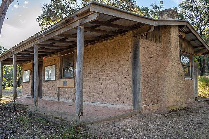
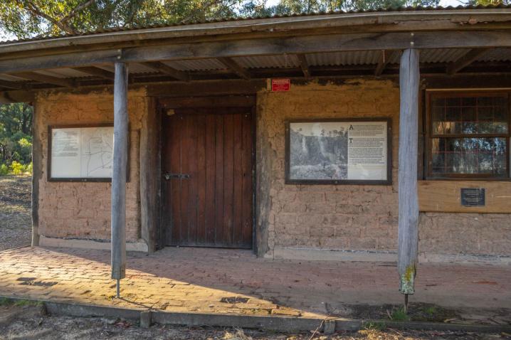
INFORMATION SIGNS AT THE WHROO Visitor CENTRE AND PICNIC AREa
There are multiple informative signs set around the park. The signs display the following text:
Whroo Historic Area consists of 490 hectares of forested land around the site of the Whroo township. It was set aside in November 1982 to:
- protect relics and sites of historical significance;
- provide opportunities for people to enjoy the area and view its many features;
- assist people to gain an understandig of the area and its interesting history.
The Visitor Centre, built in 1983 by the Shire of Waranga in conjunction with the Forests Commission and the Department of Minerals and Energy contains a display of historical maps and photographs.
The construction of the Visitor Centre and other improvements in the area were funded under the Government's Employment Initiatives Program.
Alluvial gold as found at the present sites of Rushworth and Whroo in August 1853, and the resulting gold rush brought thousands of hopeful diggers into the area almost overnight.
What eventually set Whroo apart from the many other goldfields of the district as the discovery, over a year later, of the Balaclava Reef.
The
Balaclava Mine was first developed using shafts to follow rich veins in the gold-bearing quartz. Just north of the open cut, deep fissures (called 'stopes') slant down into the rock where miners removed whole veins of quartz and left the mountain propped apart with timber.
Later, an enormous charge of explosives was used in an attempt to shatter the hill and enable open cut mining. This was not entirely successful, and unfortunately made further shaft mining unsafe. However, a convenient opening was made in the side of the hill, and material from the open cut was conveyed by tramline to steam-driven stampers.
The spectacular open cut, some 25 metres deep, remains today, as does the horizontal tunnel through 100 metres of solid rock where the tramway once passed.
Whroo - a town develops
Whroo had its beginnings in 1853 with the discovery of gold. During the gold rush era, from 1853 to 1860, the township of Whroo evolved around the hill where the Balaclava Mine was discovered.
Three surveys were conducted, to mark out land for sale at Whroo.
In 1861 Whroo was proclaimed a town and at the beginning of that yaer there were several slab houses. A schoolhouse had been established and the new store belonging to Charles Baud had been established.
By 1863, Whroo had 61 huts, 5 cottages and various stores and hotels.
From October 1864 to June 1866, a number of allotments near the heart of the diggings, south-east of Balaclava Hill were sold. This development was to be remembered as the township of Whroo.
139 buildings were recorded at Whroo in 1871. Buildings were either constructed of timber slabs, weatherboards or hand made red bricks which, were made in Rushworth. Wooden water pipe (an example of which can be viewed at the Rushworth Historical Society Museum) carried water to every home in Whroo.
Today, evidence of settlement can be seen from the remnants of underground storage tanks, constructed from bricks or rocks, to retain water for domestic purposes.
The fall of Whroo
In 1953 all that remained of a once bustling township was a weathered Church of England, Mechanics Institute, a few dwellings, and only three residents.
Lack of finance to purchase powerful machinery to prevent water rising in the shafts at deep levels saw work in the Whroo mines cease.
Whroo was almost deserted and over the next years buildings were moved away or demolished. Remnants of fences, fruit trees, grassy clearings, peppercorn trees and underground wells indicate the sites of early buildings.
This, along with the Whroo cemetery, is the only evidence of a once thriving township, where residents could purchase all of their daily requirements of food and supplies.