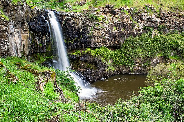
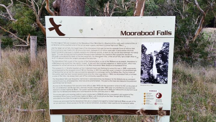
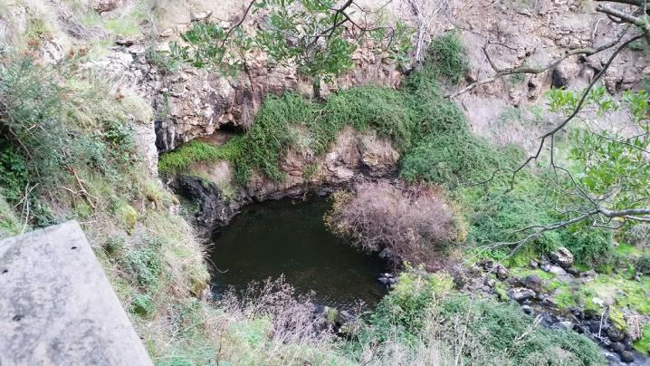
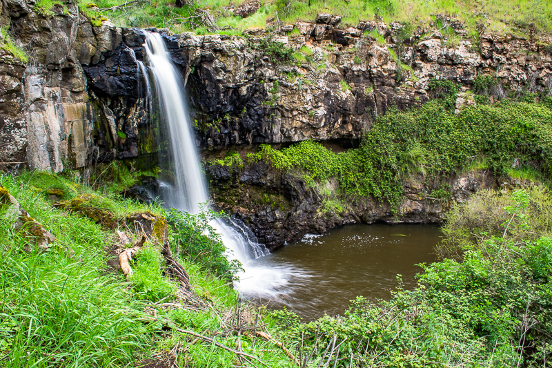
Moorabool Falls waterfall is a gorgeous stream of water dropping into a tranquil pool surrounded by rocks, moss and ferns.
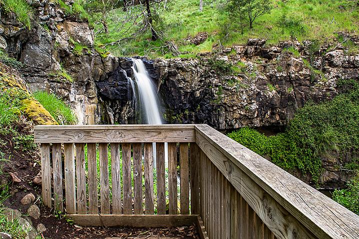
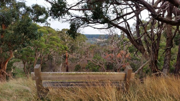
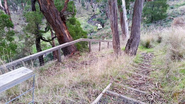
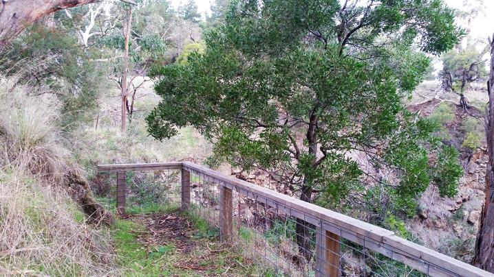
You can see the top of the waterfall from a viewing platform as you descend down towards the creek, and you will find the best view of the waterfall from a bench seat downstream of the Moorabool Falls.
Access to the waterfall itself is prohibited.
One of three gorgeous waterfalls in the area (the others being
Lal Lal Falls and
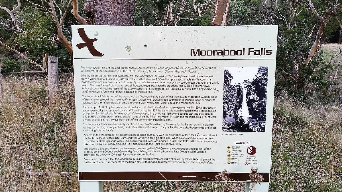
Granite Falls), Moorabool Falls is located on the Moorabool River West Branch, adjacent to the north-west corner of the Lal Lal Reserve, at the southern end of the Lal Lal water supply catchment (Central Highlands Water).
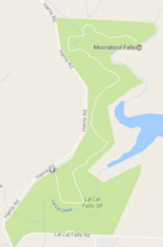
Walk to Moorabool Falls
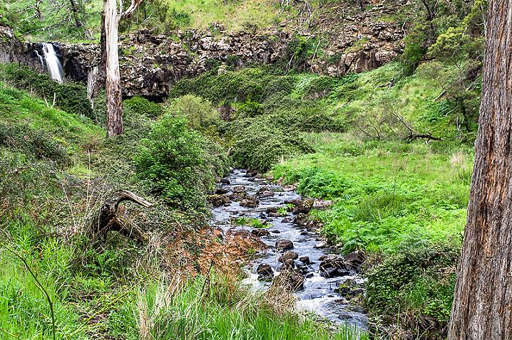
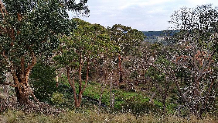
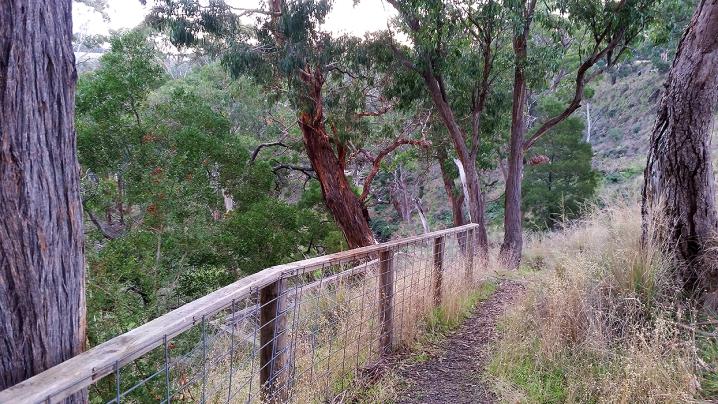
Take the scenic 5.6 km return walk to Moorabool Falls, where you can look down over the beautiful waterfall from a viewing platform, and enjoy stunning views over the Lal Lal Reservoir along the way!
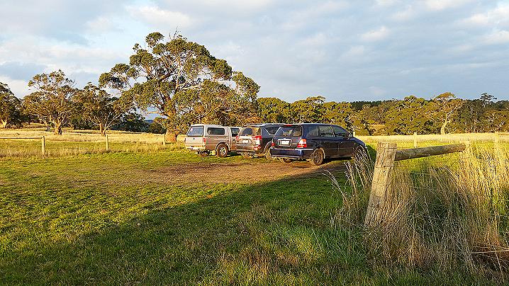
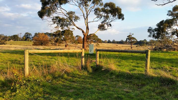
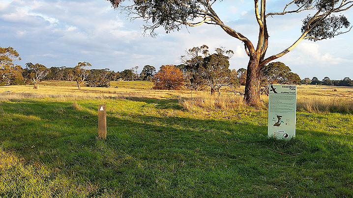
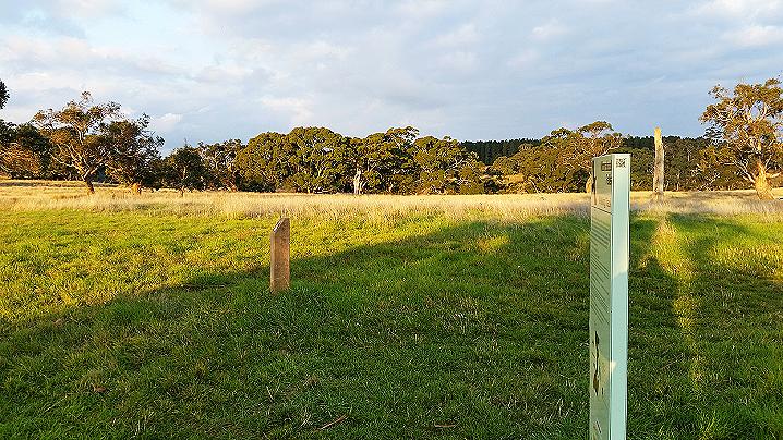
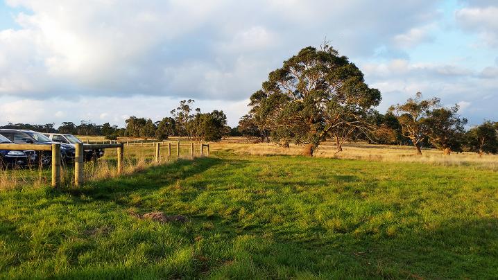
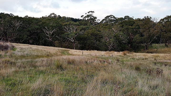
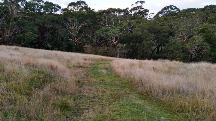
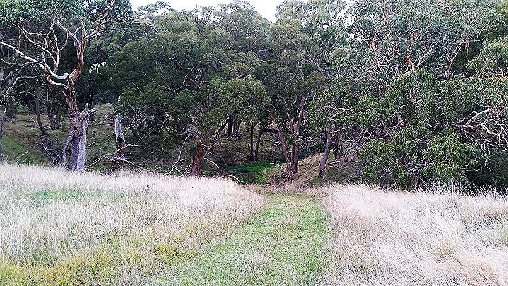
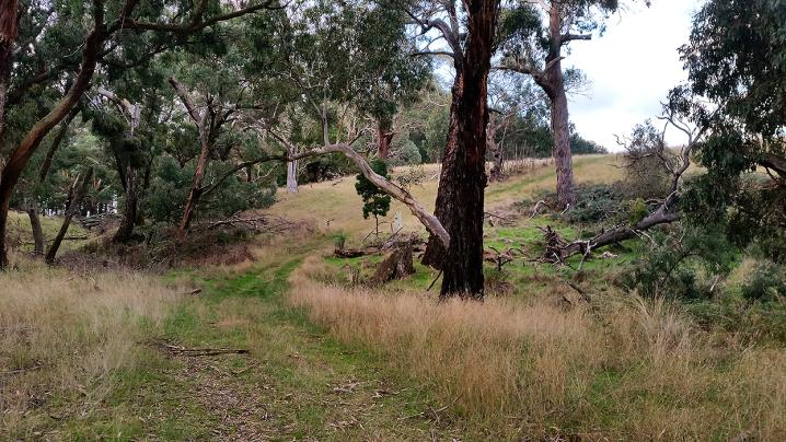
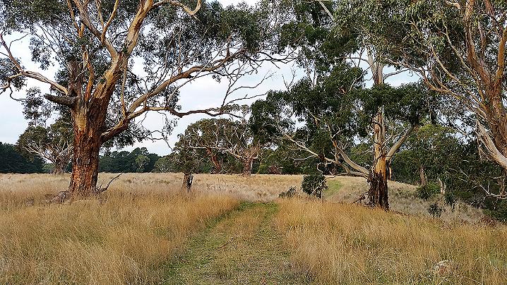
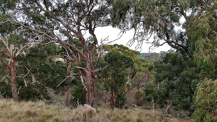
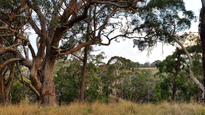
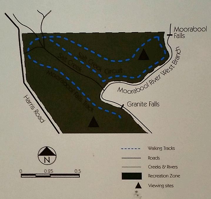
Beginning at a parking area off Harris Road, the walking track winds through a paddock alongside Lal Lal Creek, the Lal Lal Reservoir, then the Moorabool River West Branch.
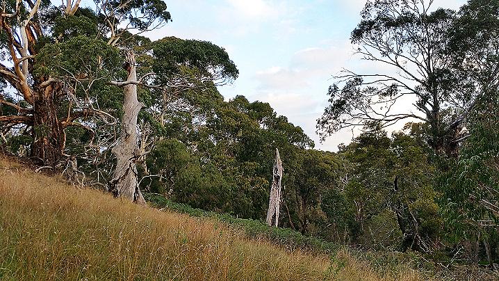
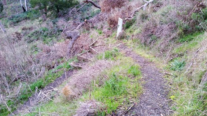
The walking track consists of a mown path through the grass and is marked by arrow posts every few hundred metres. More detailed walk information and a map can be found further down on this page.
Formation of Moorabool Falls
Like the larger nearby
Lal Lal Falls, the basalt base of the Moorabool Falls was formed by separate flows of viscous lava from a volcano near Clark's Hill, 20 kms to the north, between 2.5 - 5 million years ago.
It lacks similar columnar basalt formations because it cooled unevenly and relatively quickly. A layer of clay can be seen between the basalt layers.
This was formed during the several thousand years between the eruptions that caused the lava flows.
Although considered the lesser of the two waterfalls, the Moorabool Falls, unlike Lal Lal falls, has a single drop so its 27 m descent forms the longest cascade of the two falls.
History of Moorabool Falls
The Moorabool Falls is part of the country of the Tooloora Baluk, a clan of the Wathawurrung people.
Moorabool is a Wathawurrung word that may signify "mussel". A less well documented suggestion is "stone curlew", which was adopted for a brief period as an emblem by the West Moorabool Water Board and Moorabool Shire.
The surveyor A. H. Smythe travelled up from Indented Head near Geelong to survey the river in 1839, supposedly accompanied by the escaped convict William Buckley.
In 1857 the waterfalls were included in the proposed sale of Section 8 at Lal Lal but this was successfully opposed in a campaign led by the Ballarat Star.
The boundary of this public park has been revised several times since the initial reservation in 1860, but Moorabool Falls, or at least a view of the Falls, has always been part of the community experience here.
The Moorabool Falls was frequently mentioned in promotional touring literature for the Ballarat area as a pleasant outing for picnics, photographers, field naturalists and fishermen.
The pool at the base also became the preferred swimming hole for locals.
Access to the Moorabool Falls became more difficult after 1972 with the reservation of land for the construction of the Lal Lal Reservoir and Bungal Dam, and was virtually closed off after 1983 when an unmarked access road was leased to Central Highlands Water.
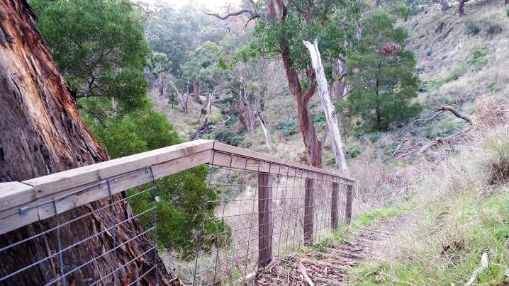
The current walking track was opened in 2008 and follows the escarpment route taken by the Ballarat and Melbourne Field Naturalists on their joint excursion in 1885.
The access paths and viewing platform were constructed in 2008-09 with the cooperation and support of the Moorabool Shire Council and Central Highlands Water, with funding from the State Drought Relief Scheme, provided by the CMA (Corangamite Management Authority).
Visitors are reminded that the Moorabool Falls are on property managed by Central Highlands Water as part of the Lal Lal catchment.
Direct access to the falls is strictly forbidden, to protect water quality and for personal safety.
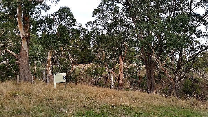
The above information is displayed on an information sign at the top of the descent to Moorabool Falls.
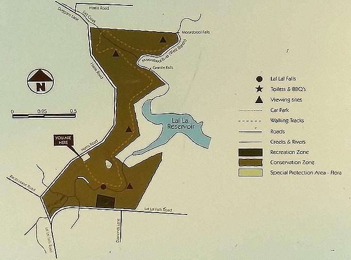
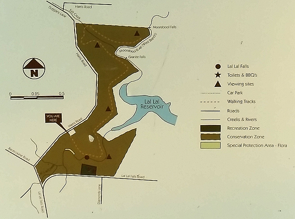
Walking track to Moorabool Falls from the Harris Road carpark:
The 2.8 km (5.6 km return) walking track winds through a paddock alongside Harris Road before turning in toward the waterfall near the end of the walk. The walking track consists of a mown path through the grass and is marked by arrow posts every few hundred metres. There are impressive views from several points along the way.
The following information is displayed on an information sign at the beginning of the Moorabool Falls walking track:
The Moorabool Falls Walking Track traverses the western conservation zone of the Lal Lal Falls Reserve. Visitors are asked to respect the conservation values of these areas by remaining on the designated track. The track is divided into three sections, each ending at a viewing point marked by a bench seat. The third seat is located downstream of the Moorabool Falls but provides the best available view. Walkers should note that the Moorabool Falls is not part of the Lal Lal Falls reserve and access is prohibited.
Distance
2.8 km (5.6 km return)
Walking time
Approximately 1.5 hours
Classification: Class 3 'Walking Track'
Opportunity for visitors to walk in slightly modified nature environments requiring a moderate level of fitness and where the provision of interpretation and facilities is not common. Users can expect opportunities to observe and appreciate the natural environment with limited provision of interpretive signage. Users can expect occasional encounters with others.
Access
Access is only permitted from the Harris Road car park.
Track Conditions
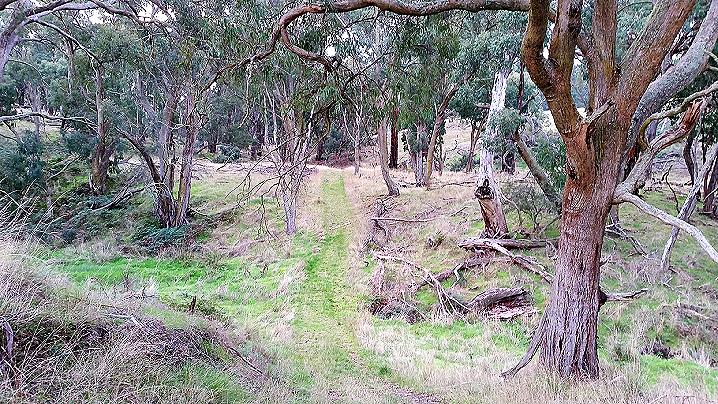
The track surface is uneven. It is a mown strip marked by bollards every few hundred metres.
Gradient
The track terrain is generally undulating, except at Salt Creek.
Caution
The columnar basalt gorges are fragile and should not be approached.
Other track distances:
- Harris Road to the Lal Lal Creek/Moorabool River (West Branch) junction view: 3 km return
- Harris Road to the Moorabool/Salt Creek junction view: 4 km return
- Harris Road to the Moorabool Falls viewing site: 5.6 km return
Warning:
- Cliff edges, keep clear
- Slippery rocks, take care
- Children at risk, supervise always
- Beware, falling limbs
- Beware, uneven ground
- No climbing
- No abseiling
- No rapelling
- No camping
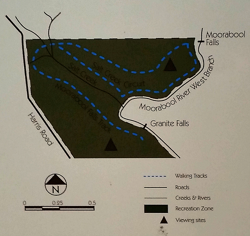
SALT CREEK TRACK - Alternate circuit
The following information is displayed on an information sign at the beginning of the Salt Creek Track alternate circuit:
Walkers along this track should be fit and able to find their way along an often indistinct and narrow path. There has been limited modification to the natural surface along most of the route and minimal clearing of debris or natural obstructions. The track begins with a very steep descent and there is also a steep ascent over an unmodified surface. The route is marked by directional bollards but these are not always clearly visible because of vegetation growth.
The steps descend from an old channel line, which also includes the adjacent viewing platform, originally cut into the slope to carry water from a small dam above the Moorabool Falls. It is believed that the channel was constructed to either support gold mining operations at Champion Hill, several kilometres away, or to supply the blast furnace above Bungal Dam. Remnants of the cut can also be seen along sections of the slope below the Granite Falls gorge.
From the base of the steps the track follows the river to a point above its junction with Salt Creek, where it veers west, along the channel line above the creek, until it rejoins the main track back to the Lal Lal Falls.
Silver tussock dominates the slopes and scattered messmates (stringy barks) provide a light canopy. Bracken thrives in open areas near the river and ferns can be seen beside the shaded creek.
The granite rock bed of the Moorabool is visible from a viewing point above the junction with Salt Creek. To the south the gorge cuts through several basalt layers, outcrops of which are visible on the higher slopes.
Walkers are reminded that this is a conservation zone and they should remain on the tracks provided.
Warning
- Cliff edges, keep clear
- Slippery rocks, take care
- Children at risk, supervise always
- Beware, falling limbs
- Beware, uneven ground
- Beware, steep ascent
- Beware, steep descent
- Beware, fit walkers only
- No climbing
- No abseiling
- No rapelling
- No camping
- No pets