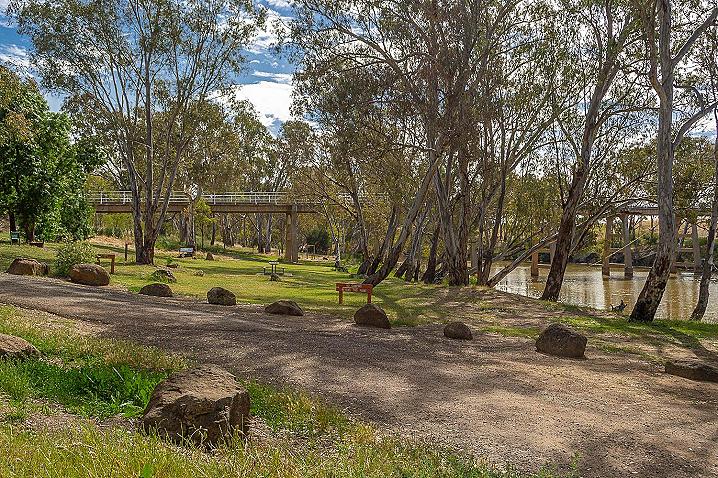
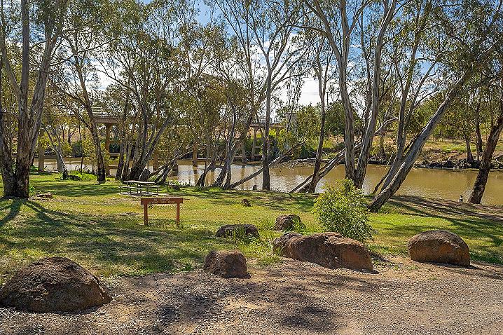
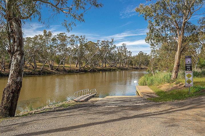
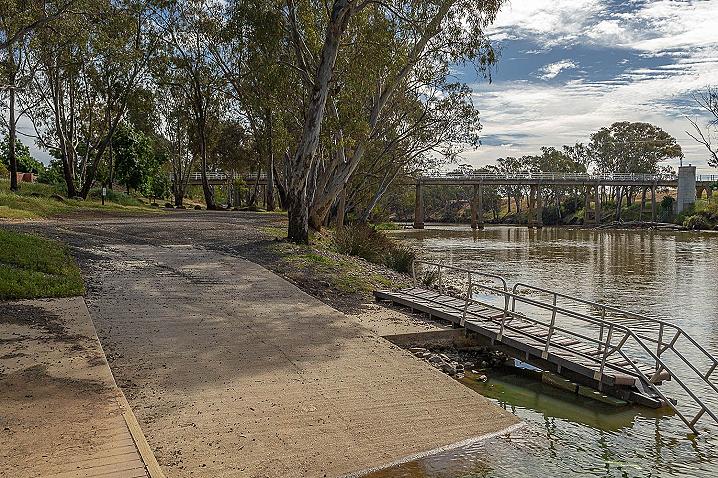
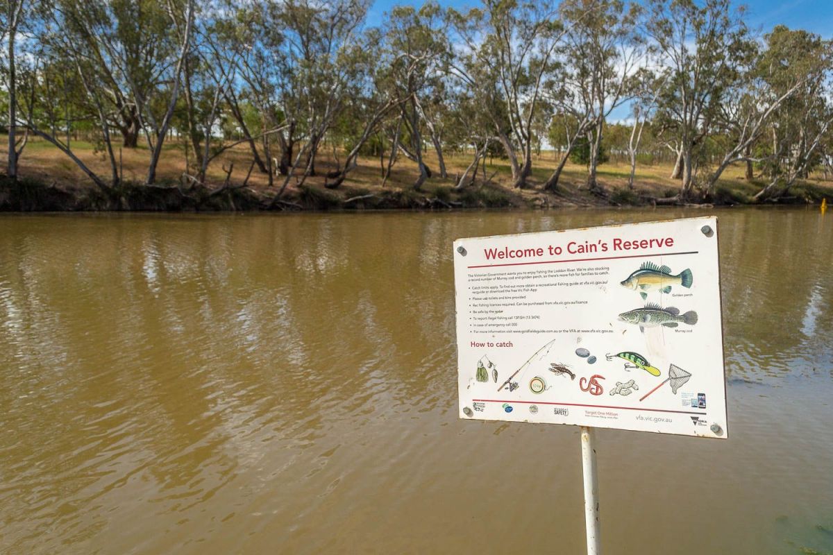
An easily accessible boat ramp and kayak entry ramp are situated alongside the campground.
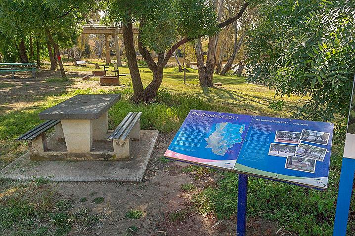
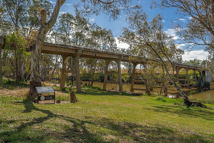
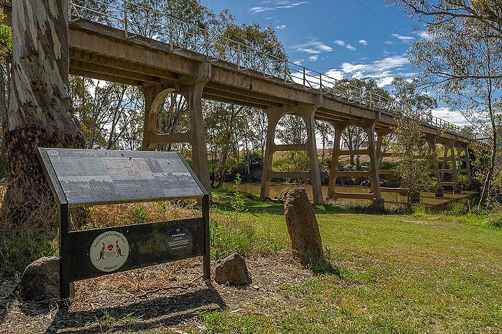
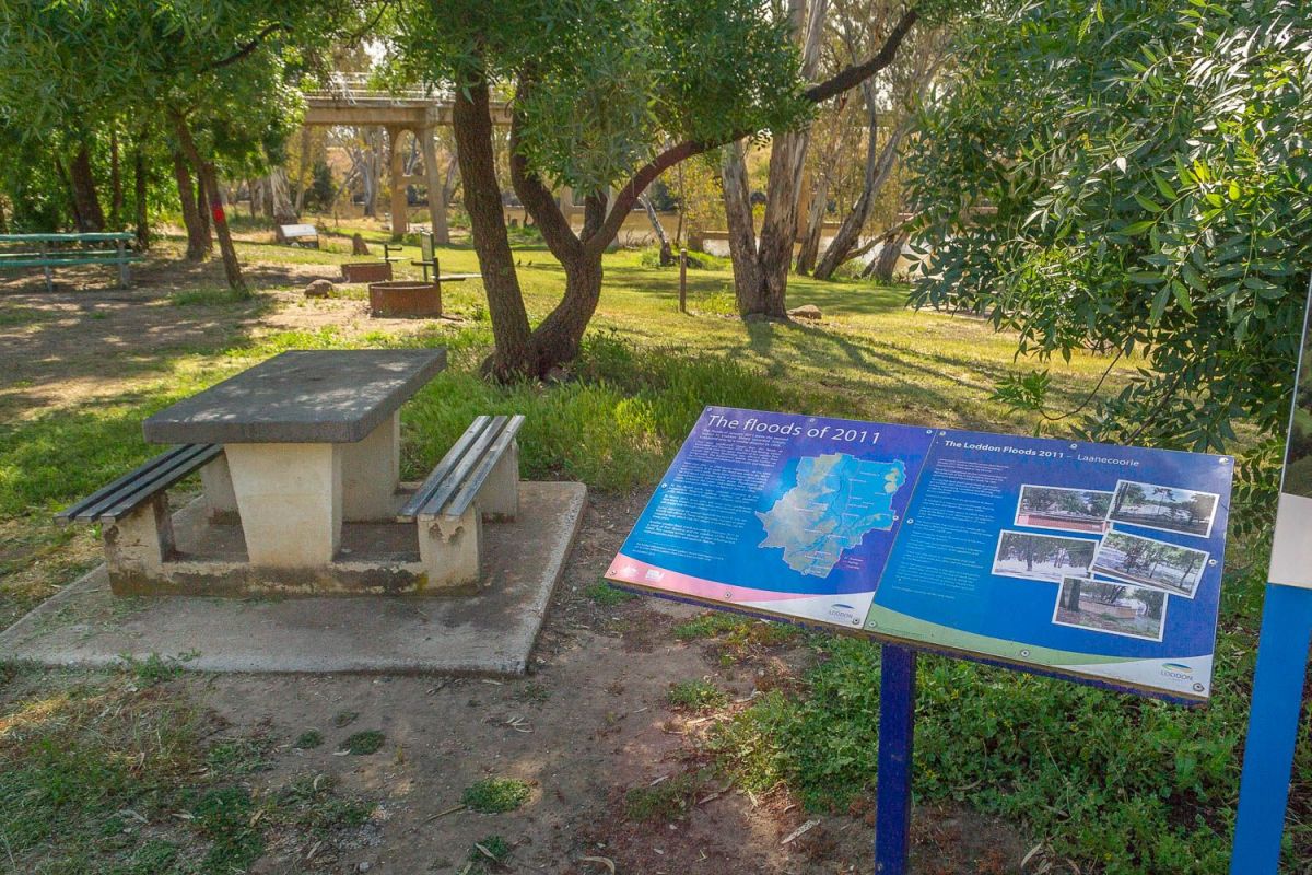
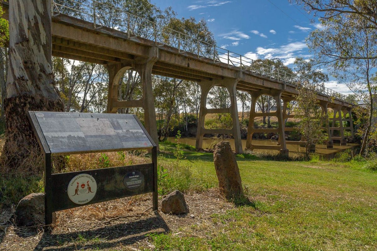
Information signs give details of the historic Janevale Bridge as well as the impact of the 2011 floods.
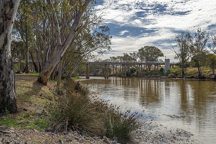
A great walking track travels off along the Loddon River, beginning at the Janevale Bridge and travelling an easy 1.2km to the Laanecoorie Reservoir Weir - a lovely spot overlooking the
Laanecoorie Reservoir and weir with spectacular views.
The following information is displayed on information signs at Laanecoorie:
LAANECOORIE RIVER TRAIL
As with many small goldfields towns, Laanecoorie was once a lively community with numerous businesses supporting a population drawn to the region by the lure of gold. Regular dances were held on moonlit nights. In such light revellers returning home in their gigs could find their way safely.
Laanecoorie means 'place of kangaroos' in local Dja Dja Wurrung language and was adopted as the name for this part of the original "Simson Run." The "Janevale" home was built on the western bank in 1840 and named after Simson's wife Jane Charlotte Coghill.
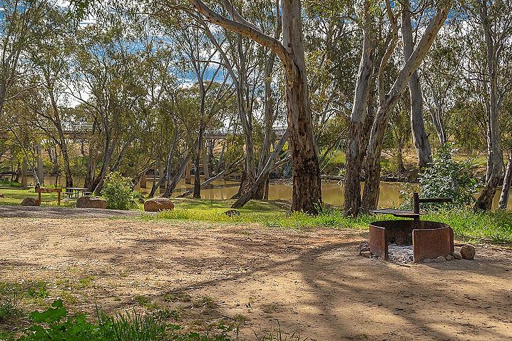
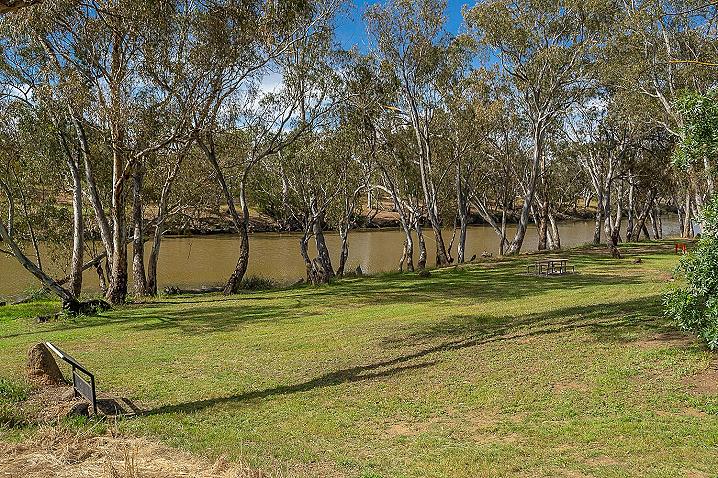
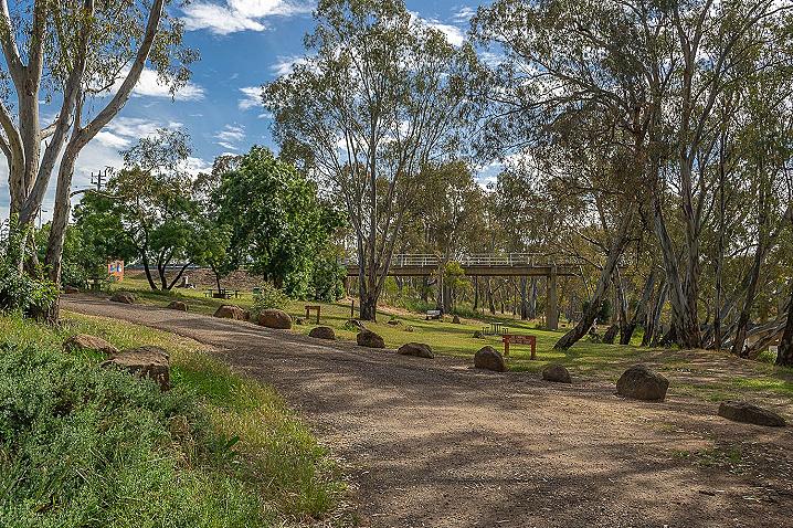
Gold was discovered in the Laanecoorie area at "Jones Creek" in 1853 attracting many people seeking their fortune. Todays life in this little hamlet is much more sedate and visitors can enjoy the serenity as they meander along the trail through the River Redgums lining the banks of the Loddon River, from the historic Janevale Bridge, to the weir and spillway of the Laanecoorie Reservoir. The trail is an easy stroll of 1.2 km and has several bench seats allowing users to rest and enjoy the sights, scents and sounds of the river environment. Returning via the attractive tree-lined Weir Road (1.2 km) offers a different perspective with views over adjacent farmland testifying to the value of the fertile alluvial soils.
Things to see
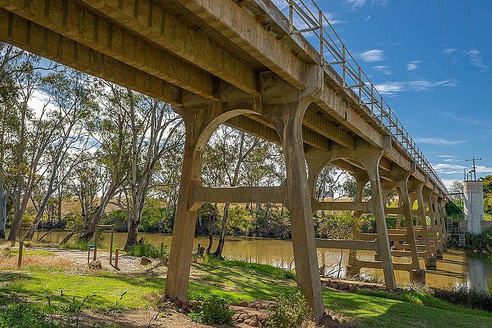
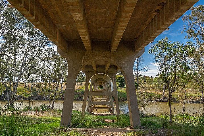
- Before you set out, take some time to appreciate the elegance of the Janevale Bridge, a reinforced concrete structure designed and constructed by Sir John Monash and completed in 1911.
- As you wander through the Floodplains Riparian Woodland on the banks of the Loddon River, notice the variety of shrubs, grasses, herbs, rushes and reeds that flourish in the absence of grazing animals. These plants and the riverine environment provide perfect habitat for a variety of fish, birds, reptiles, amphibians and mammals.
- The Laanecoorie weir serves to regulate water flows used for irrigation and town supply further down the Loddon River. It was completed in 1891 and, though it has been reduced in capacity due to siltation over the years, provides a valuable storage and recreational facility.
- On the return along Weir Road you may notice a change in the vegetation as the Yellow Gum trees become dominant. Halfway along the walk the bottle-trunked tree with bright green foliage is a Kurrajong.
Advice for walkers
This is a Grade 2 track; no bushwalking experience is required. The walk can be done as a linear return trail or loop along Weir Road (which carries vehicles so use the road shoulder on any approaching traffic). You may encounter snakes, insects, fallen tree limbs, wire and glass. Take care crossing the cattle grid as you leave the reservoir reserve.
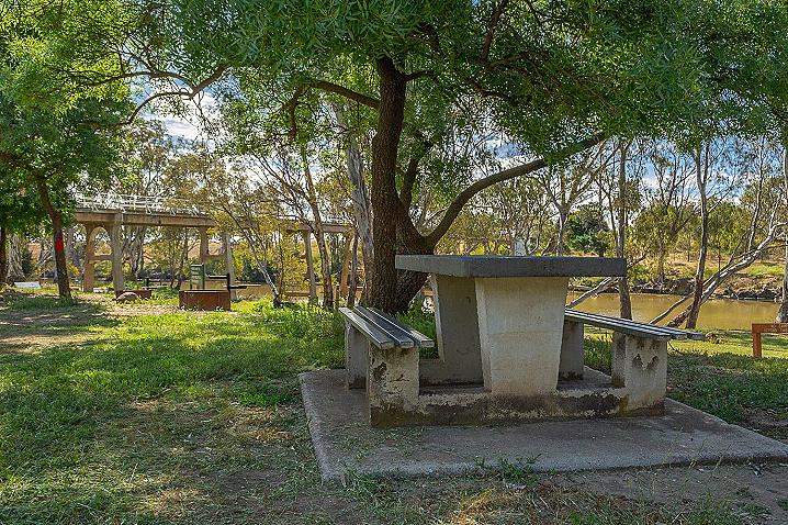
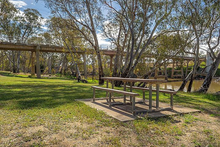
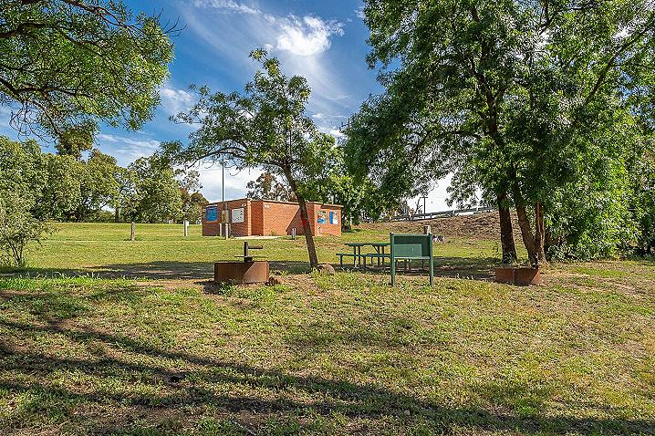
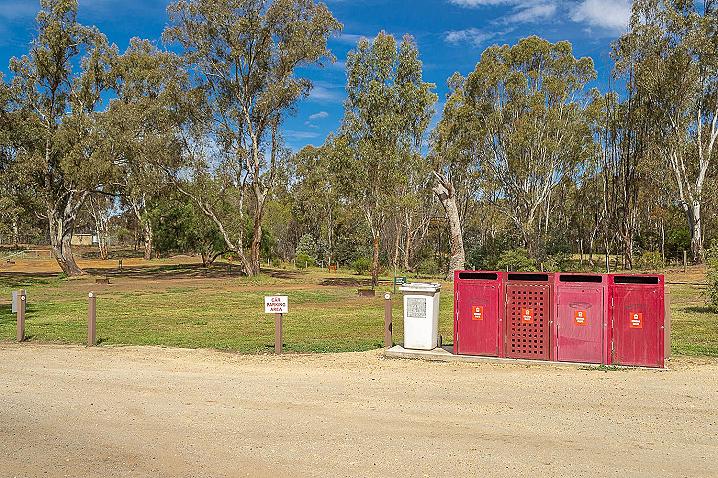
Temperatures can be very high in the summer: be sure to carry water, wear a hat and apply sunscreen. Toilets, picnic facilities, water and BBQs are available at the foreshore reserve near the bridge.
For further information on walking tracks in Loddon contact Loddon Visitor Information Centre on 03 5494 3489 or Loddon Shire Council on 03 5494 1200. May 2014.
HISTORY OF LAANECOORIE
By courtesy of La Trobe Library. Written by D.R.Mac Lellan head teacher 1918-1919.
In 1840 the first company of white men messrs, Simson, Dutton and Darling crossed the Loddon, and took up land here for a sheep run. It was called Janevale after Simson's wife. Laanecoorie was at this time the headquarters of a big tribe of blacks, who lived along the banks of the Loddon River, on the fine stretch of water now reaching from the weir to Mr Michaels. This is the longest water hole on the Loddon River. The blacks called it Languycoorie, which means long water hole hence the name Laanecoorie. The blacks were very treacherous, and killed many of the station hands. In 1850 Mr Cay leased a large acreage for sheep and cattle run. He built his homestead near where Mr Dicken's house now stands. There were about 40,000 sheep and 2,000 head of cattle on this run. These were supervised by Mr Michael, whose sons and grandsons still reside in the district and a number of shepherds, one of whom was speared and killed by the blacks. The country was at this time an immense forest, excepting on the river flats and the plain where Mr Spedding now resides. In 1855 Mr W Waugh who is now in his 93rd year and Laanecoorie's oldest living resident, passed through here on his way to the gold rush at Jones creek. He was fairly successful there, and next year, when returning was persuaded by Mr Cay to take a position on the station so he brought his family here, and remained in the Employ of Mr Cay til 1862, when he bought the property now owned by Mr A Smith.
the first farm selected was by the Lyon Brothers, of whom Mr W Lyons still resides on the property. They took up their present property in 1857 and by 1860 many had other settlers arrived and purchased farms. Mr Edward Stone who arrived in 1857 had the honour of growing the first crop on land now owned by his son. He followed chiefly the occupation of a gardener and his orchard, vineyard and vegetable garden were the first in these parts. He took a keen interest in local affairs, and was, with his friend Thomas Langdon, one of the founders of the school, which was opened in 1864. Its first teacher was Mr D Ryland, who occupied the position till his death in 1871. The old building still stands in the grounds of the present of the up to date building, which was erected in 1906. It was around this building that the township was first formed and near it in 1869 the present Methodist church was built. Previous to 1870 the river was crossed by a punt, but in 1870 the first bridge was built over the Loddon, and this caused a settlement to form near it. A hotel and a blacksmith shop were erected near it by Mr T Grisold, and Thomas and Comrie then built a grocer's shop adjacent to these. In 1890 the construction of the weir was started by the Deakin-Gillies group. It took three years to complete. The building cost £80,000, and £90,000 paid in compensation to farmers whose land it ruined. It was the first structure of its kind in Victoria. In 1909 it was partially destroyed by a great flood but was repaired and a large by wash constructed. This flood at the same time destroyed the old bridge, and this has now been replaced by a fine concrete construction.
April 27th 1872 - Laanecoorie weather
The drought had broken and farmers are preparing land for the next season's crops. Double furrow ploughs being all the rage. Mr Dave Grisold built stockyards at the back of the Laanecoorie bridge hotel, and was instrumental in stock sales being held in Laanecoorie for many years.
Bendigo advertiser 27 6 84 - Automatic exchange at Laanecoorie
Bendigo District Telephone manager, Mr T Harvey, has announced that a new automatic telephone exchange to be known as Laanecoorie came into operation this week. The new exchange will amalgamate the existing service manual exchange and the restricted service at Shelbourne and five Eastville, and two Lockwood subscribers will transfer to Laanecoorie making a total of 82 subscribers services to be connected initially to the new exchange. The post office at Laanecoorie will continue to provide postal facilities following the Cutover.
A letter from the Maldon times (1963) - From Mr A B Knight
In a recent issue of the "times" I noted that the Laanecoorie state school mothers club intended celebrating the 100th anniversary of the school building if still standing next year. As a boy of 13 years of age I worked for the carpenters from Maldon who built the present one. Firstly it was a pre-fab cut in Calders timber yard, railed to Melbourne and carted to the site by one Mr Fitzpatrick. Those who worked on the job were robinson, Arch Webster, Bill Lettuce (tenor singer), Fritz Millascott, carpenters, Fred West, plumber; and myself as kitchen hand, paint mixer and first and second coat splasher. From memory, the head teacher was named Calder and lived in Maldon. I make it 59 years ago, and I trust that the mothers club put this item away for future reference. If any of the Stone family of about my age is around they will probably remember me. Ben Knight. After this the same men built a house for Kennedy's Eddington.
FLOODS OF 2011
The floods of January 2011 were the second largest in Loddon Shire's recorded history, surpassed only by a similar disaster in 1909.
They were significantly bigger than the floods of September and December 2010. The fast-flowing waters moved north from the upper reaches of the Loddon river outside the Shire. Newbridge was affected first, then Bridgewater. The floodwaters quickly moved further up the Loddon River and dispersed into creeks and tributaries beyond Bridgewater.
More than 30% - or 2200 square kilometres - of the Shire was impacted. At its peak, the flood was said to be 90km long and 50km wide. Many farms and towns were directly hit and about $30 million worth of damage was caused to the Council-managed infrastructure alone. Floodwaters cut roads, including the Calder and Loddon Valley Highways. Phones and power were lost for hours or days at a time.
At the flood's peak, water volumes recorded at the Laanecoorie Reservoir spillway reached 194 gigalitres a day. Melbourne uses 460 gigalitres of water each year.
By March 2011, there were still large areas underwater. New lakes, known as lunette lakes, were formed and these will empty only through seepage and evaporation.
Some, reported to be several hundred hectares in size, are heavily salt-affected. these have generally formed on grain cropping land, which may not return to productive use for many years.
Another smaller flood event occurred in Febrary 2011 as a result of flash flooding and the overflow of the Bullock Creek. This caused further damage to road infrastructure, rural properties and farm and roadside fencing.
Laanecoorie resident Geoff Curnow described the January 2011 flood as "the most extraordinary natural event I have seen in my lifetime".
"We'd had widespread rain for consecutive days on the north side of the Great Dividing Range in the catchment area of the Loddon River," he said.
"During that time, there were readings of eight to 14 inches (200-350mm) of rainfall, culminating in many roads being inundated and farming properties awash with 10cm to two metres of water across paddocks.
"Livestock couldn't find any dry ground to sit down.
"It resulted in a massive volume of water flowing over the weir and down the Loddon Valley".
Laanecoorie weir holds about 8,000Ml, but at the peak of the flood it was discharging 194 gigalitres a day. Melbourne uses 460 gigalitres of water each year.
"We have photos that indicate the height of the floodwaters flowing just beneath the walking bridge across the weir," Geoff said.
"Huge amounts of water flowed around the town and surrounding districts.
"The flood was exacerbated by swollen tributaries joining the Loddon system, both upstream and downstream.
"There was one house in Laanecoorie that took water in at floor level and other homes were isolated by the floodwaters.
"Most farming properties in this area survived pretty well. I didn't hear much in the way of stock losses in this district, as farmers with property along the river had experienced flooding during the previous six months and had moved stock to higher ground."
See also
GOLDEN NUGGET DISCOVERY TOURS
Experience the best Victoria has to offer with
Golden Nugget Discovery Tours, a genuine Ecotourism Operator offering a wide range of nature, heritage and adventure tours throughout the many unique regions of Western and Central Victoria. Guided tours are available across the Goldfields, Daylesford & Spa Country, Pyrenees Wine Region, Grampians National Park, and Great Ocean Road!