Bring a picnic lunch and take an easy stroll through the Forest Creek Historic Gold Diggings, exploring many fascinating historical features of this world-renowned alluvial goldfield.
At this site during the gold rush, miners sought to strike their fortune from the gravels of an ancient river bed - a former course of Forest Creek which formed millions of years ago.
Miners continued to work this site for gold well into the 20th century, with many interesting relics left for us to see today.
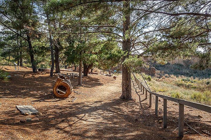
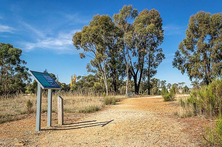
A 400 metre walking track travels in a circuit through the area past many points of interest.
Detailed information signs teach you about the ancient creek bed, shaft mining, gold puddling, hydraulic sluicing, the engine shed, and water pipes.
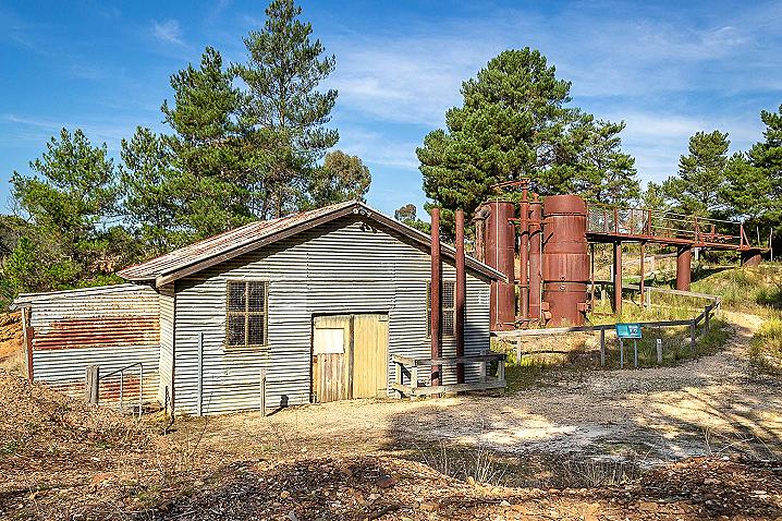
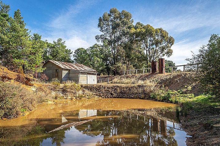
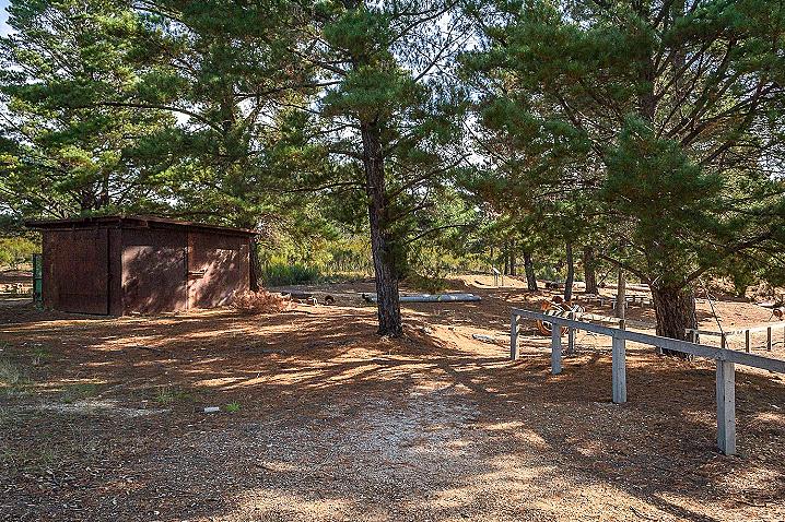
The water cannon / monitor, sluicing paddock and engine shed are particularly impressive features of the walk.
This track is pram/wheelchair friendly, and is an easy walk with short sections of gentle incline.
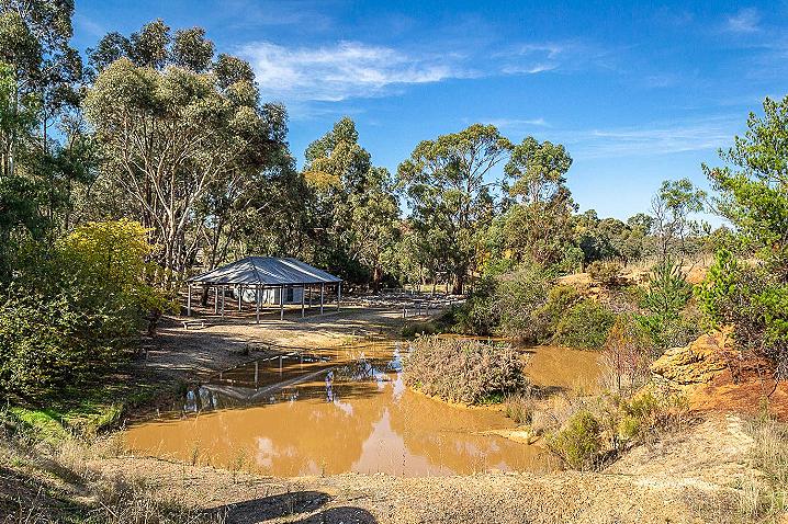
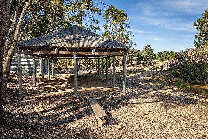
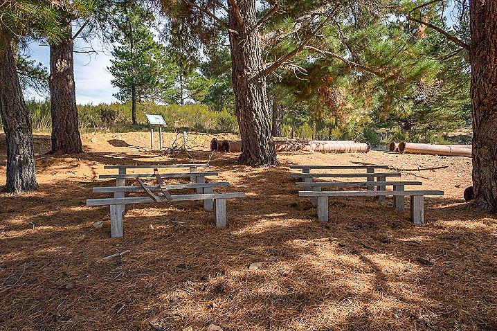
A picnic table sits among the trees beside the parking area and another one inside the gold diggings in a scenic spot beside a dam.
There are no barbecue facilities, so bring a packed picnic if you plan to stop in for lunch.
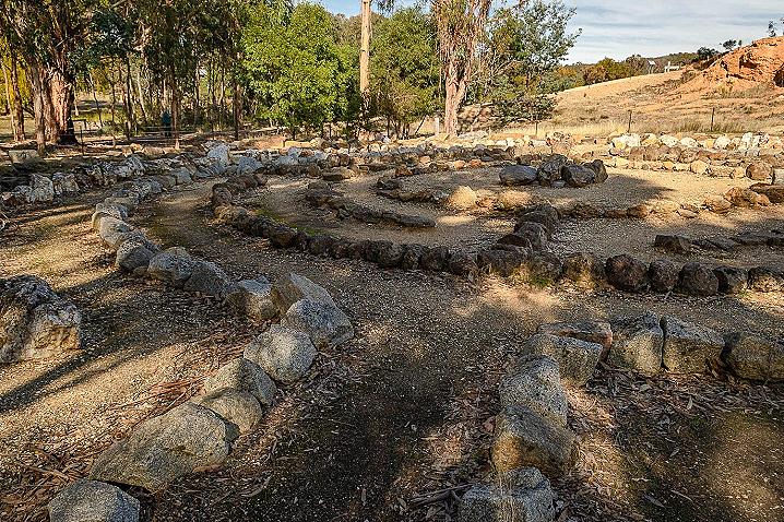
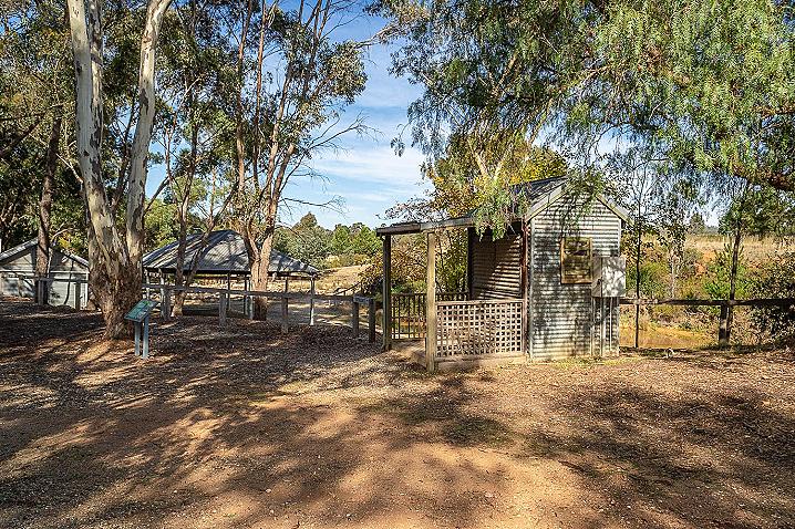
As you enter the area you will see the picnic table alongside the dam to your right, a large undercover area with concrete floor ahead to your left, an impressive circular stone maze a little further ahead, and beyond that the walking track begins its circuit around the area.
If you would like to try your luck at gold panning at the dam, a gold pan and instruction kit can be purchased at the Castlemaine Visitor Information Centre.
A sign at the Forest Creek Historic Gold Diggings states that there are group tours by appointment, phone:
5471 1729
HISTORICAL MAP OF THE CASTLEMAINE MINING DISTRICT, 1860
Map of the Castlemaine Mining District which shows historical features in superb detail, including mining divisions, reefs, gullies, and gold workings. Mining Department, Melbourne, 1860. High quality, durable A1 print in a satin finish. Large, 594 x 891 mm. Go to online shop.
More information on the Forest Creek Historic Gold Diggings
The following text and images are displayed on information signs at the Forest Creek Historic Gold Diggings:
This 400-metre long loop walk allows you to discover how miners won gold from Forest Creek: site of the famous Mount Alexander Gold Rush of 1852.
Follow the gravel track and read the notes near the appropriate numbered posts. The landscape through which you will walk shows the environmental impacts of various types of alluvial gold mining - shaft sinking, tunnelling and hydraulic sluicing.
On your way you can help solve the mystery of Big Dundee Jock and also discover the geological history of the district by finding your way to the centre of a ground level stone constructed maze. Written guides to both these activities can be found under the verandah of the small shed next to you.
Mount Alexander (Castlemaine) Goldfield - a brief history
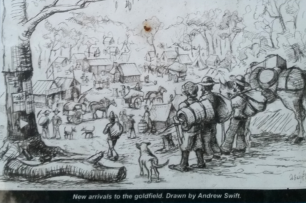
Forest Creek is located on the north side of the Pyrenees Highway, between Chewton and Castlemaine. Gold from Forest Creek sparked the world's second gold rush and soon tens of thousands of men, women and children were camped in this valley.
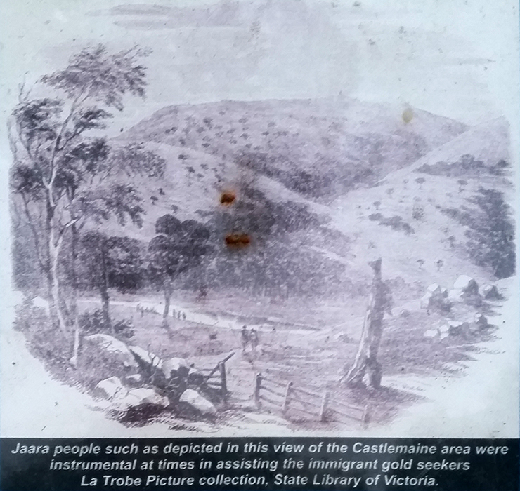
The goldfield is an ancient landscape, which bears the imprint of many cultures. Over tens of thousands of years, the region's founding layer was put in place by Aboriginal people. The Jaara or Djadjawurrung speaking people are the local Aboriginal group. Nearly two centuries ago, "new Australians" came to the region in the form of settlers from the British Isles. Before long, gold was found and the rest of the world discovered what the goldfield had to offer. Despite the tumult of the gold rushes and the changes wrought by intervening years, the connection of Jaara people to this region remains strong, and their welcome is acknowledged and respected.
In the early months of 1852 many tons of gold dug from Forest Creek began arriving in London. Many came from Britain, Europe, America and later others came from China. The prize which miners sought was alluvial gold - pieces of metal ranging in size from a grain of salt to a leg of lamb. Its bright yellow colour and great weight makes gold easy to identify. At this site, the miners obtained the alluvial gold from the gravel bed of a former course of Forest Creek formed millions of years ago. They left behind a stark transformed landscape.
Post 1: Alluvial Gold - Importance of Water
At the time of the gold rush, there were many Jaara clans in central Victoria all speaking the Djadjawurrung language. Their ancestors had occupied the land for thousands and thousands of years, and, among other things, had witnessed the fiery birth of Mt Franklin, near Daylesford, as a volcano. The impact of their activities on the land was gradual. This was not the case for the activities of the immigrant gold seekers.
The immigrant gold seekers had a very dramatic and rapid impact on the land as they cut down trees for firewood and housing and dug shafts to retrieve the buried gold. The results of these activities are still apparent today. Water was critical to the early mining process because once the soil had been removed from the shafts, it had to be washed to remove the dirt and clay to release the gold. The miners or gold diggers used simple washing devices and their mining activities commenced to transform the creeks and gullies.
Puddling - A preliminary gold mining process carried out where there were considerable quantities of clay in the wash dirt. The clay had to be broken down with the aid of a fork and dissolved in the water. A large tub was used for puddling. The tub was tilted slightly to allow the water containing the clay to wash over the edge, leaving only clean gravel.
Panning - About a shovel full of earth was placed in the gold pan and then covered with water. The miner swirled the dish round with a circular motion, tilting it slightly so that the muddy water and lighter material ran over the side. Owing to the great weight of the gold it sank to the bottom of the dish. The loose gravel was then scraped off, and the process of adding water and swirling repeated until only the gold and about half a cup of fine material was left in the dish.
Cradling - A method of recovering gold using a box like structure known as a cradle because of its rocking action. The was dirt was shovelled into the top of the cradle and washed down over sloping boards. The gold was trapped behind timber strips or riffles attached to these boards.
Post 2: An Ancient River Bed Full Of Gold
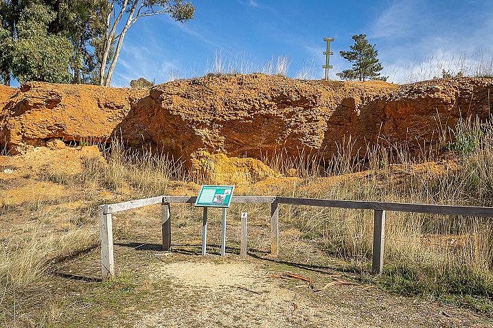
The cliff face before you is all that is left of White Hill. The cliff face is an ancient riverbed, the former course of Forest Creek. Millions of years ago pieces of metal gold were washed from its parent body (a hard white rock called quartz) and down into Forest Creek. Being heavier than any other materiel in the creek, the gold quickly sunk to the bottom, filling crevices in the clay base of the creek bed.
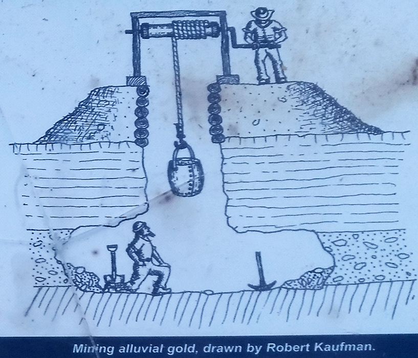
The miners dug 1.5 metre wide shafts down through the hard gravel layers of the old creek. The lucky ones, when they hit the bottom struck gold-filled crevices. They had won the lottery, sometimes getting over 1,000 ounces of gold. At today's current gold prices this would be worth over $1/2 million.
Others found nothing at the bottom of their shafts. Failure could have fatal consequences because the unlucky miners could quickly run out of money and become destitute. Many died or became insane. Conditions were tough on the goldfields.
The local Jaara people continued to live on the goldfield. Some attempted to continue their traditional practices, others looked for gold and traded items to the "new Australians". Another wave of settlers came in 1854 when Chinese miners arrived in large numbers and soon formed about 20% of the mining population.
Below the Chinese sign (which translates to "Gold found here") can be seen a section of one of the shafts. Follow the shaft down and you will see, on the left-hand side, the blue grey clay bed of the creek. Perhaps this shaft was one of the lucky ones; it appears to have been sunk in a deep hole in the creek bed.
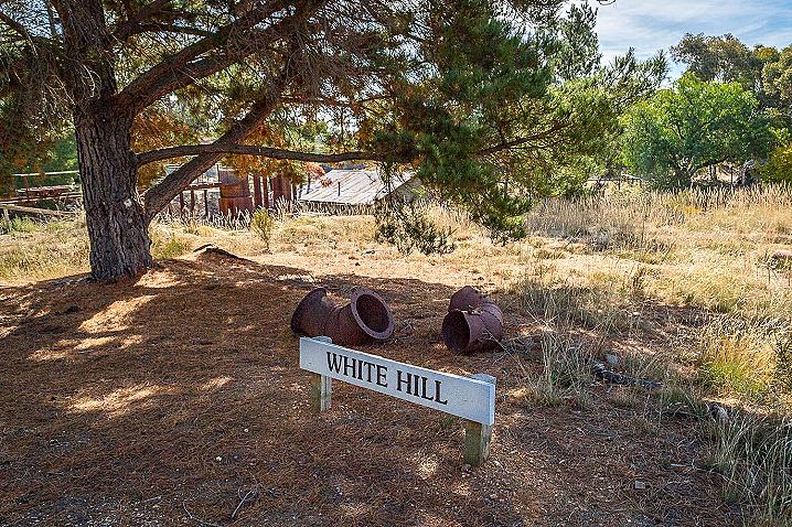
White Hill was extremely rich in gold and has been extensively mined. The stark and sheer appearance of the cliff is a result of a form of mining called hydraulic sluicing which used jets of high pressure water to wash away the deposits.
Post 3: Kampfs Gully
Most of the gold diggers came from societies whose existence depended on having money and their currency was based on gold. For many of the new arrivals it was impossible to empathise with Aboriginal people whose way of life was so different. Traditionally Aboriginal people had no need of gold. Everything they needed for their survival was acquired from the land - their ceremonial implements, tools, utensils and possum skin cloaks.
When the gold diggers arrived they gave new names to Aboriginal land. Sometimes it was their own name - Cranky Ned and Dirty Dick were real people. Others named their new homes after old ones - Cornish and Spanish Reef, South American Reef, Switzerland Reef, Turk's Hill, Chinaman's Flat, Frenchman's Reef. Often the old places would convey something of the misfortunes suffered there - Murdering Flat, Deadman's Gully and Bung-eye Gully.
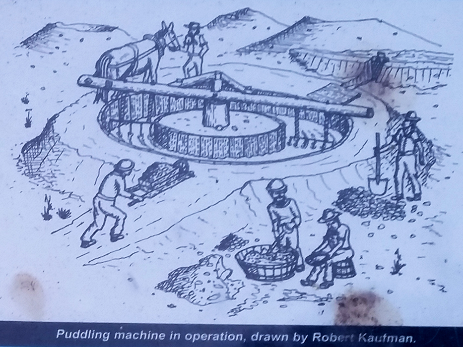
By 1854, the miners were using other technology to win gold. Below you is Kampfs Gully and it was mined by men using puddling machines. Miners began using these machines in 1854. Puddling operations involved completely stripping creek deposits down to bedrock, completely removing any traces of the original landscape. A puddling machine was constructed as a circular wood-lined trough up to 7 metres in diameter. A long pole was pivoted at the centre and a horse was harnessed to one end so that it trudged endlessly in circles around the trough breaking up the large lumps of clay and releasing the gold into the bottom. The water, with its dissolved clay, was then run off and the residue cradled or panned for the gold.
Post 4: Mine Shafts
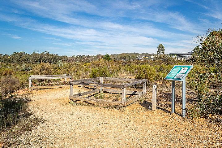
You are now standing on top of what is left of White Hill. Each of these two fenced-off areas represents the amount of ground a gold miner could 'own' during the gold rush. Mine shafts like the ones within the fenced-off areas are one of the most tangible relics of the gold rush era.
In 1852, any male adult on the gold diggings had to pay the Government 30 shillings a month. For their 30 shillings, a miner was only entitled to work a section of ground measuring 2.5 metres (8 feet) square. Just enough to dig a shaft about 1.5 metres wide and pile up the earth removed from the shaft.
Men had to carry their licenses with them at all times. If a miner was caught without a license he was arrested and marched off to a camp and had to pay a fine of five pounds. Half the fine went to the policeman responsible for the arrest. The miners deeply resented being treated as criminals.
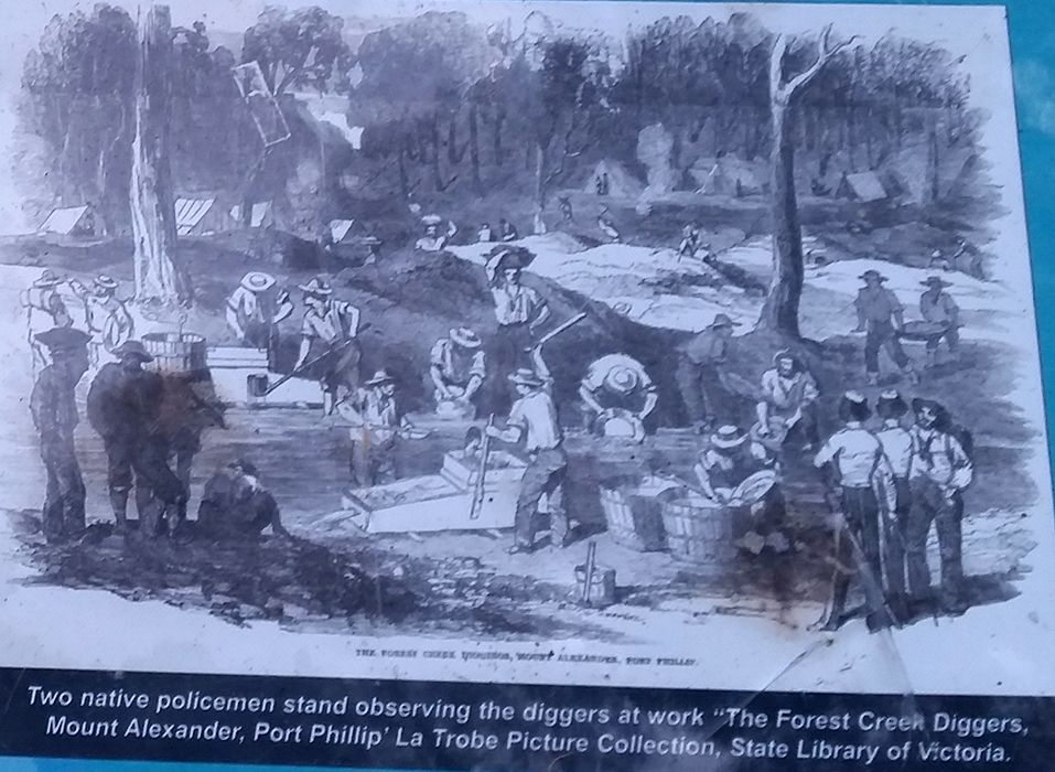
Aboriginal people also participated in the gold rushes as miners in their own right, and some guided mining parties to new fields. In some instances, they were quick to assert their rights. For example, a group of Aboriginal diggers at Forest Creek in 1852, when asked to show their licenses, replied to the mounted police that the gold and the land were theirs by right so why should they pay money to the Queen.
One of the perplexing questions is - here are two holes, two different claims, close neighbours, yet one is round, and one is rectangular...? One theory is that Chinese miners dug the round holes. It has been told that the Chinese were suspicious that evil spirits could hide in corners of rectangular shafts. It is more likely that the circular shape made better use of the available space of the claim, and was a safer construction in the less stable ground. Men from Cornwall, who were very skilled miners, may have dug the rectangular shaft. Notice in the accompanying drawing by S.T. Gill that among the tools used by the miners there is a single pointed pick, one that could be used in confined spaces.
Post 5: Top Of White Hill
Looking north, past this board, you can see where Forest Creek runs today, about 500 metres away and 30 metres lower. All of the intervening creek deposits have been quarried or washed away by gold miners. You are standing on one of the last remnants of the ancient creek bed.
Look well past Forest Creek (further north) to the mountain with the TV mast on top. This is Mount Alexander - this goldfield was originally known as the Mount Alexander Diggings because this mountain was the nearest large landmark for those walking up from Melbourne.
The Aboriginal name for Mount Alexander was Leanganook. The mountain possesses many Aboriginal cultural sites, and the country contains giant granite tors and old grown woodland, including magnificent yellow box and manna gums.
1km north of the main road lies
Pennyweight Flat Cemetery, the best preserved of Castlemaine's many gold rush cemeteries. Over 400 men, women and children are buried there. The cemetery closed in 1857.
To the south, behind you, runs the Melbourne to Bendigo railway line and, further south, the new Castlemaine (Loddon) Prison can be seen. The railway was built in the early 1860s by the Victorian Government and was the State's largest and most expensive infrastructure project for its time.
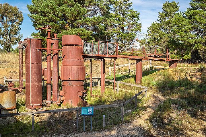
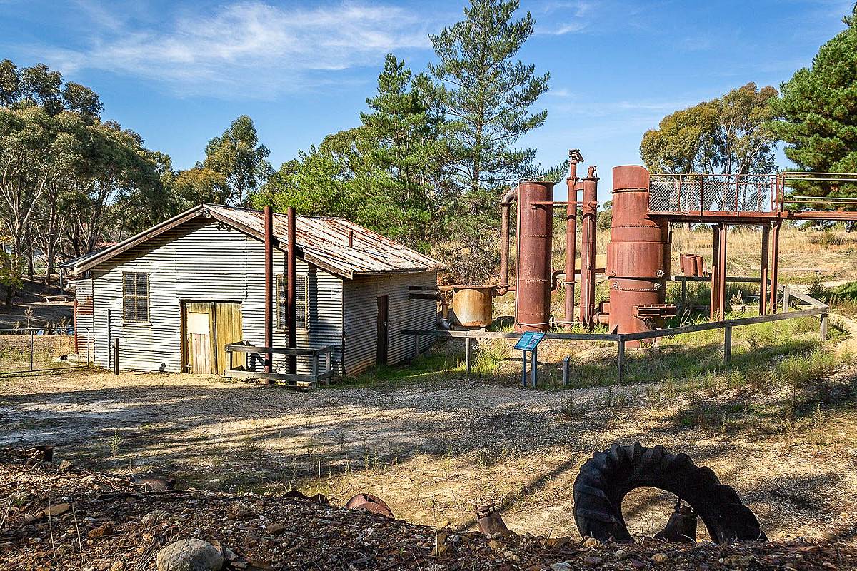
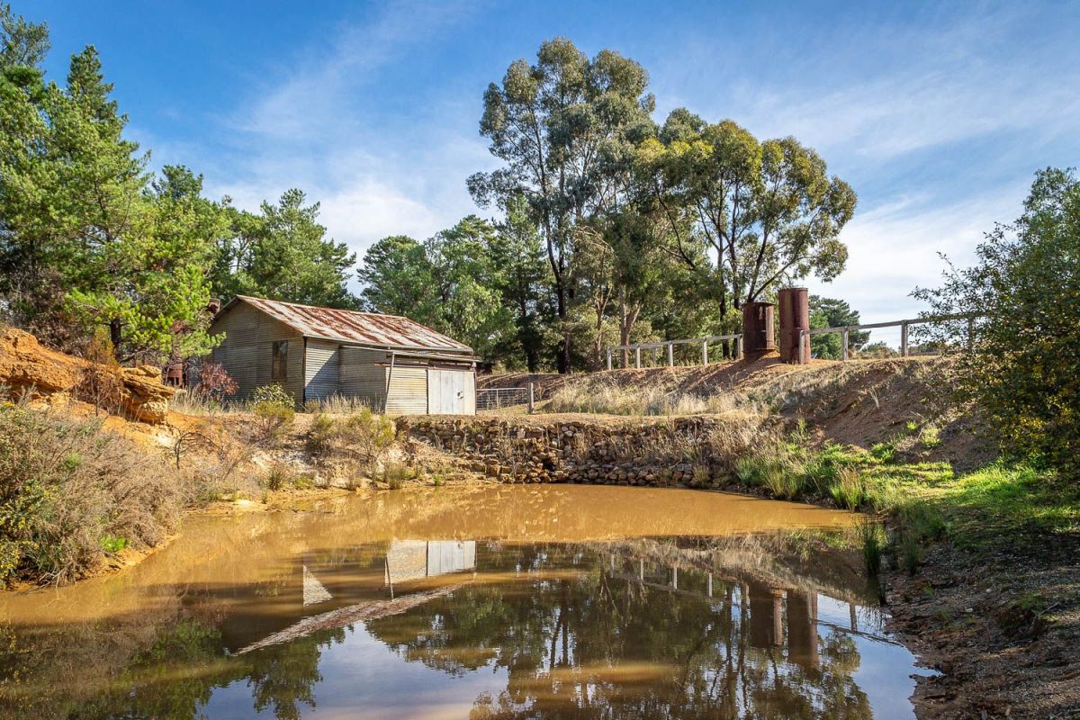
The big hole located 50 metres further along the track is all that is left of Red Hill. Red Hill was blasted away during the 1930s by powerful jets of water in order to get any gold that was missed during the gold rush. The tall iron cylinders and the corrugated iron engine shed was the power plant for the powerful jets of water.
Post 6: The Engine Shed
The massive engine inside the shed was powered by gas that was produced from the process of burning wood. A local gold miner, Alf Cox built the shed and installed the machinery in the late 1930s.
The gold miners like Alf Cox relied heavily on timber from the surrounding forests. Some of the principal uses were firewood as fuel for mining machinery, homes and the manufacturing industry that emerged as a result of mining gold. The surrounding forests were heavily cut down but they are now regrowing.
The local forest contains a mixture of Box and Ironbark trees and provided Aboriginal people with other resources than gold. For example the limbs of ironbark were commonly used for making returning boomerangs, called wonguim. The bark of box trees was used for constructing willams or bark huts.
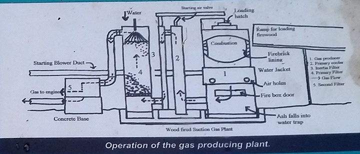
The arrangement of tall cylinders (known as a gas producer) produced a combustible, poisonous gas called carbon monoxide. Carbon monoxide gas was given off as the green wood burned very slowly with very little air. The gas accumulated in the silver tank closest to the shed. The engine inside then sucked in the gas, as it was needed.
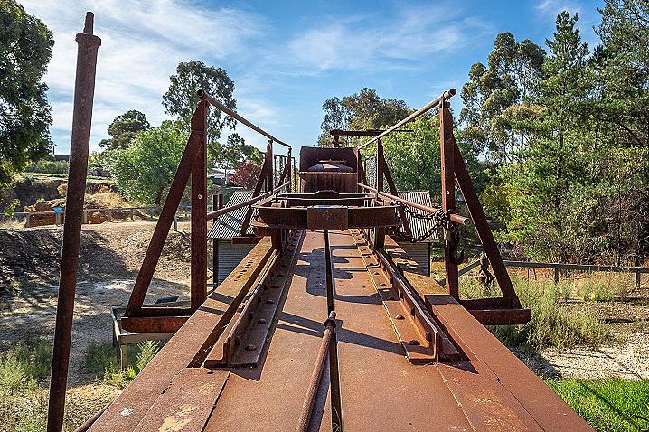
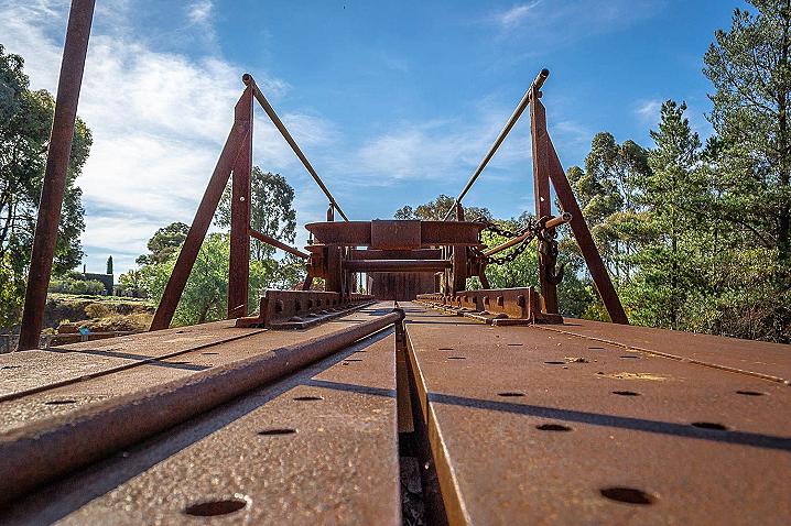
The diagram shows how the arrangement of iron cylinders delivered the gas to drive a powerful engine located in the shed. The engine installed here was used to drive the water pump. It is a Ruston and Hornsby suction-gas engine, made in England. The pump that is connected to the engine was capable of delivering 10,000 litres of water a minute. The water used came from deep underground, courtesy of the dewatering operations at a nearby gold mine.
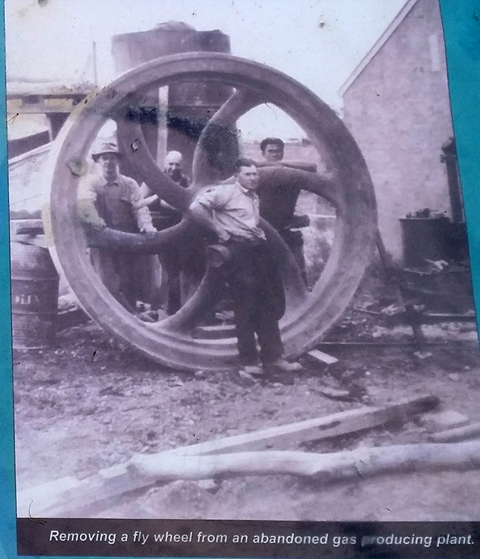
The heavy machinery was mainly installed by hand. A picture on this board shows local men handling a huge fly wheel that was part of a gas producer plant used on a local pottery.
Post 7: Piping The Water
Aboriginal people and the gold miners shared common needs, one of which was water. On the relatively dry goldfield water was crucial to mining and for life. Before the gold rush, local Aboriginal people had chipped out rock wells that enabled them to access drinking water as they travelled through their country.
The activities of the gold miners soon silted up the streams and waterholes and it was necessary to construct water races and pipelines to bring water from distant rivers. The alluvial gold was locked up in hard clay or gravel, without water you could not mine.
Water used in the northern section of the goldfield came from the Coliban River, from a reservoir constructed at Malmsbury. Mining water for the middle section of the goldfield came from the Loddon River. The south section of the goldfield was mined using water obtained from streams near Daylesford.
As you walk along the path you will see three stacks of pipes. These pipes were used to bring the water from the pump to the sluicing cannon. They were joined together to form pipelines. The force of the water delivered through these pipes was sufficient to demolish small hills. During the gold rush it was the hammer-wielding blacksmiths who did all the ironwork. The pipes would have been manufactured in one of the many local or regional foundries.
The pipes had to be strong enough to withstand the extremely high pressure of the water that was being pumped through, yet had to be light enough to enable them to be shifted by manpower.
Each pile shows a different style of pipe. These are:
- Sheet metal pipes that were double riveted and soldered with tie-bolts and hessian at the joins.
- Spiral wound and riveted pipes.
- Panel pipes, made of wrought iron.
Post 8: The Water Cannon
Aboriginal burning over thousands of years gradually helped produce a mosaic of forests and plains supporting a diversity of species. The gold miners made more immediate impacts through the use of various mining methods. For example, a writer in a local paper in 1855 predicted that the increase in quartz mining and steam power would have a drastic effect on the goldfields landscape, and that 'in a few years the wood crowned summits of our hills will look as desolate and barren as the flats and gullies do already'.
The mining industry's reliance on timber was not the only impact on the land. The excavations to extract the gold could be quite large. Some of the largest scars on the land were the product of hydraulic sluicing which used water cannons to blast away hills and gullies.
This water cannon had about 10,000 litres of water a minute pumped out at tremendous pressure. The water cannon was controlled by one man who directed the jet of water onto the cliff that you can see about 30 metres away. The box with the stones is a counterbalance to prevent the nozzle from bouncing around and injuring its operator.
Water cannons were especially constructed for the purpose with several articulated joints to allow the jet of water to be directed to where it was required. On this site, Alf Cox used the water cannon in the following way:
- A jet of water from the cannon was directed on to the top of the cliff. The cliff was kept soaked for several days.
- The base of the cliff was then undercut with a very hard jet of water until it fell onto the bedrock shattering the falling rock.
- The nozzle was then directed onto the collapsed mass, washing the gravel to the pump or jet elevator which lifted gold, fine gravel and muddy water up to the sluice box.
The jet of water was sufficiently powerful to cut away the hardest soil. The force of the water was such that its roar could be heard three kilometres away and when it was working at night the quartz rocks would create great sparks of light as they violently smashed against each other.
Post 9: The Sluicing Paddock
It is interesting to reflect on the thoughts of James Arnot, a gold digger who went botanising one Sunday afternoon in August, 1852.
'Such beautiful flowers, plucked a flower like honey suckle, also a yellow round flour [sic] like an orange, also a waxy heath looking flower very pretty pink & yellow & white petels [sic], and a great many others, above were cookatoos [sic], parrots and numerous birds with splendid plumage... Its [sic] all nonsense [that], the flowers have no smell or the birds have no song here...'
Compare these feelings to the mining scene before you. Hydraulic sluicing involved directing the jet of water at the cliff face until it became saturated and finally collapsed. Once this had happened, the operator then used a hand-held nozzle like a large fire house to wash the 'washdirt' mixture of gravel, dirt and gold along a channel to a big hole where it was then lifted by a gravel pump to the sluice box.
Men worked in the water channel up their waists in the water using wide forks to toss the larger stones into heaps on the sides of the channel. (These had to be removed so they did not travel through to the pump)
The bottom of the sluice box was lined with coconut fibre matting to trap the very fine gold pieces then riffles were placed on top. At the end of each day the sluice box would be "panned off" to get the gold. After some weeks the coconut fibre would start to wear and have to be replaced. The old coconut fibre was not thrown away, it was burned and the ashes panned to get the very last of the fine gold. The unwanted gravel and water dropped into the tailings dam behind the sluice box.
Post 10: Putting it all Together
Few comments from the 1850s express as vividly as the following extract from the London Illustrated New just how profoundly the fortune seekers from afar misunderstood the Aborigines.
"...existing without a wish beyond hunting in the forests, and living precariously on food which they obtain by climbing the immense gumtrees, wholly ignorant that at their roots the most precious metal has been concealed for thousands of years; generations after generations of aborigines has passed away, unconscious of the riches concealed beneath the surface of their native hunting-grounds, perchance to have made them the most powerful race under the sun."
Placed within an economy based on gold, the miners went to extraordinary efforts to get gold during the gold rush and were still doing so eighty years after as this hydraulic sluicing site demonstrates.
The plan shows how all the parts of Alf Cox's hydraulic sluicing works operated. The landscape of Red Hill demonstrates the environmental consequences of this form of gold mining.
The gas engine drove a pump that sucked water from the dam and pushed it with great force along the pipeline to the water cannon. The fierce jet of water from the cannon demolished Red Hill and washed its gold (and lots of dirt and small rocks) into a sump or sluice hole. Next to the sump was another pump (called a gravel pump) which lifted the gold, dirt and rocks into the sluice box.
Alf Cox recycled his water. From the sluice hole the muddy water flowed through a drainage channel. From the drainage channel the water ran through underground pipes to the other side of the main road. The muddy water then flowed into a settling pond. Over time the pond water became clear as the mud settled. Alf then pumped the water back to fill up the pond next to the engine shed.
Red Hill
Red Hill was formed about 8-10 million years ago, when gold-bearing gravel and silt were laid down by an ancient river.
Much more recently, Forest Creek cut its way through these ancient sediments, concentrating the gold in the broad Forest Creek valley (on the other side of the road). This was the site of the great 1851 Mount Alexander rush.
In April of 1852, Red Hill was stampeded by gold-seekers looking for new sites, and the cliff-face here is still riddled with the remains of holes and tunnels they dug.
In the second half of the 20th century, the greater part of Red Hill was sluiced away in yet another search for gold. High-powered jets of water cut at the cliff base, and the gravel slurry was lifted to run through a sluice box, a small water race with 'riffles' to collect the heavy gold.
See also
PROSPECTORS AND MINERS ASSOCIATION VICTORIA
Established in 1980, the Prospectors and Miners Association of Victoria is a voluntary body created to protect the rights and opportunities of those who wish to prospect, fossick or mine in the State of Victoria, Australia.
You can support the PMAV in their fight to uphold these rights by
becoming a member. You'll also gain access to exclusive publications, field days, prospecting tips, discounts and competitions.