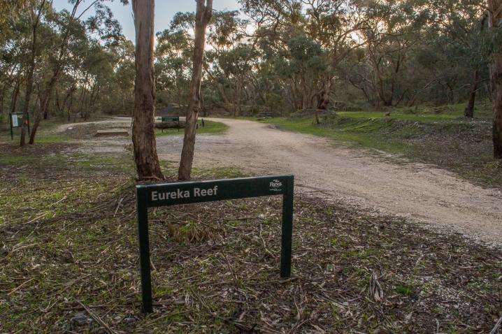
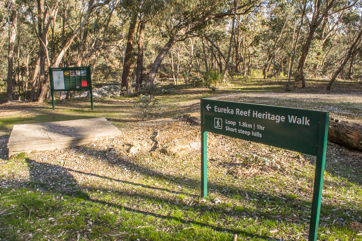
Take a walk around the Eureka Reef Gold Mining Precinct and discover the fascinating ruins and features which remain from a century of gold mining operations!
Once a busy mining village, today Eureka contains some of the oldest quartz mining relics in Victoria, as well as remnants of houses, batteries, alluvial mining, cyanide treatment, and more.
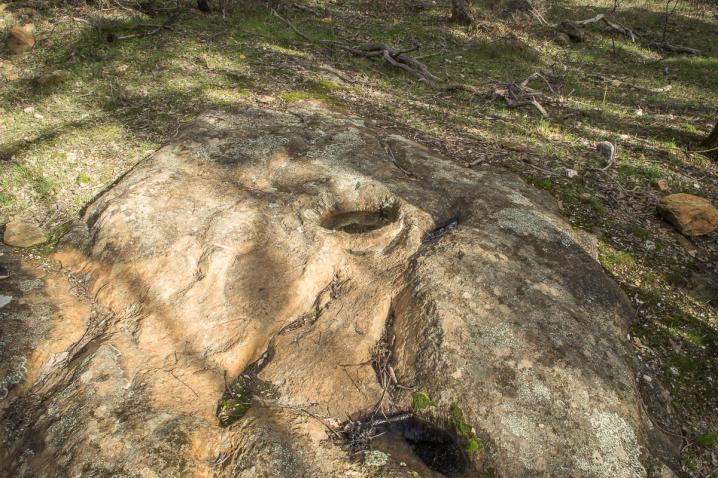
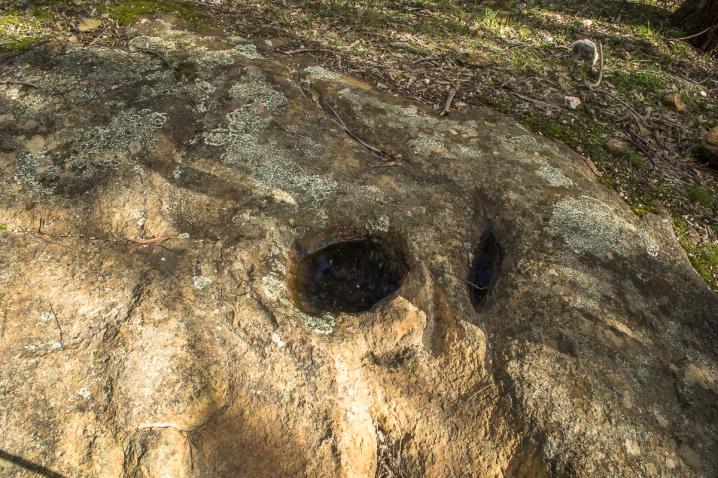
Eureka Reef is part of the traditional lands of the Dja Dja Wurrung People, and a set of Aboriginal rock wells are a beautiful feature of this area.
Eureka Reef Heritage Walk
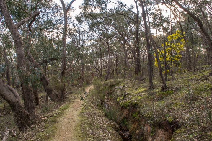
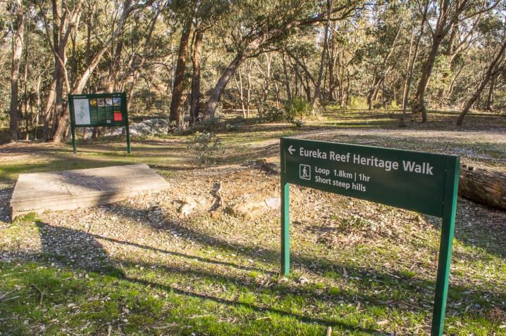
The Eureka Reef Heritage Walk has 21 numbered stops, and travels a distance of 1.8 km.
There is a shorter alternative to this walk, where you can take shortcut back to the carpark at stop 9 for a total distance of 550 m.
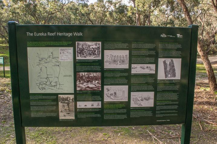
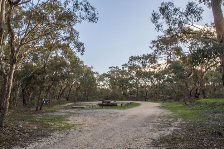
A large information display stands by the parking area and provides details about each of the 21 numbered stops along the walk.
These stops are indicated along the walk by numbered posts only, so take a few photos of this sign before you start.
You will be able to refer to each point as you go and read the corresponding text from your photos.
This text is also displayed further down on this web page, but internet service can be patchy at Eureka Reef so consider printing it out or screenshotting the information on your phone before you arrive.
- Distance: 1.8 km, 1-2 hours (or shorter version of 550 m, 30-45 mins)
- Numbered stops: 21 (or shorter version of 9 stops)
- Difficulty: Grade 3, formed track with some short steep sections and uneven ground. May be slippery after rain. Moderate fitness levels required.
History and information
Statement of Significance
Last updated on - May 11, 1999
The Eureka Reef Gold Mines consists of a range of mining sites documenting quartz and alluvial gold mining
operations carried on from the mid 1850s to 1950s. The focal point of the precinct is the Eureka Reef glory hole
and its associated cluster of stamping batteries and habitation sites. This clustering is the best surviving example
of early quartz mining technology and settlement recorded in Victoria.
The Eureka Reef Gold Mines are of historical, archaeological and scientific importance to the State of Victoria.
The Eureka Reef Gold Mines are historically and scientifically important as a characteristic example of an
important form of gold mining. Gold mining sites are of crucial importance for the pivotal role they have played
since 1851 in the development of Victoria. As well as being a significant producer of Victoria's nineteenth century
wealth, quartz mining, with its intensive use of machinery, played an important role in the development of
Victorian manufacturing industry. The Eureka Reef Gold Mines are important as having mining relics from the
pioneering years of quartz mining, and also from other mining periods.
The Eureka Reef Gold Mines are archaeologically important for its potential to yield artefacts and evidence which
will be able to provide significant information about the technological history of gold mining.
Source: Victorian Heritage Database.
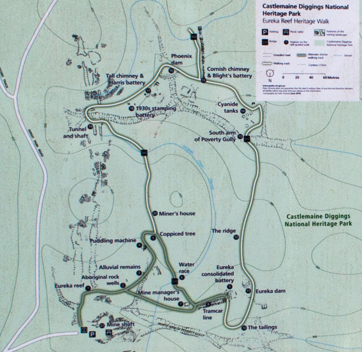
Map source: Information sign at Eureka Reef, Chewton VIC
The following text is displayed on a beautifully presented Parks Victoria information sign at the Eureka Reef parking area:
THE EUREKA REEF HERITAGE WALK
This 1.8 km self-guided walk in relaxing bushland takes you back through 140 years of mining history. Numbered posts along the track identify interesting features and correspond to the descriptions here. To make the most of your visit take a photograph of the map and descriptions to refer to as you explore.
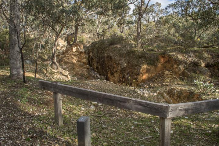
1. Eureka reef - a golden opportunity
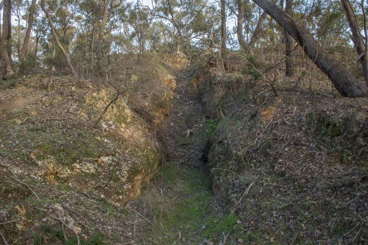
Here you can see the remains of Eureka Reef. Before the miners found it, Eureka Reef was a huge outcrop of white quartz extending in a ridge across the hills. In the 1850s and 1860s, it was mined as an open cut. Miners broke up the rock using hand tools and crushed it in machines to extract the gold.
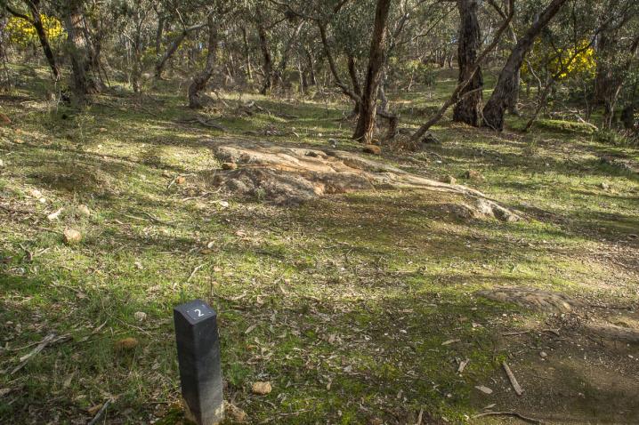
2. Aboriginal rock wells - water for the Dja Dja Wurrung People
The small depressions in the sandstone here are rock wells. The Djaara (Dja Dja Wurrung People) created them to collect rainwater by enlarging natural holes. They placed rocks over the holes to prevent animals, leaves and debris from polluting the water. Wells like these allowed them to travel long distances, even in dry weather.
Djandak (Dja Dja Wurrung Country) is a cultural landscape that includes both intangible stories and tangible objects such as scarred trees, mounds, rock wells, and stone artefact scatters. It is a living entity, which holds stories of creation and histories that cannot be erased. The rock wells are evidence of this continuing connection. The Djaara refer to mining landscapes like Eureka as 'upside down country'.
3. Alluvial remains - gold in the grass
In 1854, and again in the 1870s, diggers came here looking for alluvial gold that had slowly eroded and washed off the reef into the soil, grass and creeks. They washed the topsoil in cradles, pans and puddling machines to separate the gold from the soil. Before long they'd stripped the hillsides, and the small mounds of earth here are the slurry from puddling machines which flowed downhill to fill up the gully.
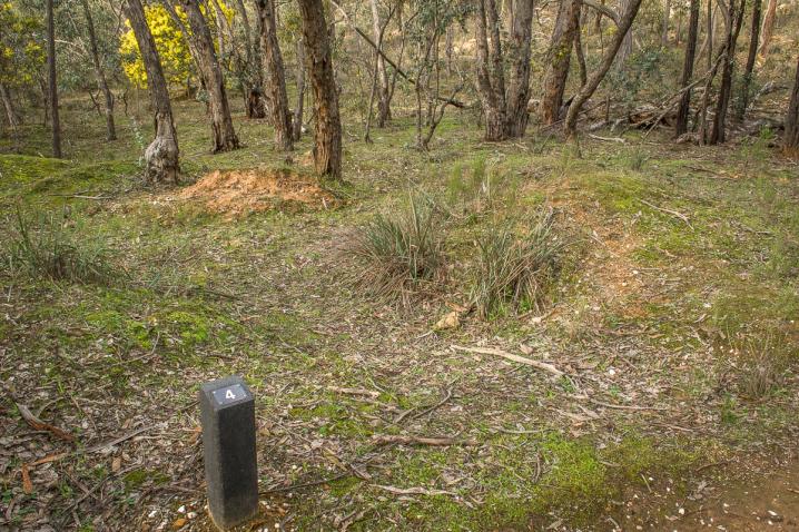
4. Remains of an 1870s puddling machine - technology to speed things up
Panning for gold is a slow process. To speed it up, diggers constructed circular ditches nearly a metre deep with an island in the middle. On the island was a pivot post that supported a long strong pole pulled around the edge of the ditch by a horse. Paddles or iron rakes hung from the pole to stir the soil and water into a slurry. When the slurry drained away, the miners could retrieve the heavy gold that had sunk to the bottom.
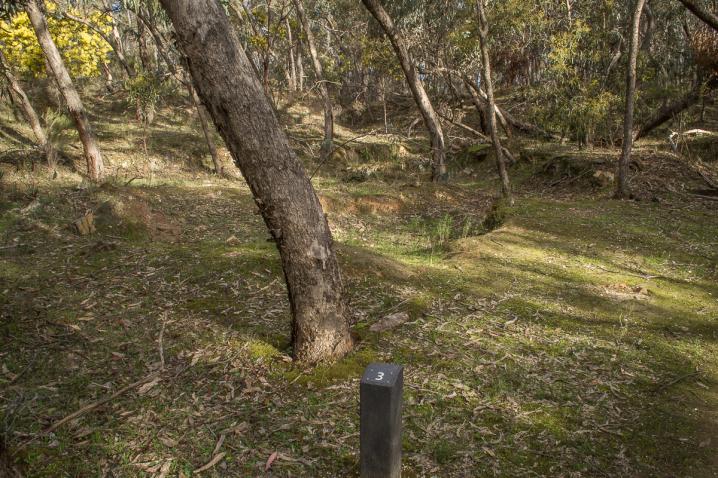
5. Coppiced Trees - surviving fire and felling
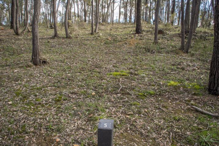
Where the track divides there is a clump of trees in a circle. Although they look like individual trees, they are multiple trunks of a single Red Ironbark, known as yeeripp by the Dja Dja Wurrung. The tree probably began its life around 500 years ago and originally had a trunk about one metre in diameter. Cut down near the base during the goldrush, the tree grew new shoots that developed into multiple trunks.
6. The water race - and the race to end the drought
Drought plagued the diggings, and sometimes work had to stop due to lack of water. This channel is part of a water race that was constructed in the 1860s and 1870s to bring water from the Coliban River. It is an incredible feat of engineering, hundreds of kilometres long.
7. The school-teacher's and mine manager's house
This house was built in the late 1850s by a young English prospector who later became a school teacher. The two-room cottage was described as having a "fine flagged floor and the best fire-place" in Eureka. When William Palliser moved to Castlemaine, his home was ideal for the manager of the Eureka Consolidated Company. Living right next to the tramway allowed the manager to keep a close eye on the company's gold!
8. Trolleys and tramways - smoothing the way
Alongside the mine manager's house is a tramway. Every day, trolleys moved tons of ore from the reef to the crushing plant. The wooden rails have rotted away, but the solid embankment remains. You can still see blocks of quartz on the ground around it that probably fell off an overloaded trolley.
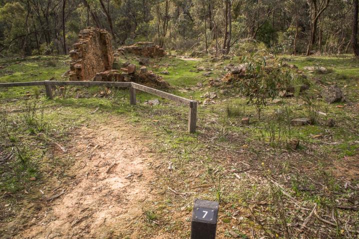
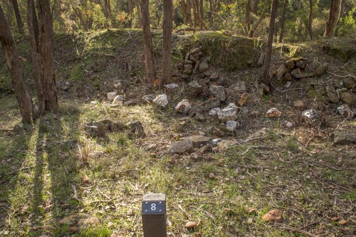
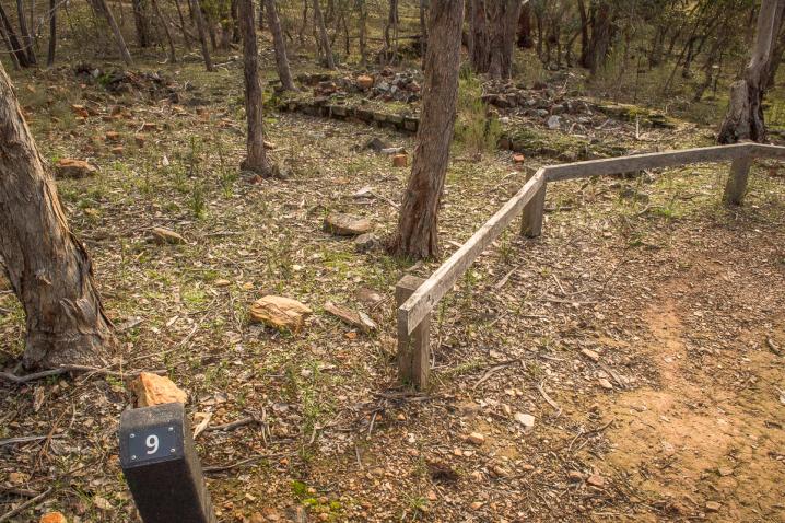
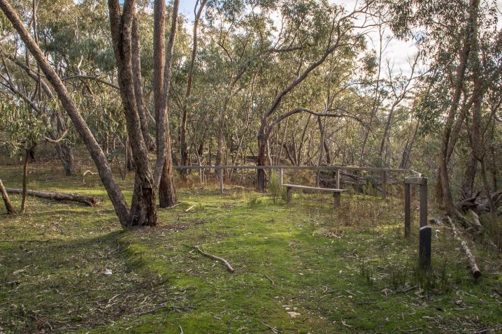
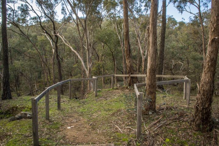
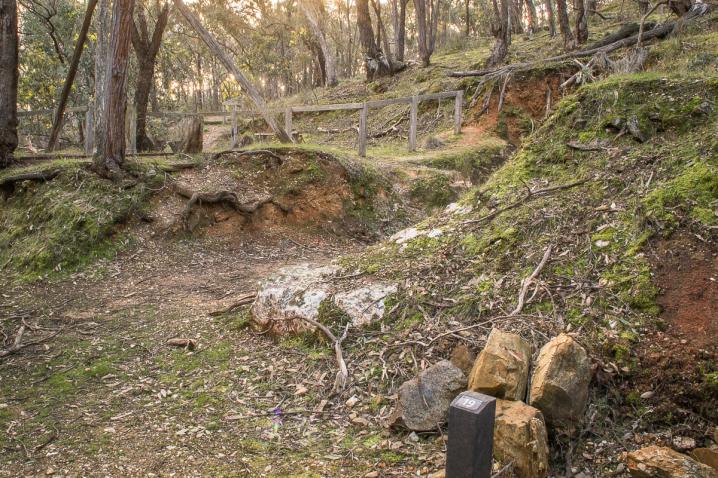
9. The Eureka Consolidated Battery - crushing quartz into dust
Eureka Consolidated's quartz crushing plant operated here in the 1870s. Its foundations can be seen to the left of the track. A steam engine powered a series of pulleys and straps that operated twelve heavy iron hammers that crushed the quartz to dust to extract the gold. Day and night, six days a week, the sound of the battery's stampers would have echoed through the valley. The noise would have been deafening.
If you want a shorter walk (about 550m), turn around here and take the short-cut between the house and tramway back to the carpark
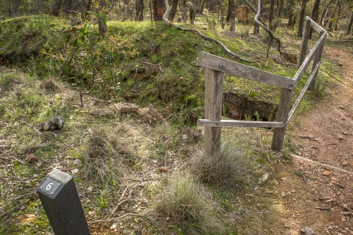
10. The tailings - an enormous pile of dust
What happened to all the quartz dust from the Eureka Consolidated battery? If you stand near the fence here, you'll be standing on a huge pile of it. A wicker embankment at the narrowest point of this gully trapped the tailings. However, the dam was breached long ago and most of the tailings have washed away.
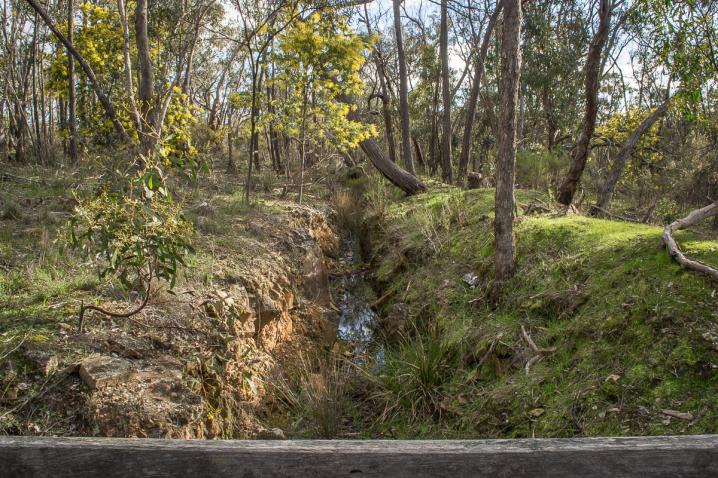
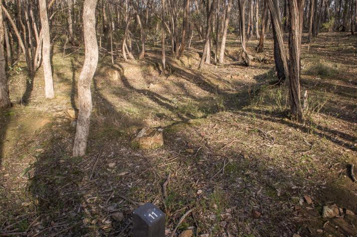
11. The Eureka dam - no water, no life!
Water was crucial for survival, and to separate gold from the rocks and soil. After the construction of the water races, water was supplied from the races to the dams. Each battery had its own dam - this one supplied the Eureka Consolidated Battery. Water was released to the crushing works by removing a plug from a hole in the dam wall. You can still see the fine stonework around this outlet.
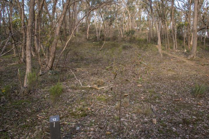
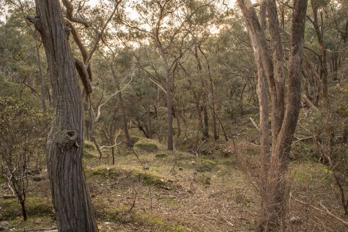
12. The ridge - a recovering forest
During the gold rush, the trees at Eureka were felled for building and fuel, and hillsides like this were stripped bare. However, many native plants survived, and the forest is regenerating. Eucalypts dominate the upper canopy, with many smaller species of trees and shrubs, like wattles, below. In spring and early summer, the forest floor is full of wildflowers. How many different species can you see?
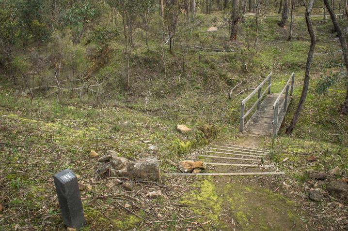
13. Poverty Gully - looking back through history
Why name somewhere with so much gold 'Poverty Gully'? It was probably named by early prospectors to discourage their rivals! The south arm of Poverty Gully is one of the most complex mining sites in Castlemaine Diggings National Heritage Park. As the track continues up the gully, you can find the relics of several waves of mining spanning a century from the 1850s to the 1950s.
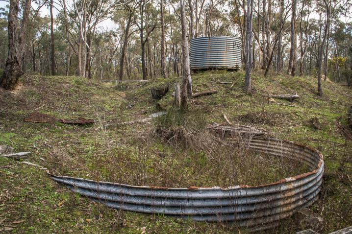
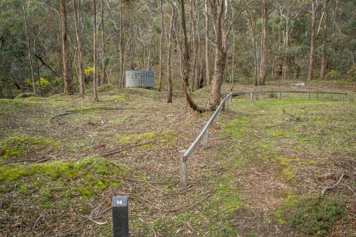
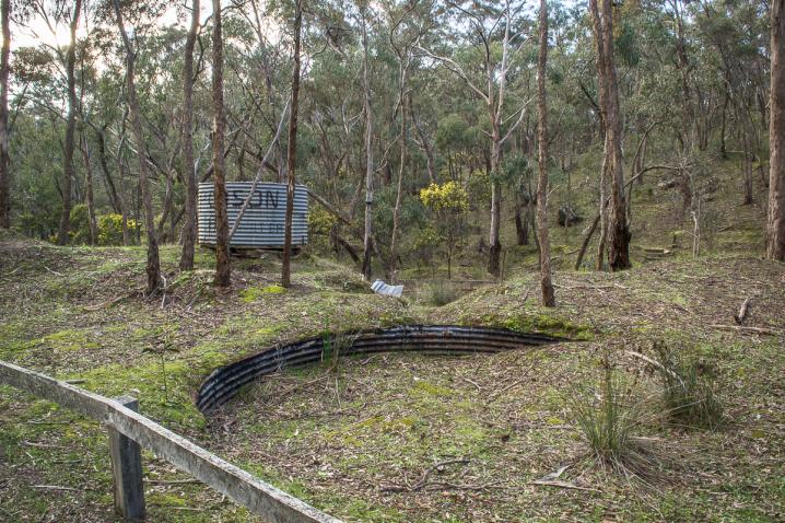
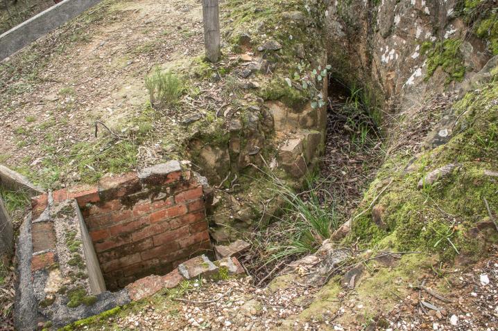
14. The cyanide tanks - a poisonous past
A cyanide plant was first established here during the 1890s to extract gold from the tailings of earlier diggings. It was reworked in the 1930s and 1950s, which is when the tanks you can see here were used. Unfortunately, gold-bearing rock often contains arsenic, which combined with cyanide produces toxic mustard gas. To stop the gas from forming, lime was added. A small heap of this white clay-like material material can be seen a few metres further along the track.
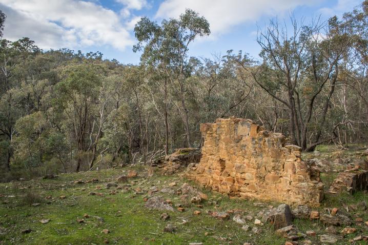
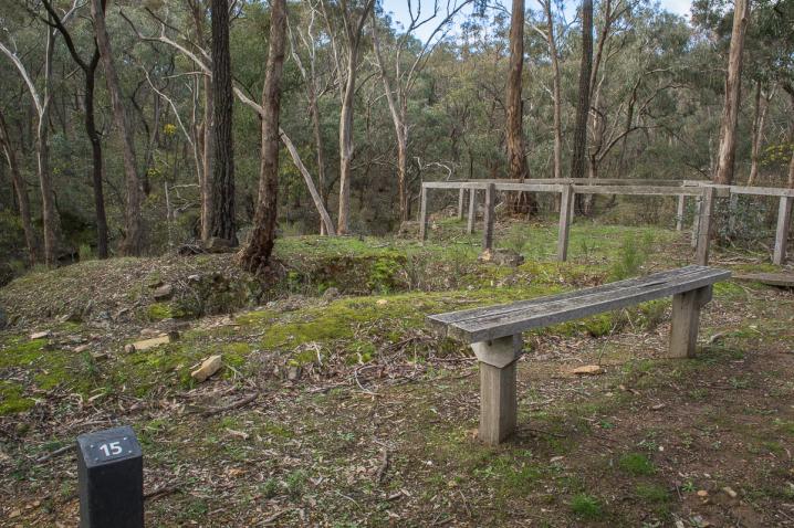
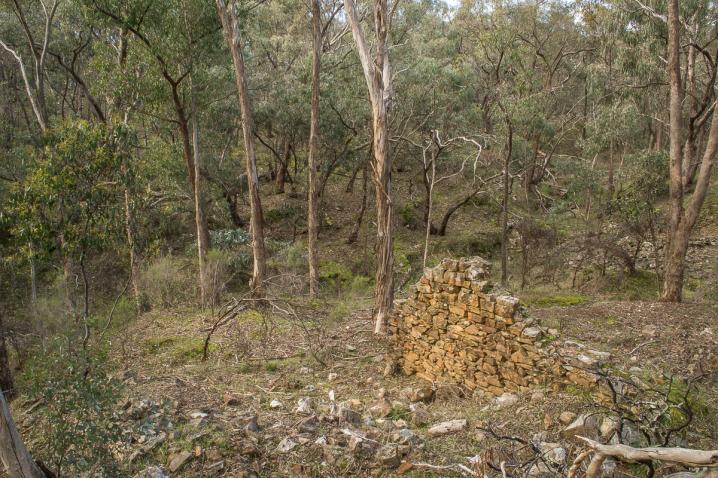
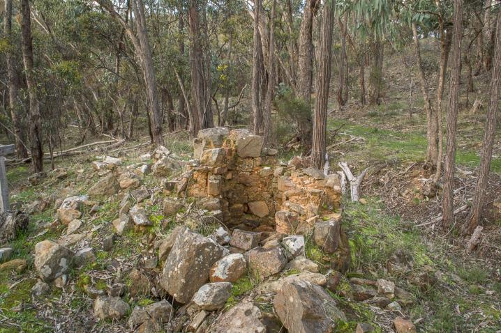
15. An earth-bound chimney - a cost-effective solution
This 'Cornish chimney' is one of the earliest quartz mining relics in Victoria. It dates from the late 1850s when the Phoenix Quartz Mining Company, also known as Blight's battery, operated in the gully below. To avoid the cost and difficulty of building a tall upright chimney, Cornish miners built tunnels of bricks up the slope of a hill. The smoke drifted up inside and emerged from a small upright section at the top. Vents allowed the chimney to be cleaned.
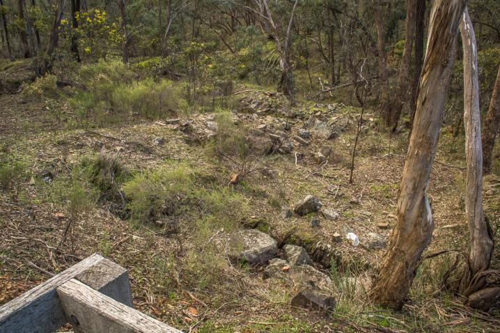
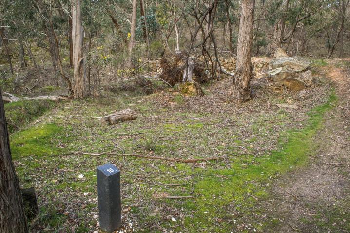
16. The Phoenix dam - being reclaimed by nature
This dam was constructed in the 1850s to supply the Phoenix battery with rainwater before the water race was built. The impressively-constructed stone retaining wall is still visible, but the dam itself has silted up. Look on the slopes nearby for large Red Ironbark trees, with deeply rutted bark, which attract a wide variety of native birds. Stop and listen. How many different species of birds can you see or hear calling.
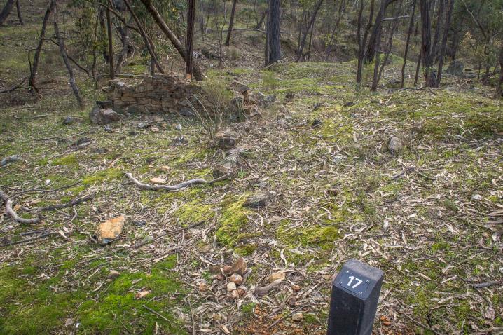
17. A tall chimney - an expensive endeavour
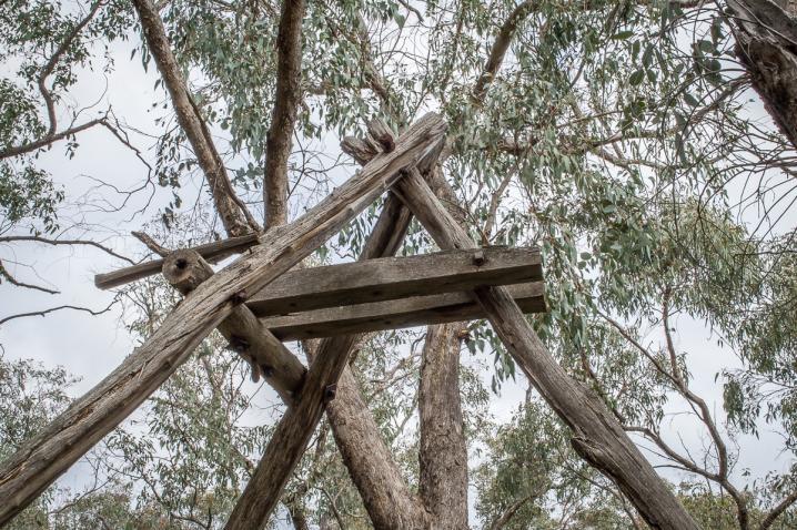
This is the site of a battery owned by Mr Harris. On the left of the track as you approach the viewing area, are the brickwork foundations of a blacksmith's workshop. Blacksmiths provided essential services to both miners and farmers - without them, work on the goldfields would have ground to a halt. To the right of the viewing area are the remains of the vertical chimney, which was once 12m high. It cost £100 to build - a huge sum of money in those days. The battery and stampers were in the gully below.
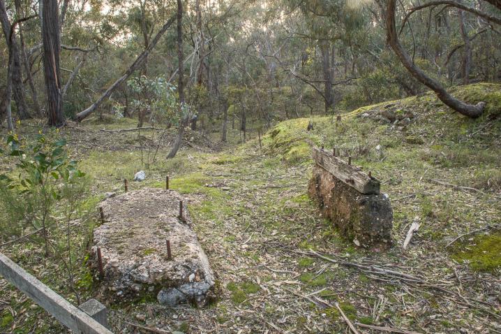
18. 1930s stamping battery - a relic of the Great Depression
Eighty years after mining began at Eureka, a new battery was built here. In the depressions of the early 1890s and 1930s, prospecting was more appealing than unemployment. Many mines were reopened, although few proved profitable. In the 1930s the sound of ten stamping heads would have echoed through this gully, supported by two blocks of concrete that formed the foundations.
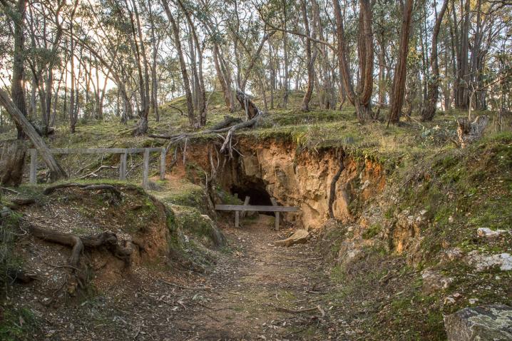
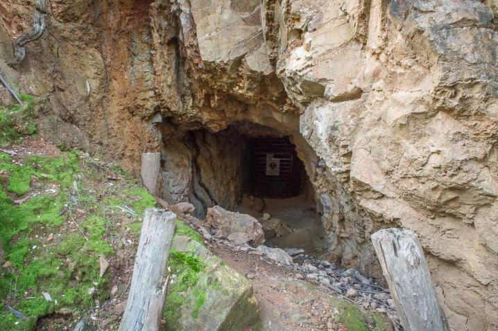
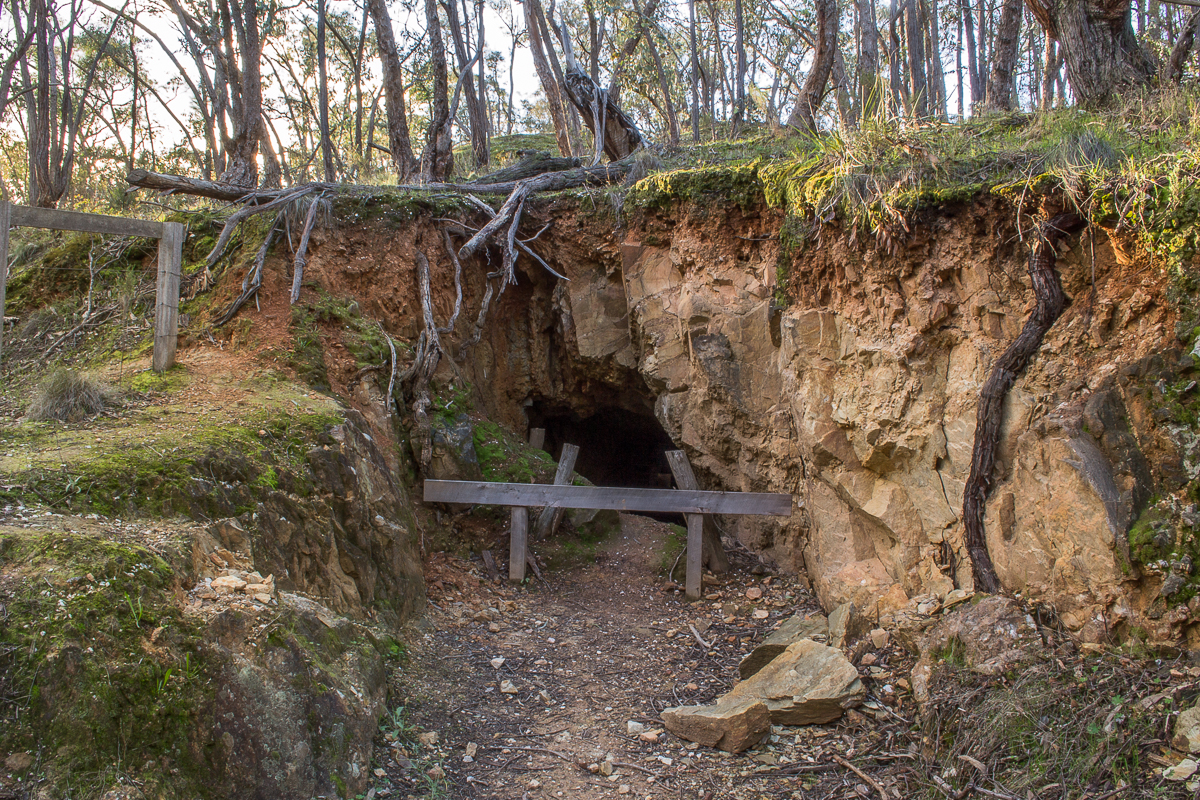
19. Tunnels and bats - finding a niche below the reef
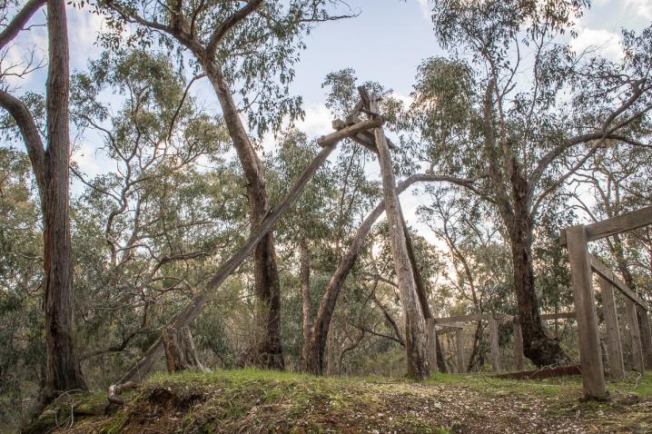
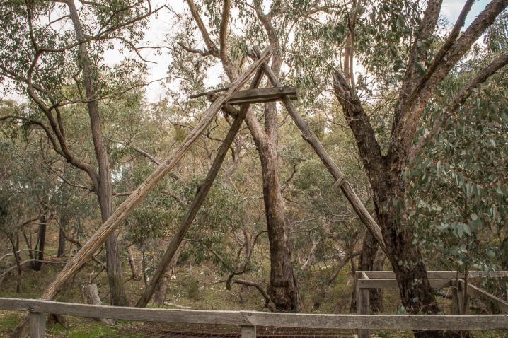
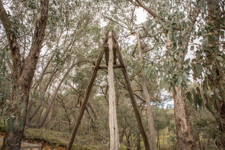
In the 1930s, this tunnel (known as an 'adit') was dug into the sandstone below Eureka reef. About 150 metres in, a vertical shaft (a 'stope') was constructed that led upwards, allowing the reef to be mined from below To the left of the tunnel is another shaft and a headframe constructed in the 1950s. For safety, both are closed to visitors. The tunnel is now a roosting site for the Common Bent-wing bat, a small insect-eating bat sacred to the Dja Dja Wurrung People, who call them yaranmillawit.
20. The miner's house - a clue to life on the goldfields
These ruins were once home to a miner, and possibly his family. They remind us of the simple life people lived on the goldfields. The house was about 3m x 2.5m with a chimney at one end - about the size of a bathroom in a modern home. In 1857, there were around a hundred men and twenty or so families living at Eureka. Regular wages from the mines allowed them to build homes and keep food on the table.
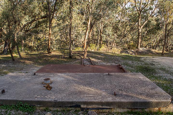
21. The mine shaft - and multiple waves of mining
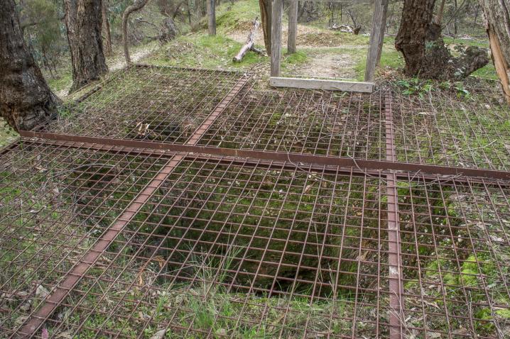
The Eureka Consolidated Company began a gold mining operation here in 1871. It continued for about seven years and extracted nearly 16,000 tonnes of ore, yielding 175 kilograms of gold (roughly the weight of two adult men). The concrete platform in the car park covers the shaft dug to get to the lower level of the reef, 150m below. In the 1980s, the shaft was briefly reopened to extract quartz for crushing into chips for the tops of graves. You can still see fine chips of quartz on the ground. There's a hole in the platform big enough to drop one inside. Listen carefully and you can hear how long it takes to reach the bottom.
EXPLORE THE EUREKA REEF DIGITAL TOUR
To reveal more of the secrets embedded in this landscape and what life was like on the goldfields, explore the digital Eureka Reef Heritage Walk on the Parks Victoria website www.parks.vic.gov.au.
This augmented reality tour allows you to get right down into the reef itself, see recreations of some of the buildings and mining infrastructure that once dotted the landscape, listen to a local storyteller and a Dja Dja Wurrung Elder revealing the human stories of Eureka and hear the sounds of machinery and music from the gold rush era.
The virtual tour is ideal for people with limited mobility, vision or hearing impairment. It is compatible with screen-reading technology and has transcripts of audio segments.
Unfortunately, mobile reception at Eureka is patchy and the digital tour contains 360 degree panoramas and many images and audio files, so we recommend waiting until you get home to explore it.
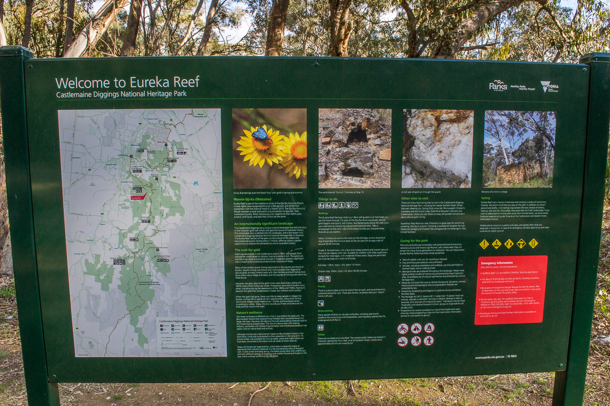
WELOME TO EUREKA REEF
Castlemaine Diggings National Heritage Park
Womin-Dji-Ka (Welcome)
Eureka Reef is part of the traditional lands of the Dja Dja Wurrung People whose rights were recognised through a Recognition and Settlement Agreement with the State of Victoria in March 2013. The Dja Dja Wurrung People maintain a close and continuing connection to Djandak, their traditional Country. Parks Victoria pays our respects to their elders, past, present, and future, and asks that visitors do the same.
An internationally significant landscape
The Castlemaine Diggings are a unique cultural landscape that tells the story of the Victorian gold rush which changed the course of Australian history. This remarkable story is etched into the landscape, and is the reason why Castlemaine Diggings became the first National Heritage Park in Australia. The Eureka Reef section of the park contains some of the oldest and best-presented quartz mining relics in Victoria, offering visitors a golden opportunity to explore this extraordinary era in Australia's history.
The rush for gold
Gold was discovered in the Castlemaine area in 1851, and people from around the world raced to Victoria, hoping to strike it rich. The gold rush, and the huge social and political changes it triggered, played a significant role in shaping the multicultural democratic Australia of today.
Relics of the earliest quartz mining operation in the country are found at Eureka. Quartz mining was slower and more complex than digging for alluvial gold, so many miners came with their families and built homes here. Once there was a village at Eureka, and the sounds of mining and machinery filled the air.
However, the glory days of the gold mines were short-lived, and by the 1870s most of the mines had closed. Prospectors returned to Eureka many times, including during the depressions of the 1890s and 1930s, hoping to discover the gold their predecessors missed, but without much success.
When the gold had gone, there was little to keep people in villages like Eureka. As they left in search of new opportunities, many small mining towns and villages simply faded away - homes and businesses slowly crumbling to rubble. Today, the only sounds you'll hear at Eureka are the birds and the wind in the trees.
Nature's resilience
The forest at Eureka is different now than it was before the gold rush. The Box-Ironbark forests that covered these hillsides then contained fewer but larger old trees. However, the demand for fuel and building materials lead to the forests being stripped bare. The loss of mature trees with nesting hollows, combined with habitat fragmentation and introduced predators has taken a toll on native birds and animals.
Although mining had a detrimental impact on Box-Ironbard forests in the short term, it has also contributed to their protection in the long term. To ensure timber was available for mining needs, areas that might otherwise have been converted to farmland were set aside as forest reserves.
Today, the forests are regenerating, and Eureka is a beautiful place to appreciate both natures resilience and the extraordinary story of the gold rush In late winter and early spring, the forest comes alive with wildflowers, and with different species of eucalypts and wattles flowering throughout the year, there is always something to appreciate.
THINGS TO DO
Walking
The Eureka Reef Heritage Walk is a 1.8km self-guided walk that helps you see the forest through the eyes of the Dja Dja Wurrung people, alluvial gold diggers and quartz reef miners. Numbered posts along the walk draw your attention to interesting cultural and historical relics. Take a photograph of the other side of this board to help you interpret these features as you explore.
Allow 1-2 hours to explore the relics on the full loop, or turn around at stop 9 and take the shortcut back to the car park for an easy walk of around 30-45 minutes.
Grade 3, formed track with a few short steep sections and uneven ground that may be slippery after rain. Suitable for children with close supervision. Suitable for most ages, with moderate fitness levels. Dogs are permitted but must be kept on a leash at all times.
Full loop: 1.8 km, stops 1-20, allow 1-2 hours
Shorter loop: 550m, stops 1-9, allow 30-45 minutes
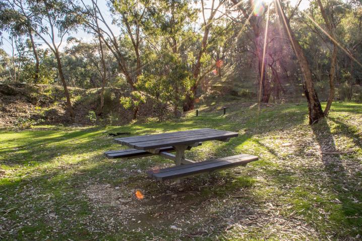
Picnics
There is a picnic table at the far end of the car park, and several benches scattered along the walk. There are no bins, so please take your rubbish home with you.
Birdwatching
Many species of birds can be seen at Eureka, including year-round residents like currawongs and honeyeaters, and migratory species like the endangered Swift Parrot.
Toilets
There are no toilets at Eureka Reef. The nearest public toilets are located in Chewton, behind the Town Hall, or at 23 Lyttleton Street, Castlemaine, approximately 20 minutes away by car.
Other sites to visit
Caring for the park
The ruins at Eureka are remarkably well-preserved and of enormous national cultural and historic significance. Left undisturbed, they will remain for many future generations to rediscover. You can help protect Eureka Reef by following these simple guidelines:
- Take all rubbish with you for recycling or disposal
- Fires and firewood collection are prohibited.
- Vehicles, including motorbikes and trailbikes, are only permitted on formed roads, not on walking tracks.
- Aboriginal sites are scattered throughout this landscape. Please tread lightly and be mindful of conserving and protecting these important sites. All artefacts are of cultural significance and protected by cultural heritage laws.
- Please do not touch the ruins or disturb the ground. All plants, animals, historical and archaeological sites and geographic features are protected by law.
- Fossicking, prospecting and digging for gold are strictly prohibited. Penalties apply.
- The Heritage Act 2017, Section 89 (1) states that "A person must not remove, relocate or demolish, damage or despoil, develop or alter or excavate, all or any part of a registered place." Individuals may be fined 10 penalty units (several thousand dollars), groups or organisations 20 penalty units.
- Prospectors can access a prospecting map of the Castlemaine area showing where prospecting is allowed from local visitor information centres or www.parks.vic.gov.au
Safety
Eureka Reef was a heavily mined area and contains a variety of continuing hazards. We recommend that you stay on the path. In addition to uneven ground and shafts, mine tailings may contain the toxic residue of arsenic, mercury, and cyanide. Fortunately, they pose little risk if left undisturbed. If you wish to safely explore mining relics away from formed tracks, we recommend hiring an experienced guide. Enquire at the Castlemaine and Maldon Visitor Information Centres.
Mobile reception is patchy at Eureka, and signals often drop out, especially in the gullies. In case of an emergency, the best spots to try and make a call are on higher ground.
SEE ALSO
HISTORICAL MAP OF THE CASTLEMAINE MINING DISTRICT, 1860
Map of the Castlemaine Mining District which shows historical features in superb detail, including mining divisions, reefs, gullies, and gold workings. Mining Department, Melbourne, 1860. High quality, durable A1 print in a satin finish. Large, 594 x 891 mm. Go to online shop.
PROSPECTORS AND MINERS ASSOCIATION VICTORIA
Established in 1980, the Prospectors and Miners Association of Victoria is a voluntary body created to protect the rights and opportunities of those who wish to prospect, fossick or mine in the State of Victoria, Australia.
You can support the PMAV in their fight to uphold these rights by
becoming a member. You'll also gain access to exclusive publications, field days, prospecting tips, discounts and competitions.