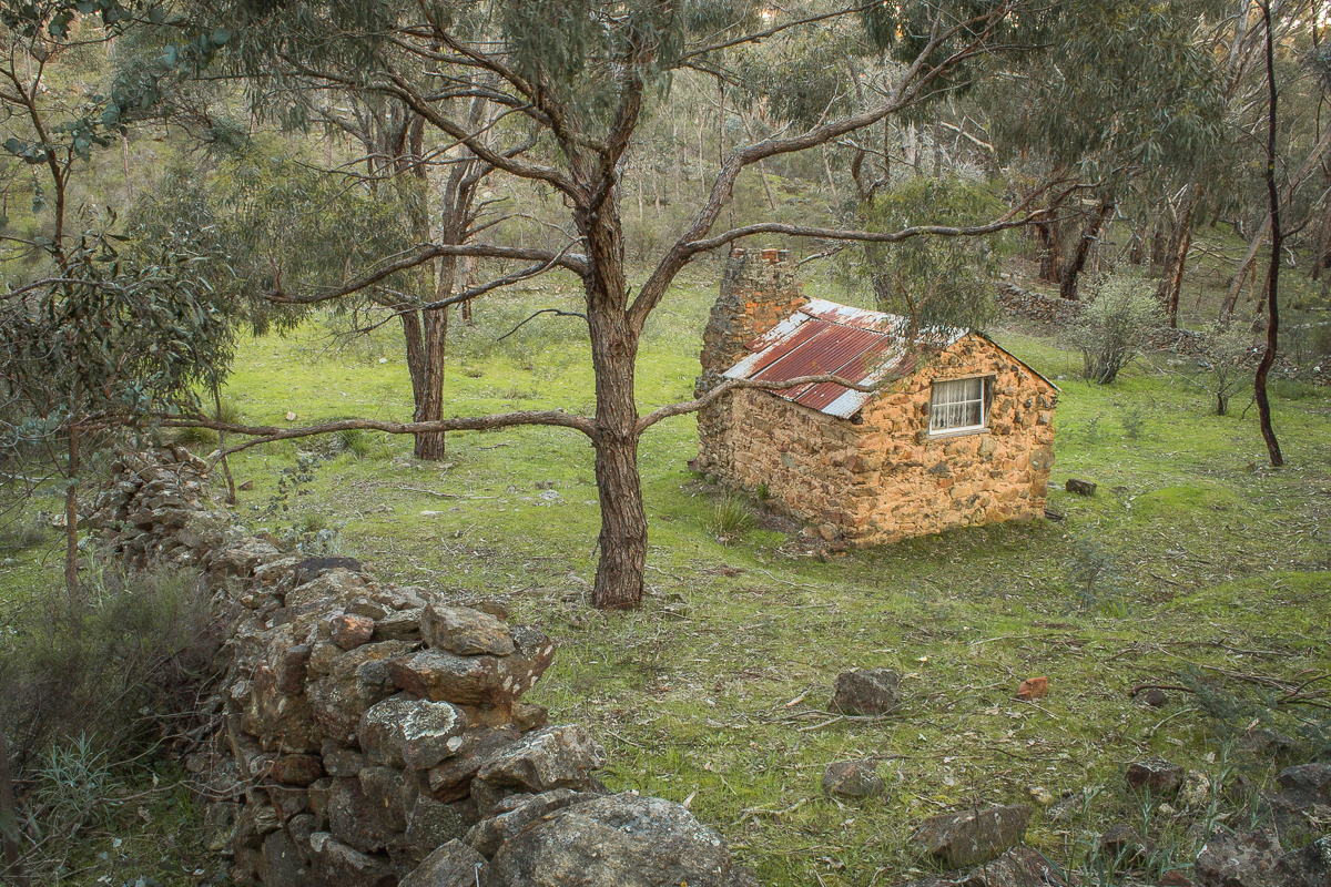
Ferntree Falls, Raglan VIC
The beautiful, varied landscape of the Victorian Goldfields provides countless fantastic settings for bushwalkers to enjoy.
Along with the epic 210 km Goldfields Track, you can take many scenic walks throughout the region which showcase our rich history and stunning natural treasures.
Take a look through this huge collection of local bushwalks and start planning your next day out exploring in the Victorian Goldfields.
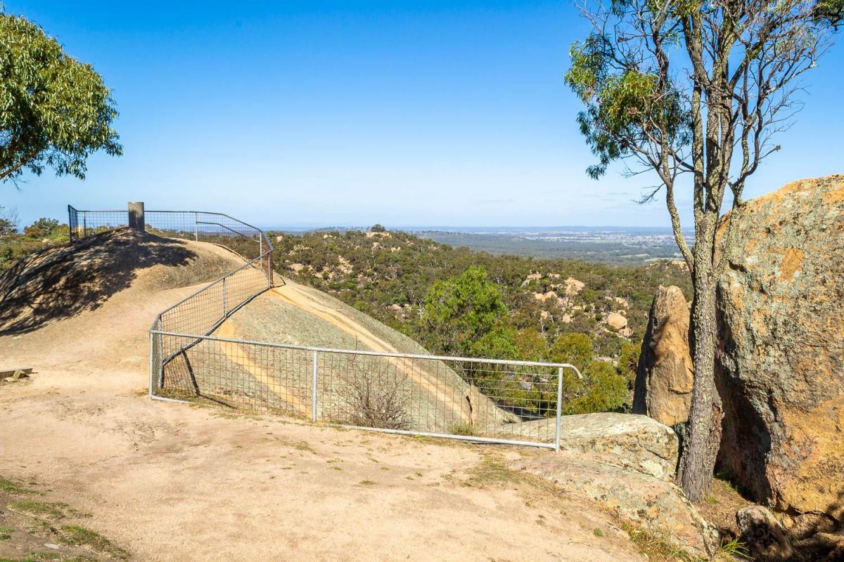
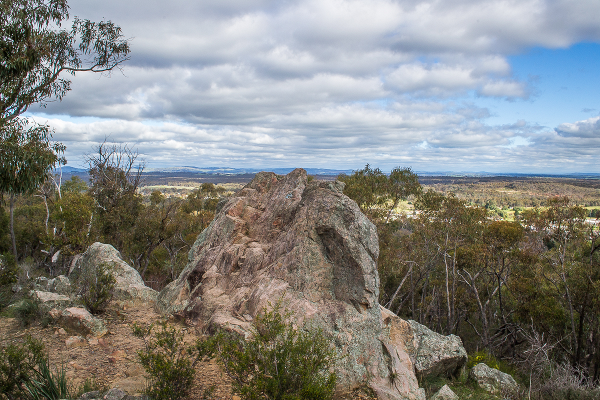
Mount Alexander's West Ridge Walking Track, Harcourt North VIC
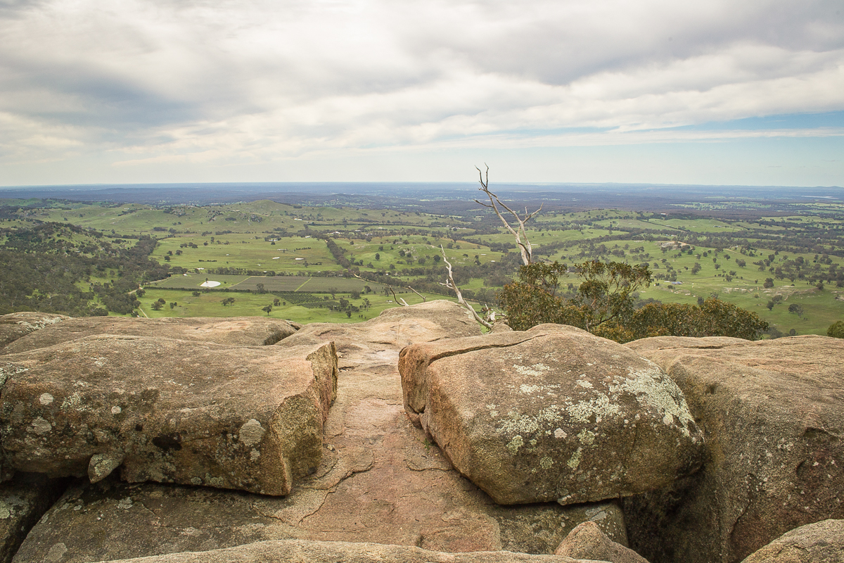
Lang's Lookout along the West Ridge Walking Track, Mt Alexander Regional Park, Harcourt North VIC
Embark on an adventure across the stunning rocky outcrops of the Mount Alexander Regional Park!
Experience breathtaking views and gorgeous scenery as you trek among the enormous granite boulders and across forested slopes, visiting multiple lookouts along the way.
This walk is 4km each way, moderate difficulty.
Find out more about the West Ridge Walking Track.
Crusoe Reservoir, Bendigo VIC
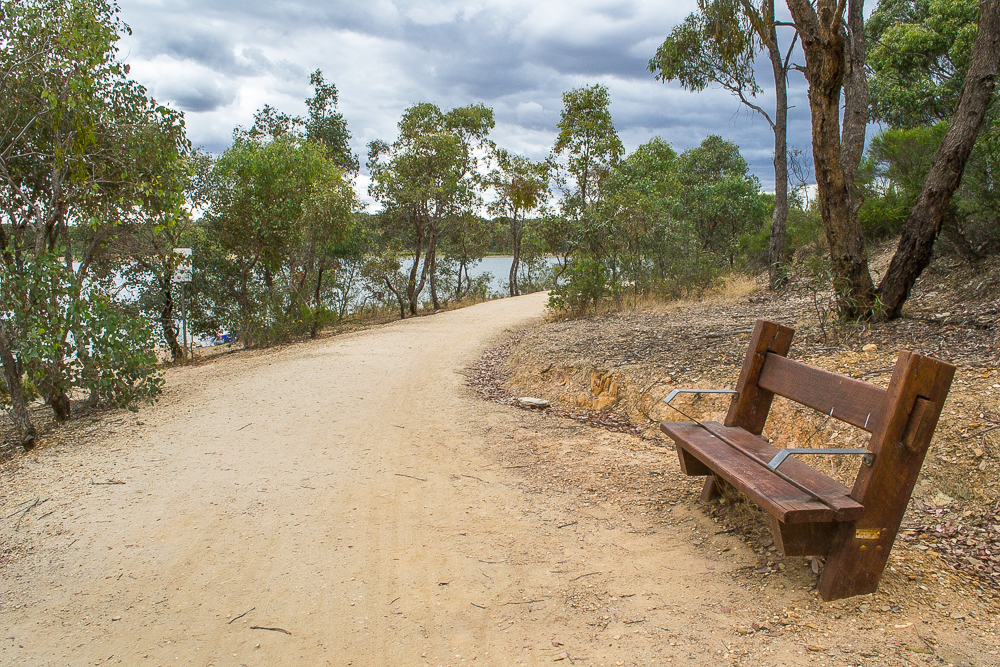
Crusoe Reservoir, Bendigo VIC
Crusoe Reservoir is a local favourite for swimming, fishing, kayaking, bushwalking and photography.
Surrounded by bushland views and scenic walking tracks, this is a beautiful spot for recreation and relaxation.
Visitors can take a 3.3 km scenic circuit walk around Crusoe Reservoir, enjoying a mixture of bushland and water views.
This gravel track is wide and well formed, accessible by walkers, cyclists, prams and wheelchairs.
You can also walk across to the nearby No 7 Reservoir via a 1.7 km walking track which connects the two areas.
Find out more about Crusoe Reservoir.
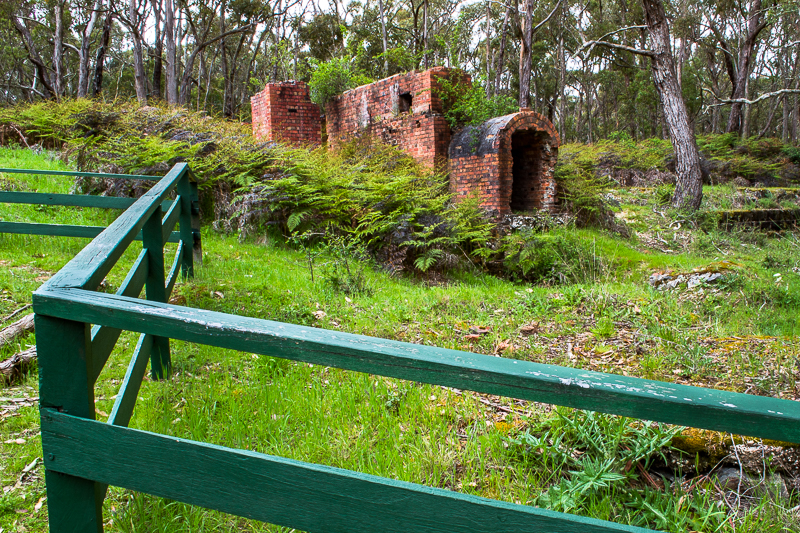
Iron Mine and Blast Furnace, Lal Lal VIC
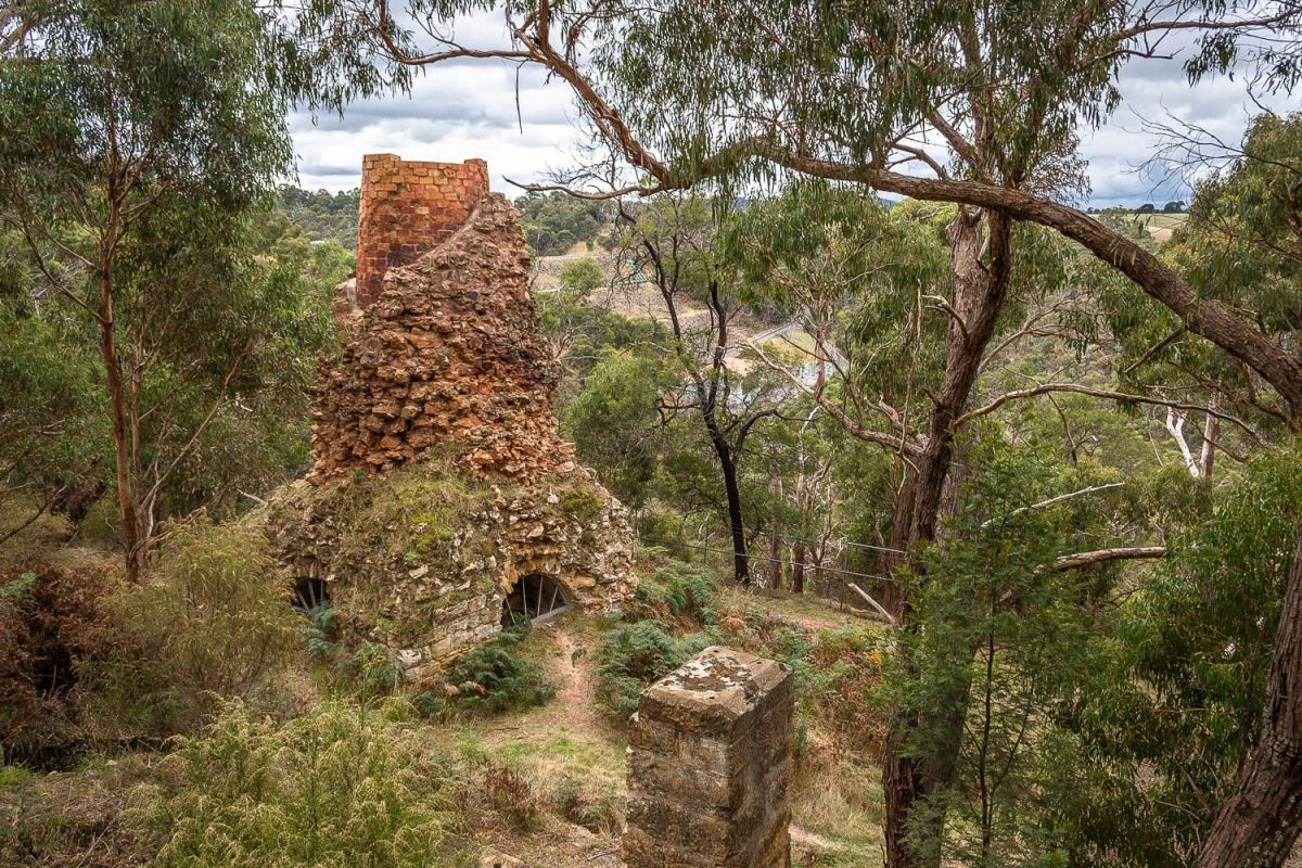
Iron Mine and Blast Furnace, Lal Lal VIC
A 400m circuit track begins at the picnic area and takes you on a short scenic walk along the hillside past the impressive blast furnace.
You can view the blast furnace from a wooden platform with a railing, and there are several interesting information signs about the Lal Lal Iron Company, the blast furnace itself, the former blacksmith's shop, and the men who lived and worked there.
Alongside the picnic area you will also find the remains of the iron mine itself.
Find out more about the Iron Mine and Blast Furnace.
Goldfields Reservoir, Maryborough VIC
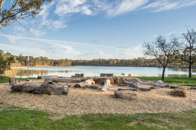
Goldfields Reservoir, Maryborough VIC
Goldfields Reservoir is a peaceful lake on the outskirts of Maryborough which features a picnic area, nature playground, and a scenic walking track.
This is a popular spot for swimming, fishing, picnicking and bushwalking.
The walking track circles the entire reservoir, and is about a 1.7 km easy, pram friendly, scenic walk.
The track features multiple bridges, interesting hand made wooden barriers, wetland areas and water views.
Find out more about Goldfields Reservoir.
Blackwood Mineral Springs Reserve, Blackwood VIC
Blackwood Mineral Springs Reserve, Blackwood VIC
Blackwood Mineral Springs Reserve is a gorgeous park, picnic and play area which runs alongside the beautiful Lerderderg River.
Sample some mineral water, take a walk across the foot bridge to enjoy views down the creek, or head off on one of the longer walking tracks.
Be sure to keep an eye out for the resident Kookaburras!
Find out more about Blackwood Mineral Springs Reserve.
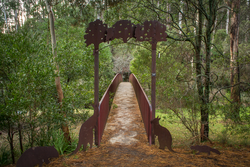
Battery Dam to Bull Gully Aboriginal Rock Wells, Daisy Hill VIC
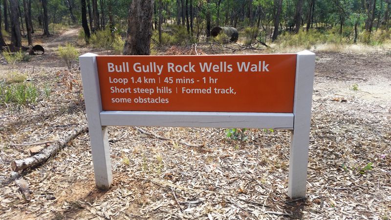
Walking track From the Battery Dam and Distillery to the Bull Gully Aboriginal Rock Wells, Daisy Hill VIC
A set of four Aboriginal rock water wells can be found at Bull Gully, just outside Maryborough.
These wells are generally thought to be the best example of Aboriginal rock wells in Victoria.
There is a great walking track through the Craigie State Forest which begins at the Battery Dam and Distillery Site and takes you up to the Bull Gully Aboriginal Rock Wells.
You can spend some time exploring the fascinating ruins and relics of the Battery Dam and Distillery site before heading off to the rock wells.
Find out more about the Bull Gully Aboriginal Rock Wells.
Welcome Stranger Discovery Walk, Moliagul VIC
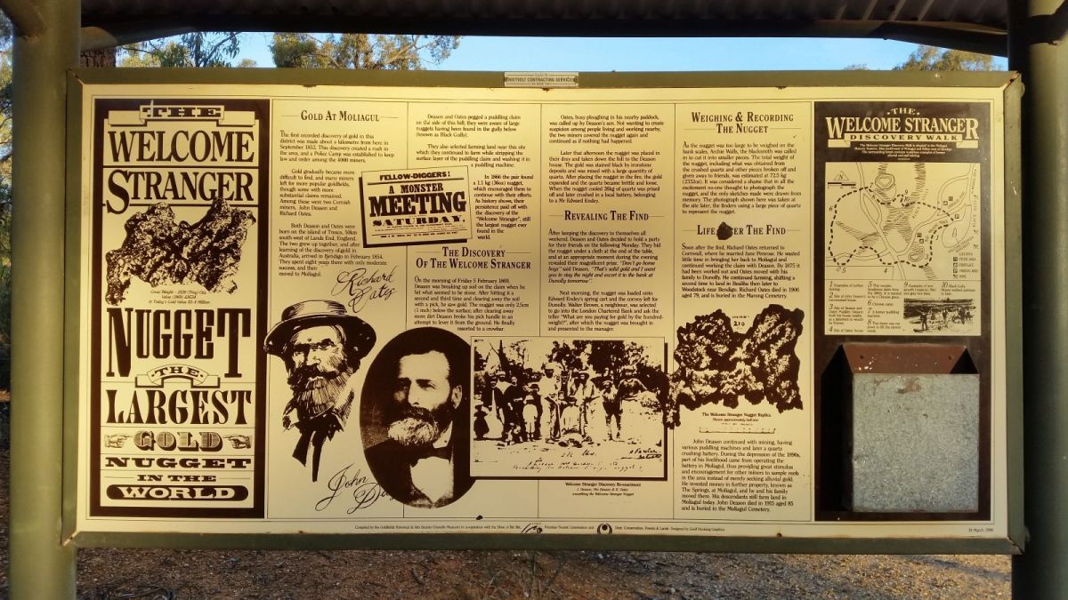
Welcome Stranger Discovery Walk, Moliagul VIC
The Welcome Stranger Discovery Walk is an 850 metre circuit which travels around the discovery site of the world's largest alluvial gold nugget ever found, the famous Welcome Stranger.
The walk takes you past many interesting examples of former alluvial and reef mining efforts, the house sites of John Deason and Richard Oates (the two lucky miners who unearthed the world's largest nugget in 1869), puddlers, a Chinese grave and the site of a Chinese camp.
The walk begins from the Welcome Stranger Monument and Picnic Area within the Moliagul Historic Area.
Find out more about the Welcome Stranger Discovery Walk.
Melville Caves, Brenanah VIC
Melville Caves, Kooyoora State Park, Brenanah VIC
Melville Caves lie atop a spectacular rocky mountain within the Kooyoora State Park in Brenanah, Victoria.
Featuring a scenic lookout, walking tracks and caves, Melville Caves are a fantastic place to spend the day exploring.
The caves are named after notorious bushranger Captain Melville who used the caves as a hiding place in the mid 19th century.
You can take an easy, scenic walk to the caves from the top carpark or alternatively you can take the steeper track up the mountainside from the Picnic Area below.
Find out more about Melville Caves.
Rise and Shine Nature Conservation Reserve, Strangways VIC
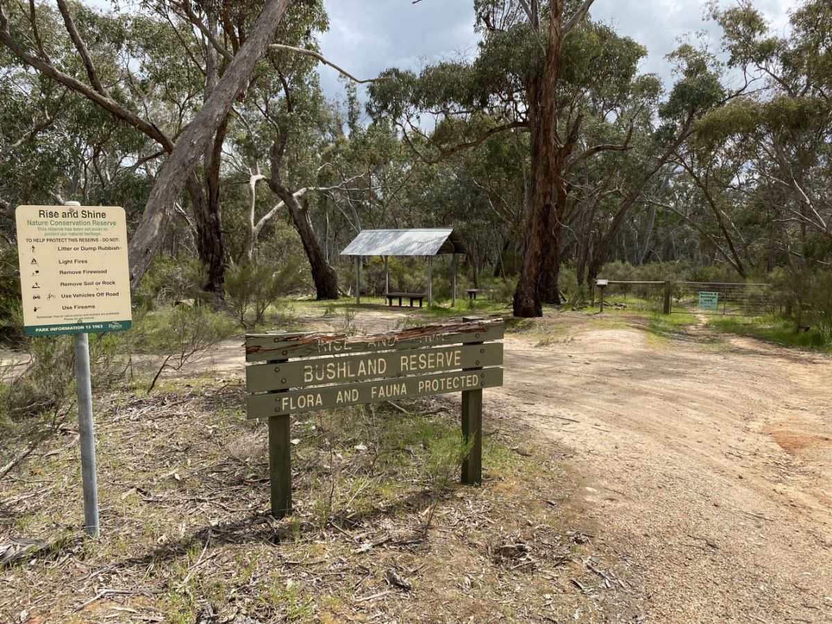
Rise and Shine Nature Conservation Reserve, Strangways VIC
The Rise and Shine Nature Conservation Reserve is a beautiful patch of bushland with an educational self guided tour, located between Newstead and Daylesford.
A walking track follows the path of an ancient river, and 21 numbered information points allow you to refer to your park notes (available in a container at the beginning of the walk) and learn about each feature.
Discover native plants and animals, fascinating geological features, and the impact both animals and humans have had on the land.
Find out more about the Rise and Shine Nature Conservation Reserve.
Garfield Water Wheel, Chewton VIC
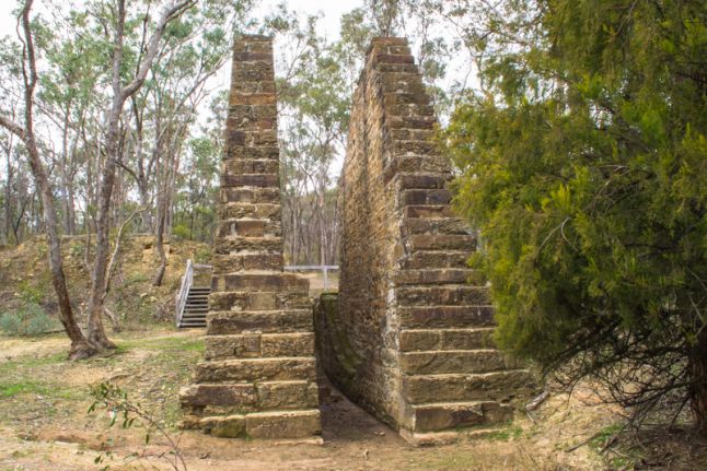
Garfield Water Wheel, Castlemaine Diggings National Heritage Park, Chewton VIC
Visit the Garfield Water Wheel historical site in Chewton and explore the ruins and remnants of the Garfield Company Mine.
The massive stone supports which still remain at the site once supported an enormous water wheel with a diameter of 22 metres.
Upon its construction the Garfield Water Wheel was hailed as the largest in the southern hemisphere! The water wheel was used between 1887 and 1903 to power the stamp battery for the mine.
A self guided walk takes you around the area and shows many fascinating features including winding engine foundations, water races and cyanide tanks.
Find out more about the Garfield Water Wheel.
Inglewood Reservoir, Inglewood VIC
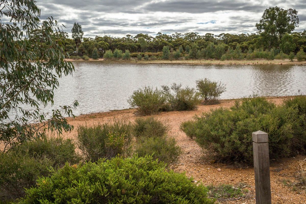
Inglewood Reservoir, Inglewood VIC
This scenic reservoir lies on the outskirts of Inglewood and is a great place to spend the afternoon bushwalking, fishing, swimming or picnicking.
Situated right alongside the Botanical Gardens Reserve, the reservoir features a 1.5-2km walking track, historical gold diggings, old water settling ponds, and picnic facilities located a short walk from the water.
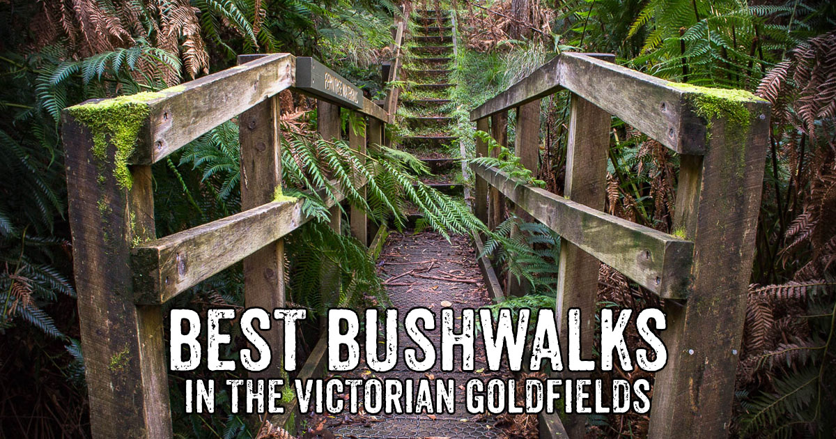
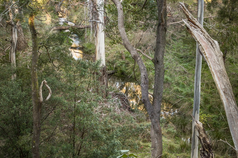
Ferntree Falls, Raglan VIC
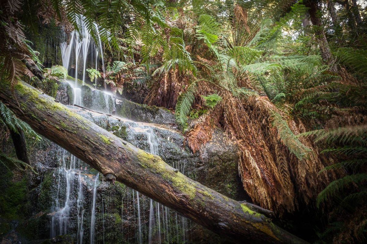
Ferntree Falls, Mount Buangor State Park, Raglan VIC
Ferntree Falls is a beautiful little waterfall nestled among the huge ferns and moss covered rocks within the spectacular Mount Buangor State Park.
Experience the beauty of upper Middle Creek, a tributary which meanders through the park among the forest of tree ferns and water ferns.
A short and easy 250 metre walk takes you to the falls where you can clamber over the rocks and among the gorgeous ferns right beneath the waterfall.
By crossing a bridge over Middle Creek from beneath the falls, you can continue on the Waterfalls Nature Walk and access several other walks including the walk to nearby Cascade Falls.
Find out more about Ferntree Falls.
Waanyarra Walk, Waanyarra VIC
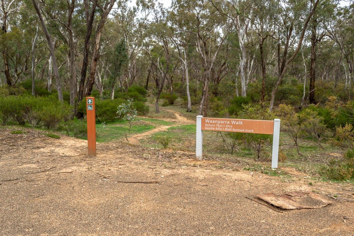
Waanyarra Walk, Waanyarra VIC
Explore the remarkable historic features of the Dunolly State Forest via the interesting Waanyarra Walk.
The track begins from the Waanyarra Recreation Site, taking you on a 7 km (2 hour) return walk over gentle hills on a well formed track.
Find out more about the Waanyarra Walk.
Blue Waters, Creswick VIC
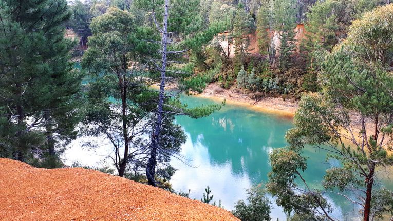
Blue Waters, Creswick VIC
Blue Waters is a stunningly beautiful waterhole located within the Creswick Regional Park, right off the Melbourne Road and just minutes from the town centre.
Once an open cut mine, Blue Waters is now a gorgeous scenic area fantastic for bushwalking, gold prospecting, four wheel driving and photography.
Surrounded by striking red cliffs, the water is incredibly clear and shines an iridescent blue when the sun hits it.
A dirt track travels around the waterhole and offers many spectacular viewing points and tracks down to the water along the way.
Find out more about Blue Waters.
Sailors Falls Waterfall and Mineral Spring, Sailors Falls VIC
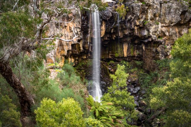
Sailors Falls, Hepburn Regional Park, Sailors Falls VIC
Sailors Falls Mineral Spring is located just outside Daylesford, Victoria and features a stunning seasonal waterfall, mineral spring taps, walking tracks, two undercover picnic tables and excellent information signs/displays.
Sailors Falls are spectacular with or without water flow due to the impressive rock face and beautiful ferns lining the creek.
The falls are worth visiting all year round, but water is most reliably flowing in winter/spring.
Find out more about Sailors Falls.
Koala Park, Creswick VIC
Koala Park, Creswick VIC
Take a walk through Creswick's beautiful Koala Park, where a circuit track with multiple walk options takes you on a journey through a section of the Creswick Regional Park.
Walk along forested hillsides looking down over the gullies, take the quaint foot bridges over Creswick Creek, and have a rest at the various bench seats provided along the way.
This walk is about half an hour, easy/moderate, with the option of additional side tracks along the way.
Find out more about Koala Park.
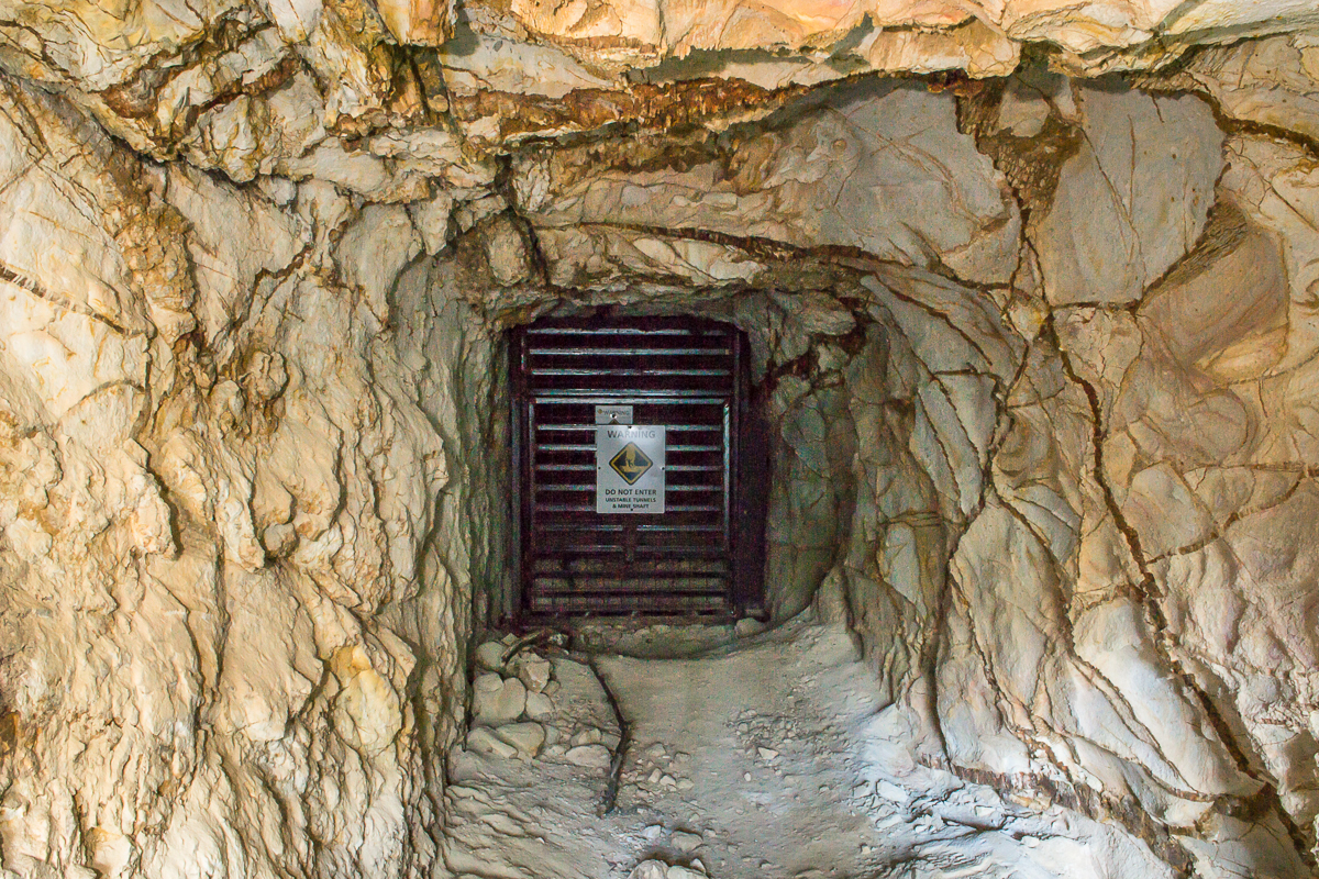
Jubilee Mine, Staffordshire Reef VIC
Jubilee Mine, Staffordshire Reef VIC
The extensive ruins of the Jubilee Company Quartz Gold Mine are a fascinating place to explore.
This significant site is nestled away within the beautiful forest of the Jubilee Historic Area, just half an hour from Ballarat.
A fantastic self-guided walk takes you around the site of the Jubilee Company Quartz Gold Mine.
Features you will discover along the walk include battery foundations, engine beds, a water race, old mine shafts, surface workings, cyanide plant, tailings, old house sites and more.
Illustrated signposts provide lots of information along the way.
Find out more about the Jubilee Mine.
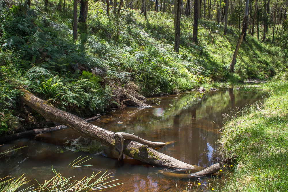
Loddon River / Cairn Curran Weir Walking Track, Baringhup VIC
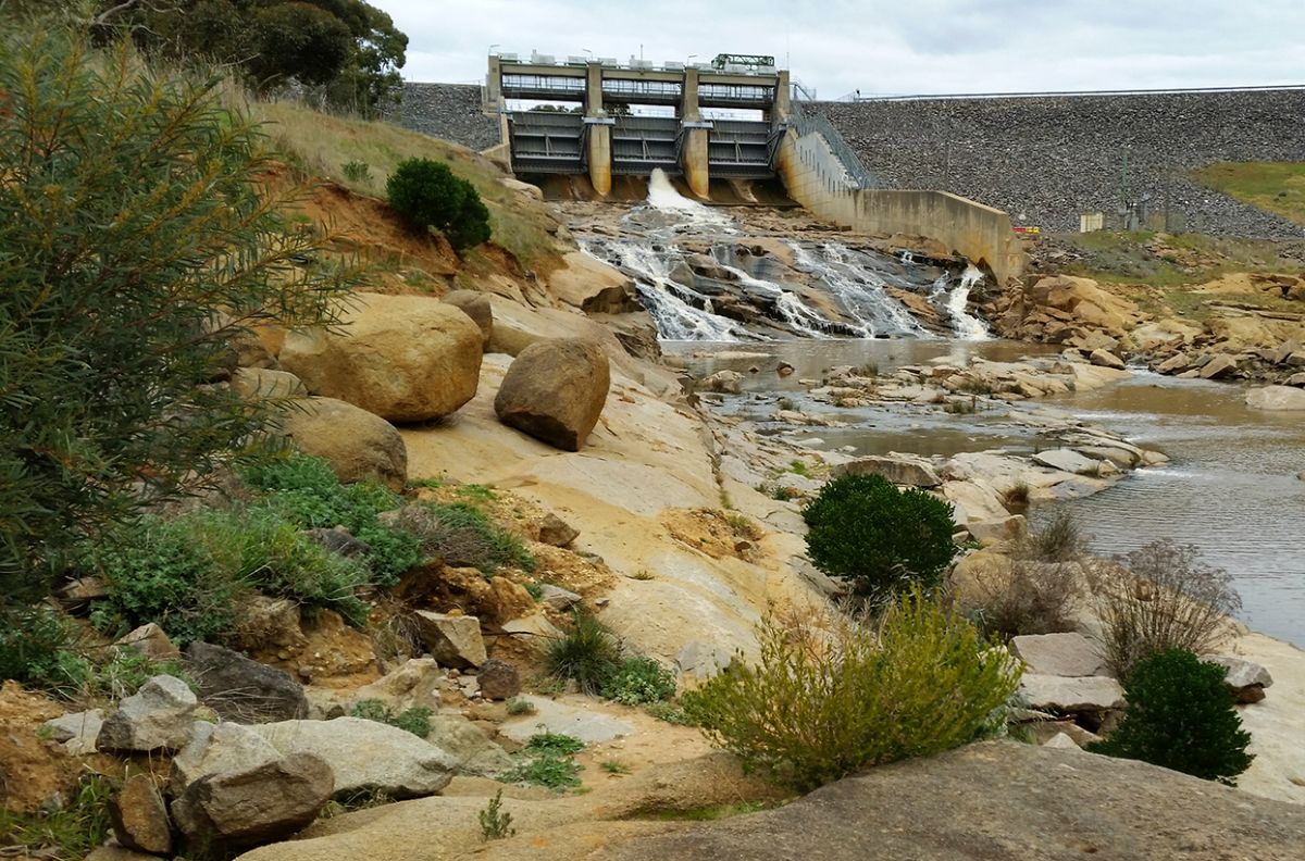
Loddon River / Cairn Curran Weir Walking Track, Baringhup VIC
This scenic walking track along the Loddon River takes about 20 minutes and leads to the base of the Cairn Curran Weir.
When water levels are high enough, the water flowing from the weir cascades dramatically down over layers of huge rocks!
The walking track itself is a narrow track winding through pretty shrubs and trees alongside the Loddon River.
Find out more about the Loddon River / Cairn Curran Weir Walking Track.
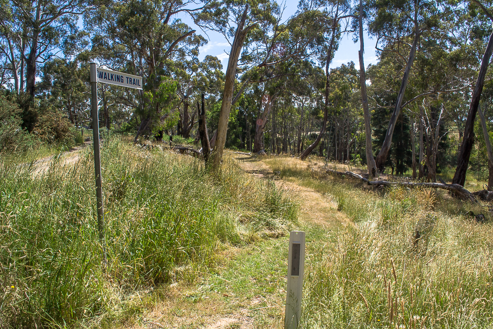
Viewing Rock Lookout, Heathcote VIC
Viewing Rock Lookout, Heathcote VIC
The Viewing Rock Lookout is a rocky outcrop atop a mountain ridge offering spectacular views over Heathcote and beyond.
Take a walk from here down to the historical Powder Magazine at the foot of the mountain, which can be reached by two different tracks. One is a more direct route down, the other takes you via Devils Cave.
Both these tracks make up the (one hour return) Viewing Rock Circuit Walk, which begins down at the Powder Magazine but can also be started from here at the lookout instead.
Signs at the parking area show the directions of the walking tracks.
Find out more about Viewing Rock Lookout.
The Junction Walk, Chewton VIC
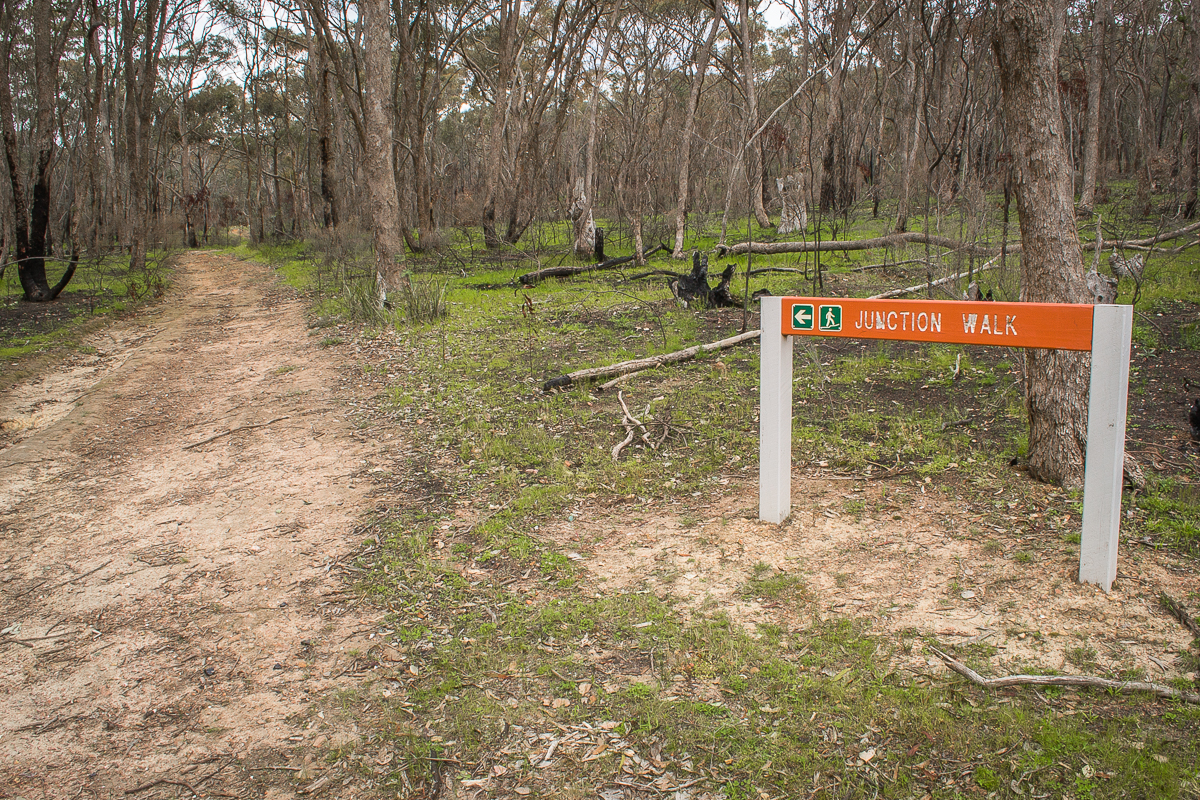
The Junction Walk, Chewton VIC
Beginning at the scenic Railway Dam, the Junction Walk is an easy 2.5 km circuit walk which showcases the natural and historical landscape of the area.
This place is thought to have been a busy Indigenous pathway, and during the gold rush it became the junction of the roads to Forest Creek and Fryers Creek.
Evidence of the area's history remains throughout the forest, including stone fireplaces, bridge footings, mullock from the tunnel, a stone sump on the bottom of the dam and cobbled stone roads which were made by the 200 German stone masons who worked in this area.
Interpretive information boards are located along the walking track.
Find out more about The Junction Walk.
Breakneck Gorge, Hepburn VIC
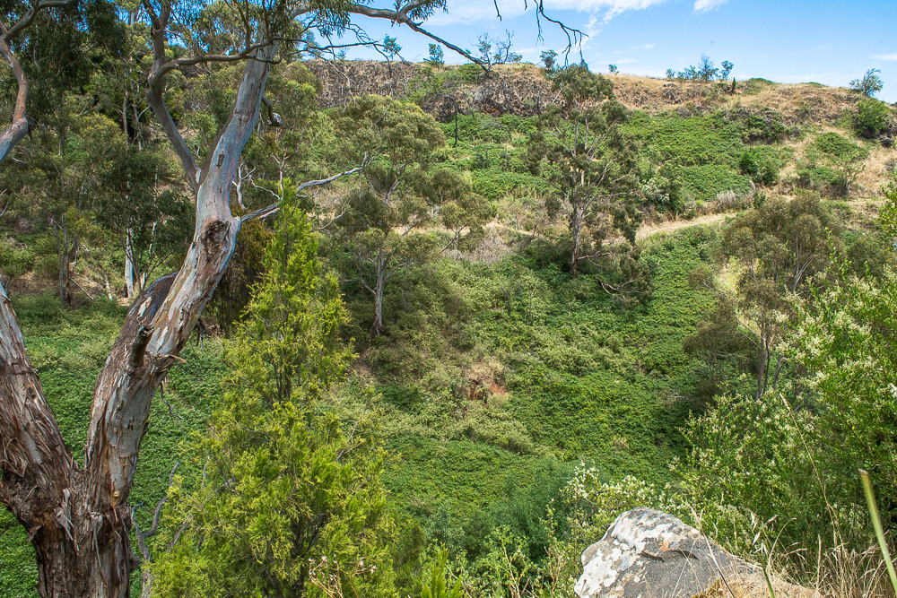
Breakneck Gorge, Hepburn VIC
Take a walk through the scenic Breakneck Gorge, a stunning natural feature alongside the Hepburn-Newstead Road.
You can reach Breakneck Gorge directly from the roadside or via a 3 km walk from The Blowhole, a historical gold diversion tunnel on Sailors Creek which now forms a beautiful waterfall and swimming hole!
Find out more about Breakneck Gorge.
Biolink Track, Glenlyon VIC
Biolink Track, Glenlyon VIC
Glenlyon's fascinating Biolink Track is a scenic and informative walk which travels through a valley alongside the Loddon River, with signs sharing the area's history and ecology along the way.
This track is a 1.5 hour return walk from Loddon Drive to the nearby Glenlyon Recreation Reserve and Mineral Springs.
Find out more about the Biolink Track.
Werribee River Walk, Blakeville VIC
Werribee River Walk, Blakeville VIC
This shady river-side picnic area is a beautiful place to spend an afternoon, where you can have a picnic lunch beneath the trees before heading off on the scenic Werribee River Walk.
The walk is a 4.5 km return track with short steep hills and some obstacles, taking you along the river to the nearby Werribee River Camping Ground.
Find out more about the Werribee River Walk.
Eureka Reef, Chewton VIC
Eureka Reef, Chewton VIC
Take a 1.8 km walk around the Eureka Reef Gold Mining Precinct and discover the fascinating ruins and features which remain from a century of gold mining operations!
Once a busy mining village, today Eureka contains some of the oldest quartz mining relics in Victoria, as well as remnants of houses, batteries, alluvial mining, cyanide treatment, and more.
Find out more about Eureka Reef.
Lake Burrumbeet Nature Walk, Burrumbeet VIC
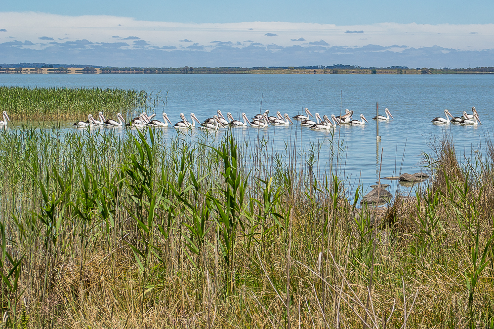
Lake Burrumbeet Nature Walk, Burrumbeet VIC
The Lake Burrumbeet Nature Walk is a short, scenic track which travels alongside the shore of Lake Burrumbeet, providing plenty of opportunity to spot the abundant local wildlife.
Make your way along the rocky slope through the rich lake-side ecosystem, and keep an eye out for the many varieties of water birds, including the gorgeous resident pelicans!
Find out more about the Lake Burrumeet Nature Walk.
Herons Reef Gold Diggings, Chewton VIC
Herons Reef Gold Diggings, Chewton VIC
Part of the Castlemaine Diggings National Heritage Park, Herons Reef is an extraordinary site in Fryerstown filled with extensive ruins and remnants of the Victorian gold rush.
The area showcases examples of many different methods and eras of gold mining, multiple stone ruins, blacksmith forges, and a remarkably intact Cornish miner's hut.
A gravel carpark off the Vaughan-Chewton Road is indicated by a sign for 'Herons Reef', where a dirt road heads through a gate and serves as a walking track through the area.
You can also enter via another walking track which begins down on Crocodile Reservoir Road.
Find out more about Herons Reef Gold Diggings.
SEE ALSO
- 20 remarkable places in the Victorian Goldfields
- Best campgrounds for hiking in the Victorian Goldfields
- Top swimming spots in the Victorian Goldfields
- Waterfalls of the Goldfields
- Spectacular rocky outcrops in the Victorian Goldfields
- 50 amazing places for kids to explore
- Best places to kayak in the Victorian Goldfields
- Gold-bearing creeks and rivers in Victoria
- Gold prospecting guides for the Victorian Goldfields